Beerenberg
The volcano fills the northern end of the island, and its round, glacier-covered cone gives the map a strong, heavy head. The coastline around it is steep and largely inaccessible.
Minimalistiskt kortplakat · Noreg
70.9931° N / 8.5029° W
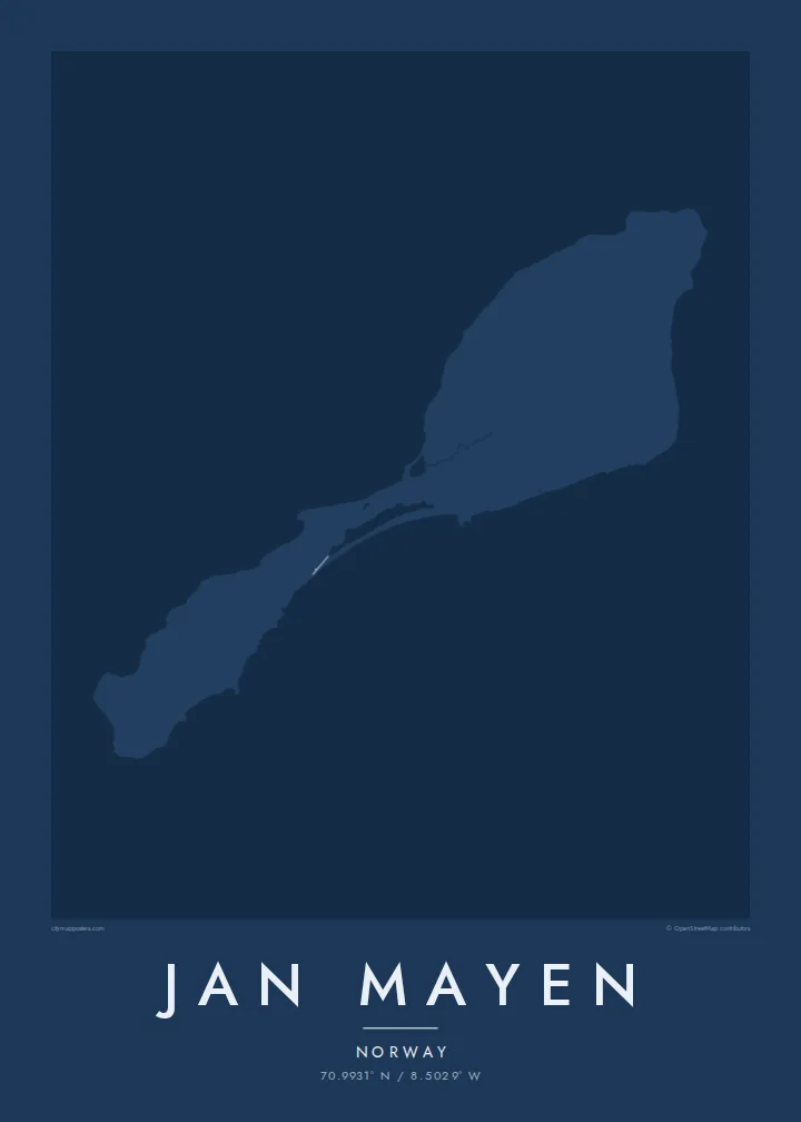
A narrow Arctic island of two volcanic halves joined by a thin neck, crowned by a glaciated volcano in the north.



Ein býur, fimm stemningar
Trýst á ein stíl fyri at síggja hann á veggnum. Allir stílar kosta tað sama — sum prent, í ramma ella sum HD-fílur.
 Veruligar pixlar · 24 × 36″ prentfíla
Prentskarpt
Hetta er ein 100% útskurður av teirri veruligu prentfíluni. Hvør plakat — prentað, í ramma ella niðurhalað — verður gjørd á okkara ambætarum við 300 DPI, upp til 7,200 × 10,800 pixlar, so eisini tær smæstu gøtur halda seg skarpar á einum 24 × 36″ prenti.
Á veggnum


Kortið
Jan Mayen is a Norwegian volcanic island in the Arctic Ocean, northeast of Iceland. It is long and slender, and its outline falls into two parts: a broad northern section dominated by the volcano Beerenberg, and a lower, narrower southern section, linked by a slim isthmus. Beerenberg is the northernmost active volcano above sea level, and glaciers flow down its flanks toward the sea.
There is no permanent population. A small station staffed by Norwegian personnel handles weather observation and other services, and it accounts for most of the island's few tracks and buildings. A Jan Mayen map poster is therefore almost entirely coastline: capes, lagoons and the round mass of the volcano, with only the faintest trace of anything built by people.
Access is restricted, and the island is rarely visited outside official duty or occasional expeditions. Its isolation is part of its appeal as a subject. The outline, with its heavy northern head and thin southern tail, is one of the more unusual shapes a map poster can hold, and it reads clearly even without streets.
The volcano fills the northern end of the island, and its round, glacier-covered cone gives the map a strong, heavy head. The coastline around it is steep and largely inaccessible.
A narrow neck of land joins the two halves, with small lagoons along its shores. On the poster it is the thinnest point of the outline, easy to trace by eye.
The island's only settlement is a small cluster of buildings and tracks used by station staff. It is the one place where the map shows anything made by people.
Ger tað til títt
Legg ein dag, eitt navn ella egnan tekst afturat, skift stíl, stødd ella snið.
Ókeypis forskoðanin er í lágari upploysing og hevur vatnmerki. Prent og HD-fílur verða gjørdar við 300 DPI, upp til 7,200 × 10,800 px, uttan vatnmerki.
Hví Jan Mayen
Jan Mayen appeals to people who have served on the station, polar travellers and those who collect remote places. It is a map almost free of roads, which makes the poster feel more like a drawing of land and sea than a guide.
Use the title and subtitle for a posting, an expedition year or simply the island's name, and adjust the coordinates line. Noir and Blueprint suit its Arctic character, though all five styles, including Classic, Paper and Sand, are available. Files include six sizes as PNG and PDF.
Panta Jan Mayen-plakatið| Prentstødd | Upploysn | Fílur |
|---|---|---|
| 30 × 40 cm11.8 × 15.7″ | 3,543 × 4,724 px | PNG · PDF |
| 29.7 × 42 cm (A3)11.7 × 16.5″ | 3,508 × 4,961 px | PNG · PDF |
| 42 × 59.4 cm (A2)16.5 × 23.4″ | 4,961 × 7,016 px | PNG · PDF |
| 45.7 × 61 cm18 × 24″ | 5,400 × 7,200 px | PNG · PDF |
| 50 × 70 cm19.7 × 27.6″ | 5,906 × 8,268 px | PNG · PDF |
| 61 × 91.4 cm24 × 36″ | 7,200 × 10,800 px | PNG · PDF |
Til samanberingar er ókeypis forsýningin 900 px breið, við vatnmerki og ætlað til skerm. HD-fílurnar hava upp til 8 ferðir so høga upploysn í hvørja átt og verða prentaðar reint í fullari plakatstødd.
Vel ein stíl ovast á síðuni, og vel síðani Prentað Plakat — eina stødd og, um tú vil, eina ramma — ella Digital HD-Fílur. Tað tekur bara eitt stig at ganga til kassa, og pantanarsíðan tín dagførist so skjótt sum gjaldið er gjøgnumført.
Tað verður prentað á 200 gsm matt kvalitetspappír í einari av seks støddum, frá 30 × 40 cm til 24 × 36″. Prentaðar plakatir byrja á $39, sending íroknað.
Ja. Vel eina ramma av massivum træi í svørtum, hvítum, natúrligum eik ella dekkum træi. Hon kemur við glassi, sum ikki brotnar, og er klár at hongja upp. Plakatir í ramma byrja á $99, sending íroknað.
Flutningur er ókeypis til 60+ landa. Hvør plakat verður prentaður hjá tí prentfelaga okkara, sum er næstur, í 30+ londum, og kemur vanliga fram á 3–7 arbeiðsdøgum. Tú kanst fylgja støðuni og sporing undir Mínar pantanir. Fá lond taka 2–5 vikur, og har vit ikki enn senda, sigur vevsíðan tær frá, áðrenn tú rindar.
Send okkum eitt mynd innan 14 dagar eftir móttøku, og vit prenta tað umaftur ókeypis ella endurgjalda tær.
Ja. Í ritlinum á hesi síðu kanst tú broyta heitið, undirheitið og koordinatlinjuna til hvat sum helst, og velja stíl og stødd. Prentaðar, ramma- og digitalar pantanir brúka allar sama honnun, sum tú hevur gjørt.
Fyri $9 fært tú 300 DPI PNG- og prentklárar PDF-fílur í øllum seks støddum, uttan vatnmerki, so tú kanst prenta hvar sum helst. Ikki vís enn? Halda niður eina ókeypis forskoðan við vatnmerki fyrst.
