Town centre junctions
The core of Kasulu forms where the main roads meet. Here the street network is tightest, and shops, markets and offices gather close together.
Minimalistiskt kortplakat · Tansania
4.5767° S / 30.1025° E
A highland town in western Tanzania, with roads branching across rolling hills toward Kigoma and the Burundi border.




Ein býur, fimm stemningar
Trýst á ein stíl fyri at síggja hann á veggnum. Allir stílar kosta tað sama — sum prent, í ramma ella sum HD-fílur.
 Veruligar pixlar · 24 × 36″ prentfíla
Prentskarpt
Hetta er ein 100% útskurður av teirri veruligu prentfíluni. Hvør plakat — prentað, í ramma ella niðurhalað — verður gjørd á okkara ambætarum við 300 DPI, upp til 7,200 × 10,800 pixlar, so eisini tær smæstu gøtur halda seg skarpar á einum 24 × 36″ prenti.
Á veggnum


Kortið
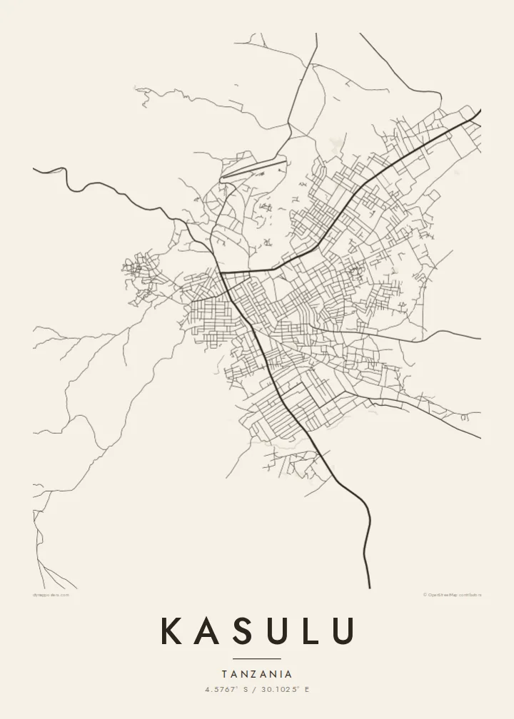
Kasulu is a district town in the Kigoma Region of western Tanzania, set in hilly country not far from the border with Burundi. The map shows a modest centre where the main roads meet, with streets spreading loosely outward into farmland. The ground is uneven, so the roads bend and branch rather than follow a strict grid.
The wider district is largely rural, with small farms spread across the hills and valleys. For several decades it has also hosted large refugee settlements for people displaced by conflicts in neighbouring countries. That history has shaped the region's roads and services, even where it is not visible in the town centre itself.
A Kasulu map poster keeps the focus on structure: the central junctions, the main roads leading out of town, and the lighter tracks that reach into the surrounding hills. In black and white, the open landscape becomes empty space that lets the lines of movement stand out, giving the print a spare, calm feel.
The core of Kasulu forms where the main roads meet. Here the street network is tightest, and shops, markets and offices gather close together.
Roads follow ridges and valleys through the surrounding highlands. As a result, the lines on the map curve and fork with the shape of the land.
Beyond the centre, streets fade into scattered tracks and farm plots. These wide open areas give the composition room to breathe around its small, dense core.
Ger tað til títt
Legg ein dag, eitt navn ella egnan tekst afturat, skift stíl, stødd ella snið.
Ókeypis forskoðanin er í lágari upploysing og hevur vatnmerki. Prent og HD-fílur verða gjørdar við 300 DPI, upp til 7,200 × 10,800 px, uttan vatnmerki.
Hví Kasulu
Kasulu matters to people who were born here, who worked in the district's schools, clinics and aid programmes, or who passed through on the way to a new life. A clean, simple map of the town is a respectful way to remember it.
You can personalise the title, subtitle and coordinates line, for example with the years you spent there, and choose Classic black & white, Noir, Paper, Blueprint or Sand. The digital files cost $9, and printed posters ship from partners in more than 30 countries.
Panta Kasulu-plakatið| Prentstødd | Upploysn | Fílur |
|---|---|---|
| 30 × 40 cm11.8 × 15.7″ | 3,543 × 4,724 px | PNG · PDF |
| 29.7 × 42 cm (A3)11.7 × 16.5″ | 3,508 × 4,961 px | PNG · PDF |
| 42 × 59.4 cm (A2)16.5 × 23.4″ | 4,961 × 7,016 px | PNG · PDF |
| 45.7 × 61 cm18 × 24″ | 5,400 × 7,200 px | PNG · PDF |
| 50 × 70 cm19.7 × 27.6″ | 5,906 × 8,268 px | PNG · PDF |
| 61 × 91.4 cm24 × 36″ | 7,200 × 10,800 px | PNG · PDF |
Til samanberingar er ókeypis forsýningin 900 px breið, við vatnmerki og ætlað til skerm. HD-fílurnar hava upp til 8 ferðir so høga upploysn í hvørja átt og verða prentaðar reint í fullari plakatstødd.
Vel ein stíl ovast á síðuni, og vel síðani Prentað Plakat — eina stødd og, um tú vil, eina ramma — ella Digital HD-Fílur. Tað tekur bara eitt stig at ganga til kassa, og pantanarsíðan tín dagførist so skjótt sum gjaldið er gjøgnumført.
Tað verður prentað á 200 gsm matt kvalitetspappír í einari av seks støddum, frá 30 × 40 cm til 24 × 36″. Prentaðar plakatir byrja á $39, sending íroknað.
Ja. Vel eina ramma av massivum træi í svørtum, hvítum, natúrligum eik ella dekkum træi. Hon kemur við glassi, sum ikki brotnar, og er klár at hongja upp. Plakatir í ramma byrja á $99, sending íroknað.
Flutningur er ókeypis til 60+ landa. Hvør plakat verður prentaður hjá tí prentfelaga okkara, sum er næstur, í 30+ londum, og kemur vanliga fram á 3–7 arbeiðsdøgum. Tú kanst fylgja støðuni og sporing undir Mínar pantanir. Fá lond taka 2–5 vikur, og har vit ikki enn senda, sigur vevsíðan tær frá, áðrenn tú rindar.
Send okkum eitt mynd innan 14 dagar eftir móttøku, og vit prenta tað umaftur ókeypis ella endurgjalda tær.
Ja. Í ritlinum á hesi síðu kanst tú broyta heitið, undirheitið og koordinatlinjuna til hvat sum helst, og velja stíl og stødd. Prentaðar, ramma- og digitalar pantanir brúka allar sama honnun, sum tú hevur gjørt.
Fyri $9 fært tú 300 DPI PNG- og prentklárar PDF-fílur í øllum seks støddum, uttan vatnmerki, so tú kanst prenta hvar sum helst. Ikki vís enn? Halda niður eina ókeypis forskoðan við vatnmerki fyrst.
