Mountain edge
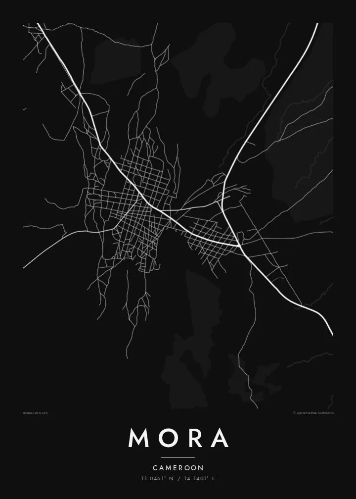
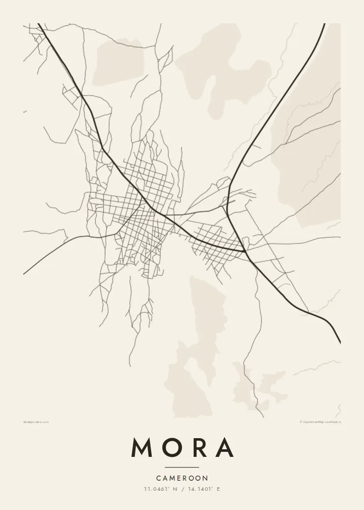
The Mandara Mountains rise close to the town, and the map shows the change from dense streets to sparse tracks where the ground becomes steep.
Minimalistiskt kortplakat · Kamerun
11.0461° N / 14.1401° E
A Sahel market town at the foot of the Mandara Mountains, where rocky slopes meet flat northern plains



Ein býur, fimm stemningar
Trýst á ein stíl fyri at síggja hann á veggnum. Allir stílar kosta tað sama — sum prent, í ramma ella sum HD-fílur.
 Veruligar pixlar · 24 × 36″ prentfíla
Prentskarpt
Hetta er ein 100% útskurður av teirri veruligu prentfíluni. Hvør plakat — prentað, í ramma ella niðurhalað — verður gjørd á okkara ambætarum við 300 DPI, upp til 7,200 × 10,800 pixlar, so eisini tær smæstu gøtur halda seg skarpar á einum 24 × 36″ prenti.
Á veggnum


Kortið
Mora is a town in the Far North Region of Cameroon, close to the border with Nigeria. It sits where the Mandara Mountains give way to the flat plains that stretch toward Lake Chad. On a map, that contrast is immediate: to one side, broken high ground with few roads; to the other, open country crossed by straight tracks. The town gathers between them.
The street pattern is simple and low. A few main roads lead into the centre, and around them lie compounds and lanes arranged loosely rather than in a strict grid. Seasonal watercourses cut across the surrounding land, dry for much of the year and visible on the map as thin, wandering lines. The overall impression is of a small settlement shaped by terrain and climate.
Mora is the administrative seat of its department and a meeting point for people from the mountain villages and the plains. A Mora map poster renders this setting in fine black lines on plain paper: the gathering of streets in the middle, roads reaching out across the lowland, and the quieter, more irregular ground where the hills begin to rise.
The Mandara Mountains rise close to the town, and the map shows the change from dense streets to sparse tracks where the ground becomes steep.
Long, fairly straight routes run out across the flat northern country, giving the poster clear directional lines leading away from the centre.
Thin, winding channels cross the land around Mora, tracing where water runs in the rainy season and adding soft curves to the composition.
Ger tað til títt
Legg ein dag, eitt navn ella egnan tekst afturat, skift stíl, stødd ella snið.
Ókeypis forskoðanin er í lágari upploysing og hevur vatnmerki. Prent og HD-fílur verða gjørdar við 300 DPI, upp til 7,200 × 10,800 px, uttan vatnmerki.
Hví Mora
A map of Mora suits anyone with roots in the Far North or memories of time spent there. It shows the town as it is placed in the land, between hills and plains, without the need for any landmark to explain it.
The title, subtitle and coordinates line can all be personalised, and the design comes in five styles: Classic black & white, Noir, Paper, Blueprint and Sand. Sand in particular echoes the dry-season colours of the region.
Panta Mora-plakatið| Prentstødd | Upploysn | Fílur |
|---|---|---|
| 30 × 40 cm (11.8 × 15.7″) | 3,543 × 4,724 px | PNG · PDF |
| 29.7 × 42 cm (A3, 11.7 × 16.5″) | 3,508 × 4,961 px | PNG · PDF |
| 42 × 59.4 cm (A2, 16.5 × 23.4″) | 4,961 × 7,016 px | PNG · PDF |
| 45.7 × 61 cm (18 × 24″) | 5,400 × 7,200 px | PNG · PDF |
| 50 × 70 cm (19.7 × 27.6″) | 5,906 × 8,268 px | PNG · PDF |
| 61 × 91.4 cm (24 × 36″) | 7,200 × 10,800 px | PNG · PDF |
Til samanberingar er ókeypis forsýningin 900 px breið, við vatnmerki og ætlað til skerm. HD-fílurnar hava upp til 8 ferðir so høga upploysn í hvørja átt og verða prentaðar reint í fullari plakatstødd.
Vel ein stíl ovast á síðuni, og vel síðani Prentað Plakat — eina stødd og, um tú vil, eina ramma — ella Digital HD-Fílur. Tað tekur bara eitt stig at ganga til kassa, og pantanarsíðan tín dagførist so skjótt sum gjaldið er gjøgnumført.
Tað verður prentað á 200 gsm matt kvalitetspappír í einari av seks støddum, frá 30 × 40 cm til 24 × 36″. Prentaðar plakatir byrja á {printFrom}, sending íroknað.
Ja. Vel eina ramma av massivum træi í svørtum, hvítum, natúrligum eik ella dekkum træi. Hon kemur við glassi, sum ikki brotnar, og er klár at hongja upp. Plakatir í ramma byrja á {framedFrom}, sending íroknað.
Sending er ókeypis um allan heimin. Hvør plakat verður prentað av tí næstu av okkara prentpartnarum í 30+ londum og kemur vanliga innan 3–7 arbeiðsdagar. Tú kanst fylgja við støðu og sporing undir Mínar Pantanir.
Send okkum eitt mynd innan 14 dagar eftir móttøku, og vit prenta tað umaftur ókeypis ella endurgjalda tær.
Ja. Í ritlinum á hesi síðu kanst tú broyta heitið, undirheitið og koordinatlinjuna til hvat sum helst, og velja stíl og stødd. Prentaðar, ramma- og digitalar pantanir brúka allar sama honnun, sum tú hevur gjørt.
Fyri $9 fært tú 300 DPI PNG- og prentklárar PDF-fílur í øllum seks støddum, uttan vatnmerki, so tú kanst prenta hvar sum helst. Ikki vís enn? Halda niður eina ókeypis forskoðan við vatnmerki fyrst.
