Lake Cochituate
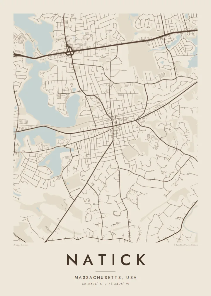
The lake forms a series of connected basins on the town's north-western edge. Their irregular shorelines give the map broad, open shapes that contrast with the fine lines of the surrounding streets.
Minimalistiskt kortplakat · Sambandsríki Amerika
42.2834° N / 71.3495° W
A wooded New England town of winding roads, framed by Lake Cochituate on one side and the Charles River on the other.



Ein býur, fimm stemningar
Trýst á ein stíl fyri at síggja hann á veggnum. Allir stílar kosta tað sama — sum prent, í ramma ella sum HD-fílur.
 Veruligar pixlar · 24 × 36″ prentfíla
Prentskarpt
Hetta er ein 100% útskurður av teirri veruligu prentfíluni. Hvør plakat — prentað, í ramma ella niðurhalað — verður gjørd á okkara ambætarum við 300 DPI, upp til 7,200 × 10,800 pixlar, so eisini tær smæstu gøtur halda seg skarpar á einum 24 × 36″ prenti.
Á veggnum


Kortið
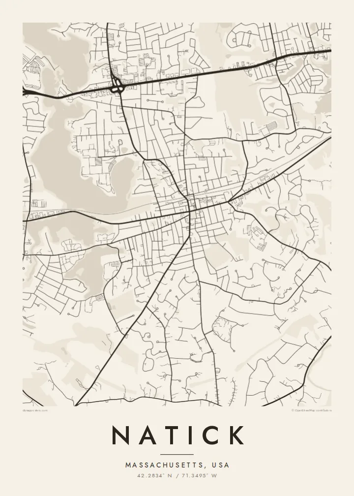
Natick lies in the MetroWest suburbs west of Boston, and its map is shaped more by water and woodland than by any grid. Curving residential streets fill the spaces between ponds and patches of forest, while a few long routes cross the town in straighter lines. The Massachusetts Turnpike runs along the northern side, and the commuter rail line cuts through toward the centre.
Natick was founded in 1651 by the missionary John Eliot as a settlement for Christian Native Americans, the first of the so-called praying towns in Massachusetts. Today it is also known as a stage on the Boston Marathon course, which follows Route 135 through the town centre. A Natick map poster brings these layers together on one sheet of carefully drawn lines.
Lake Cochituate stretches along the north-western side as a chain of long, lobed basins, and the Charles River winds past South Natick in the south. Between them, Route 9 draws a busy commercial corridor across the town. In monochrome, the two bodies of water work as natural borders and give the suburb a clear, recognisable outline.
The lake forms a series of connected basins on the town's north-western edge. Their irregular shorelines give the map broad, open shapes that contrast with the fine lines of the surrounding streets.
In South Natick the Charles River loops past the older village. It is a slow, winding line of water that marks the southern side of the town and softens the lower edge of the print.
The road that carries the Boston Marathon runs through the town centre. It is a straight thread linking Natick to its neighbours, and one many runners will recognise at once.
Ger tað til títt
Legg ein dag, eitt navn ella egnan tekst afturat, skift stíl, stødd ella snið.
Ókeypis forskoðanin er í lágari upploysing og hevur vatnmerki. Prent og HD-fílur verða gjørdar við 300 DPI, upp til 7,200 × 10,800 px, uttan vatnmerki.
Hví Natick
Natick maps often end up with families who grew up near the lake, commuters who moved out from Boston, or runners who remember the marathon miles through town. The title, subtitle and coordinates line can all be edited, so a street, a race year or a moving date fits neatly beneath the map.
Five styles are available: Classic black & white, Noir, Paper, Blueprint and Sand. A free 900 px watermarked preview lets you check the framing first. For $9 you get six print sizes as 300 DPI PNG and print-ready PDF files, or you can order a matte poster, framed in wood if you like.
Panta Natick-plakatið| Prentstødd | Upploysn | Fílur |
|---|---|---|
| 30 × 40 cm11.8 × 15.7″ | 3,543 × 4,724 px | PNG · PDF |
| 29.7 × 42 cm (A3)11.7 × 16.5″ | 3,508 × 4,961 px | PNG · PDF |
| 42 × 59.4 cm (A2)16.5 × 23.4″ | 4,961 × 7,016 px | PNG · PDF |
| 45.7 × 61 cm18 × 24″ | 5,400 × 7,200 px | PNG · PDF |
| 50 × 70 cm19.7 × 27.6″ | 5,906 × 8,268 px | PNG · PDF |
| 61 × 91.4 cm24 × 36″ | 7,200 × 10,800 px | PNG · PDF |
Til samanberingar er ókeypis forsýningin 900 px breið, við vatnmerki og ætlað til skerm. HD-fílurnar hava upp til 8 ferðir so høga upploysn í hvørja átt og verða prentaðar reint í fullari plakatstødd.
Vel ein stíl ovast á síðuni, og vel síðani Prentað Plakat — eina stødd og, um tú vil, eina ramma — ella Digital HD-Fílur. Tað tekur bara eitt stig at ganga til kassa, og pantanarsíðan tín dagførist so skjótt sum gjaldið er gjøgnumført.
Tað verður prentað á 200 gsm matt kvalitetspappír í einari av seks støddum, frá 30 × 40 cm til 24 × 36″. Prentaðar plakatir byrja á $39, sending íroknað.
Ja. Vel eina ramma av massivum træi í svørtum, hvítum, natúrligum eik ella dekkum træi. Hon kemur við glassi, sum ikki brotnar, og er klár at hongja upp. Plakatir í ramma byrja á $99, sending íroknað.
Flutningur er ókeypis til 60+ landa. Hvør plakat verður prentaður hjá tí prentfelaga okkara, sum er næstur, í 30+ londum, og kemur vanliga fram á 3–7 arbeiðsdøgum. Tú kanst fylgja støðuni og sporing undir Mínar pantanir. Fá lond taka 2–5 vikur, og har vit ikki enn senda, sigur vevsíðan tær frá, áðrenn tú rindar.
Send okkum eitt mynd innan 14 dagar eftir móttøku, og vit prenta tað umaftur ókeypis ella endurgjalda tær.
Ja. Í ritlinum á hesi síðu kanst tú broyta heitið, undirheitið og koordinatlinjuna til hvat sum helst, og velja stíl og stødd. Prentaðar, ramma- og digitalar pantanir brúka allar sama honnun, sum tú hevur gjørt.
Fyri $9 fært tú 300 DPI PNG- og prentklárar PDF-fílur í øllum seks støddum, uttan vatnmerki, so tú kanst prenta hvar sum helst. Ikki vís enn? Halda niður eina ókeypis forskoðan við vatnmerki fyrst.
Í nándini
