Balcón de Europa
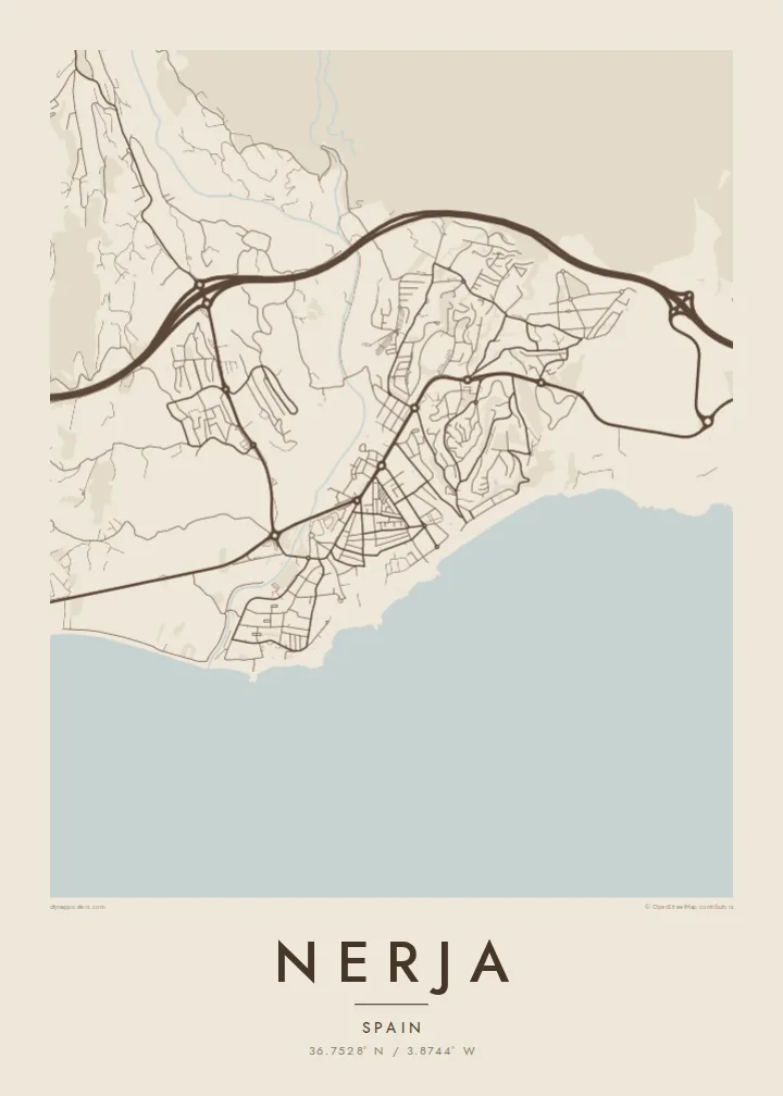
The promontory at the heart of town projects into the Mediterranean like a small pier of rock, a sharp point on the coastline that gives the map its focal centre.
Minimalistiskt kortplakat · Spania
36.7528° N / 3.8744° W
A cliff-top town on a scalloped coastline, cut by ravines and anchored by the Balcón de Europa promontory


Ein býur, fimm stemningar
Trýst á ein stíl fyri at síggja hann á veggnum. Allir stílar kosta tað sama — sum prent, í ramma ella sum HD-fílur.
 Veruligar pixlar · 24 × 36″ prentfíla
Prentskarpt
Hetta er ein 100% útskurður av teirri veruligu prentfíluni. Hvør plakat — prentað, í ramma ella niðurhalað — verður gjørd á okkara ambætarum við 300 DPI, upp til 7,200 × 10,800 pixlar, so eisini tær smæstu gøtur halda seg skarpar á einum 24 × 36″ prenti.
Á veggnum


Kortið
Nerja sits at the eastern end of the Málaga coast, where the Sierra Almijara drops steeply toward the Mediterranean. The town occupies a low plateau above the sea, and on a map its edge is anything but straight: small coves, rocky points and beaches alternate along the shore, each tucked between cliffs. Behind the town the mountains close in, leaving a narrow strip for streets and terraces.
At the centre of that coastline is the Balcón de Europa, a promontory that juts into the sea from the old town and forms the most recognisable point on any map of Nerja. Around it the historic streets are short and irregular. East of the centre, Burriana beach traces a long curve, and beyond it the river Chíllar cuts its valley down from the sierra.
Nerja is widely known for its caves, a vast cavern system discovered in 1959 just east of town near the village of Maro, now among the most visited sites in Andalusia. A Nerja map poster brings together the elements that make the place distinct from above: the jagged shore, the promontory, the ravines running to the sea and the mountain wall that frames it all.
The promontory at the heart of town projects into the Mediterranean like a small pier of rock, a sharp point on the coastline that gives the map its focal centre.
Between cliffs, a series of beaches and small coves gives the shoreline a scalloped outline, with Burriana forming the longest and most open curve east of the old town.
The Chíllar descends from the Sierra Almijara along the eastern side of town, its narrow valley tracing a line from the mountains down to the sea.
Ger tað til títt
Legg ein dag, eitt navn ella egnan tekst afturat, skift stíl, stødd ella snið.
Ókeypis forskoðanin er í lágari upploysing og hevur vatnmerki. Prent og HD-fílur verða gjørdar við 300 DPI, upp til 7,200 × 10,800 px, uttan vatnmerki.
Hví Nerja
Nerja is a place people return to year after year, and many Spaniards first saw it in the television series Verano azul, filmed here in the early 1980s. A map of the town is a way to keep those summers at home, from the promontory to the beach where you always swam.
Add a title and subtitle, perhaps the year you first came or the name of your street, and choose Classic black & white, Noir, Paper, Blueprint or Sand. Sand suits the coastline especially well. Get HD files for $9 or a matte printed poster, framed if you prefer.
Panta Nerja-plakatið| Prentstødd | Upploysn | Fílur |
|---|---|---|
| 30 × 40 cm (11.8 × 15.7″) | 3,543 × 4,724 px | PNG · PDF |
| 29.7 × 42 cm (A3, 11.7 × 16.5″) | 3,508 × 4,961 px | PNG · PDF |
| 42 × 59.4 cm (A2, 16.5 × 23.4″) | 4,961 × 7,016 px | PNG · PDF |
| 45.7 × 61 cm (18 × 24″) | 5,400 × 7,200 px | PNG · PDF |
| 50 × 70 cm (19.7 × 27.6″) | 5,906 × 8,268 px | PNG · PDF |
| 61 × 91.4 cm (24 × 36″) | 7,200 × 10,800 px | PNG · PDF |
Til samanberingar er ókeypis forsýningin 900 px breið, við vatnmerki og ætlað til skerm. HD-fílurnar hava upp til 8 ferðir so høga upploysn í hvørja átt og verða prentaðar reint í fullari plakatstødd.
Vel ein stíl ovast á síðuni, og vel síðani Prentað Plakat — eina stødd og, um tú vil, eina ramma — ella Digital HD-Fílur. Tað tekur bara eitt stig at ganga til kassa, og pantanarsíðan tín dagførist so skjótt sum gjaldið er gjøgnumført.
Tað verður prentað á 200 gsm matt kvalitetspappír í einari av seks støddum, frá 30 × 40 cm til 24 × 36″. Prentaðar plakatir byrja á {printFrom}, sending íroknað.
Ja. Vel eina ramma av massivum træi í svørtum, hvítum, natúrligum eik ella dekkum træi. Hon kemur við glassi, sum ikki brotnar, og er klár at hongja upp. Plakatir í ramma byrja á {framedFrom}, sending íroknað.
Sending er ókeypis um allan heimin. Hvør plakat verður prentað av tí næstu av okkara prentpartnarum í 30+ londum og kemur vanliga innan 3–7 arbeiðsdagar. Tú kanst fylgja við støðu og sporing undir Mínar Pantanir.
Send okkum eitt mynd innan 14 dagar eftir móttøku, og vit prenta tað umaftur ókeypis ella endurgjalda tær.
Ja. Í ritlinum á hesi síðu kanst tú broyta heitið, undirheitið og koordinatlinjuna til hvat sum helst, og velja stíl og stødd. Prentaðar, ramma- og digitalar pantanir brúka allar sama honnun, sum tú hevur gjørt.
Fyri $9 fært tú 300 DPI PNG- og prentklárar PDF-fílur í øllum seks støddum, uttan vatnmerki, so tú kanst prenta hvar sum helst. Ikki vís enn? Halda niður eina ókeypis forskoðan við vatnmerki fyrst.
