Penn's five squares
City Hall at the centre and four squares placed symmetrically around it are still visible as open spaces in the grid, a direct trace of the 1682 plan.
Minimalistiskt kortplakat · Sambandsríki Amerika
39.9524° N / 75.1636° W
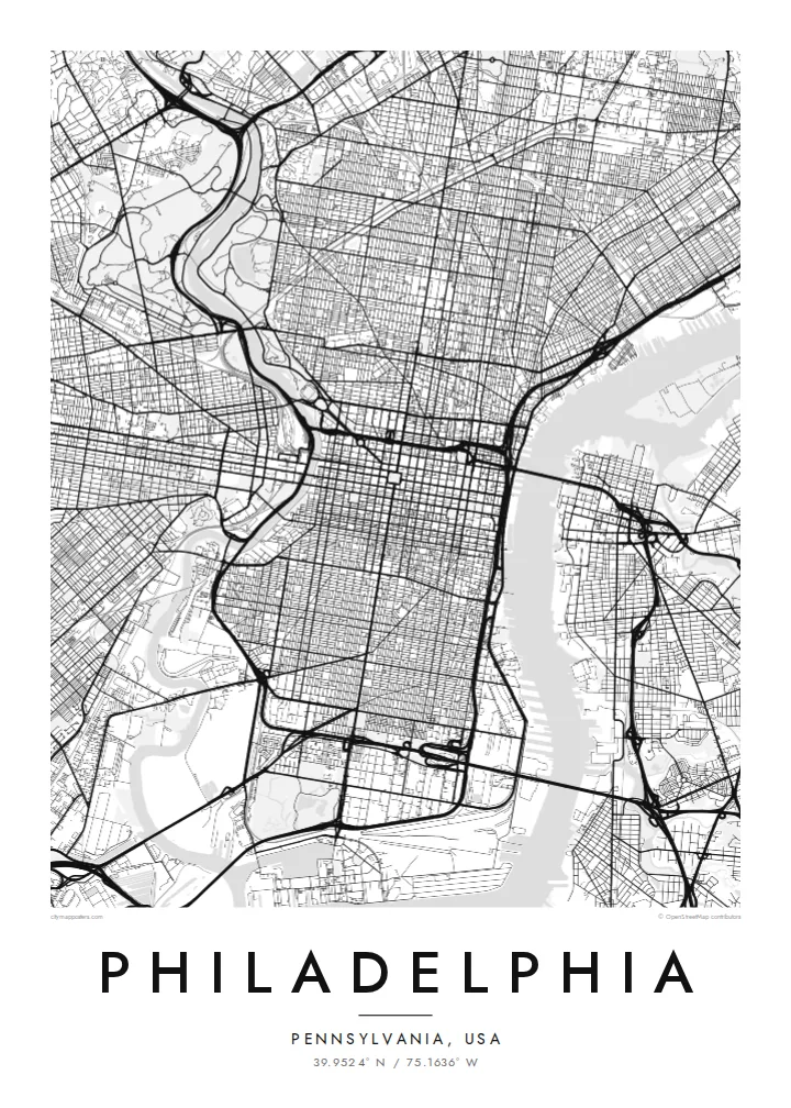
William Penn's orderly grid between two rivers, anchored by City Hall and cut by a single diagonal parkway.


Ein býur, fimm stemningar
Trýst á ein stíl fyri at síggja hann á veggnum. Allir stílar kosta tað sama — sum prent, í ramma ella sum HD-fílur.
 Veruligar pixlar · 24 × 36″ prentfíla
Prentskarpt
Hetta er ein 100% útskurður av teirri veruligu prentfíluni. Hvør plakat — prentað, í ramma ella niðurhalað — verður gjørd á okkara ambætarum við 300 DPI, upp til 7,200 × 10,800 pixlar, so eisini tær smæstu gøtur halda seg skarpar á einum 24 × 36″ prenti.
Á veggnum


Kortið
Philadelphia began as one of the first planned cities in America. In 1682 William Penn and his surveyor Thomas Holme laid out a rectangular grid stretching between the Delaware River on the east and the Schuylkill on the west, with five public squares placed at regular points. That plan still governs Center City, and it is easy to trace on a map today.
Broad Street and Market Street cross at the central square, where City Hall now stands, and four smaller squares, Rittenhouse, Washington, Logan and Franklin, sit in each quadrant. Near the Delaware, Independence Hall marks where the Declaration of Independence and the Constitution were debated and signed. Beyond the original grid, later neighbourhoods tilt and bend to follow old roads and the rivers.
The Benjamin Franklin Parkway breaks the pattern with a deliberate diagonal from City Hall to the Philadelphia Museum of Art, beyond which Fairmount Park follows the Schuylkill and the Wissahickon Creek for miles. A Philadelphia map poster frames all of this: the strict grid, the two rivers and the green valleys winding out toward the northwest.
City Hall at the centre and four squares placed symmetrically around it are still visible as open spaces in the grid, a direct trace of the 1682 plan.
The only major diagonal in Center City runs northwest from City Hall to the art museum, a wide boulevard modelled on Parisian avenues.
One of the largest urban park systems in the country follows the Schuylkill and Wissahickon Creek, drawing long green corridors through the northwestern neighbourhoods.
Ger tað til títt
Legg ein dag, eitt navn ella egnan tekst afturat, skift stíl, stødd ella snið.
Ókeypis forskoðanin er í lágari upploysing og hevur vatnmerki. Prent og HD-fílur verða gjørdar við 300 DPI, upp til 7,200 × 10,800 px, uttan vatnmerki.
Hví Philadelphia
Philadelphians tend to identify strongly with their neighbourhood, whether that is Fishtown, South Philly, Germantown or Rittenhouse. A map of the city lets you show the whole grid while pointing to one corner of it, a first apartment, a rowhouse or the place you met someone.
Personalise the title, the subtitle and the coordinates line with a street, a name or a date. Choose Classic black & white, Noir, Paper, Blueprint or Sand. Printed posters ship from partners in more than 30 countries, with an optional wooden frame.
Panta Philadelphia-plakatið| Prentstødd | Upploysn | Fílur |
|---|---|---|
| 30 × 40 cm11.8 × 15.7″ | 3,543 × 4,724 px | PNG · PDF |
| 29.7 × 42 cm (A3)11.7 × 16.5″ | 3,508 × 4,961 px | PNG · PDF |
| 42 × 59.4 cm (A2)16.5 × 23.4″ | 4,961 × 7,016 px | PNG · PDF |
| 45.7 × 61 cm18 × 24″ | 5,400 × 7,200 px | PNG · PDF |
| 50 × 70 cm19.7 × 27.6″ | 5,906 × 8,268 px | PNG · PDF |
| 61 × 91.4 cm24 × 36″ | 7,200 × 10,800 px | PNG · PDF |
Til samanberingar er ókeypis forsýningin 900 px breið, við vatnmerki og ætlað til skerm. HD-fílurnar hava upp til 8 ferðir so høga upploysn í hvørja átt og verða prentaðar reint í fullari plakatstødd.
Vel ein stíl ovast á síðuni, og vel síðani Prentað Plakat — eina stødd og, um tú vil, eina ramma — ella Digital HD-Fílur. Tað tekur bara eitt stig at ganga til kassa, og pantanarsíðan tín dagførist so skjótt sum gjaldið er gjøgnumført.
Tað verður prentað á 200 gsm matt kvalitetspappír í einari av seks støddum, frá 30 × 40 cm til 24 × 36″. Prentaðar plakatir byrja á $39, sending íroknað.
Ja. Vel eina ramma av massivum træi í svørtum, hvítum, natúrligum eik ella dekkum træi. Hon kemur við glassi, sum ikki brotnar, og er klár at hongja upp. Plakatir í ramma byrja á $99, sending íroknað.
Flutningur er ókeypis til 60+ landa. Hvør plakat verður prentaður hjá tí prentfelaga okkara, sum er næstur, í 30+ londum, og kemur vanliga fram á 3–7 arbeiðsdøgum. Tú kanst fylgja støðuni og sporing undir Mínar pantanir. Fá lond taka 2–5 vikur, og har vit ikki enn senda, sigur vevsíðan tær frá, áðrenn tú rindar.
Send okkum eitt mynd innan 14 dagar eftir móttøku, og vit prenta tað umaftur ókeypis ella endurgjalda tær.
Ja. Í ritlinum á hesi síðu kanst tú broyta heitið, undirheitið og koordinatlinjuna til hvat sum helst, og velja stíl og stødd. Prentaðar, ramma- og digitalar pantanir brúka allar sama honnun, sum tú hevur gjørt.
Fyri $9 fært tú 300 DPI PNG- og prentklárar PDF-fílur í øllum seks støddum, uttan vatnmerki, so tú kanst prenta hvar sum helst. Ikki vís enn? Halda niður eina ókeypis forskoðan við vatnmerki fyrst.
Í nándini
