Charlotte Amalie
The capital wraps around a broad harbour, and its historic centre climbs in steep, stepped lanes above the waterfront. It is the densest part of the map.
Minimalistiskt kortplakat · Sambandsríki Amerika
18.3429° N / 64.9370° W
A steep, ridged Caribbean island with a harbour capital on its south coast and a deep, rounded bay on the north.




Ein býur, fimm stemningar
Trýst á ein stíl fyri at síggja hann á veggnum. Allir stílar kosta tað sama — sum prent, í ramma ella sum HD-fílur.
 Veruligar pixlar · 24 × 36″ prentfíla
Prentskarpt
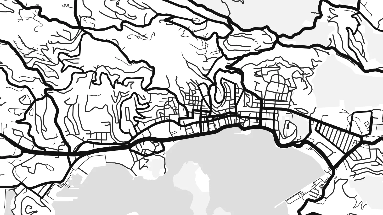
Hetta er ein 100% útskurður av teirri veruligu prentfíluni. Hvør plakat — prentað, í ramma ella niðurhalað — verður gjørd á okkara ambætarum við 300 DPI, upp til 7,200 × 10,800 pixlar, so eisini tær smæstu gøtur halda seg skarpar á einum 24 × 36″ prenti.
Á veggnum


Kortið
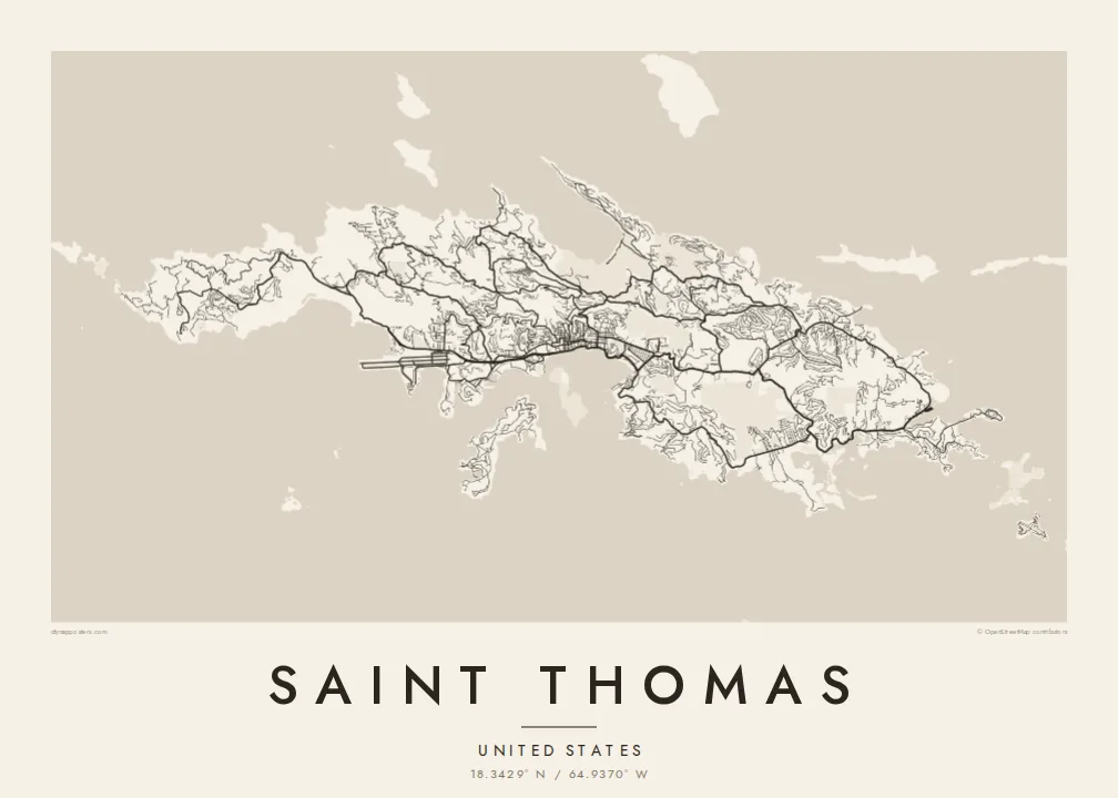
Saint Thomas is one of the three main United States Virgin Islands, a narrow island with a high ridge along its length. From above, the coast is intricate, with headlands, coves and small offshore islands on every side. The land rises steeply almost everywhere, so roads follow the contours in long switchbacks. Most building is spread along the southern shore.
Charlotte Amalie, the territorial capital, lines a wide harbour on the south coast. Cruise piers and a waterfront road front a historic core of narrow lanes and stepped streets that climb the hill. On the north side, Magens Bay forms a deep, rounded bite into the coast, sheltered by long headlands. A Saint Thomas map poster brings out both shapes clearly.
The island was a Danish colony for more than two centuries, until the United States bought the Danish West Indies in 1917. Danish street names and buildings still mark Charlotte Amalie. Cars still drive on the left, a long-standing local convention, even though most vehicles on the island are built for driving on the right.
The capital wraps around a broad harbour, and its historic centre climbs in steep, stepped lanes above the waterfront. It is the densest part of the map.
A deep, sheltered bay on the north shore, almost enclosed by two long headlands. Its rounded shape is one of the most recognisable features on the island.
A mountainous spine runs east to west through the island. The roads that climb it twist into tight curves before dropping down to either coast.
Ger tað til títt
Legg ein dag, eitt navn ella egnan tekst afturat, skift stíl, stødd ella snið.
Ókeypis forskoðanin er í lágari upploysing og hevur vatnmerki. Prent og HD-fílur verða gjørdar við 300 DPI, upp til 7,200 × 10,800 px, uttan vatnmerki.
Hví Saint Thomas
Saint Thomas is a landmark for cruise passengers, sailors and people who have made a life in the Virgin Islands. The map is a lasting keepsake of a harbour arrival, a wedding on the beach or years spent living on the hillside.
You can personalise the title and subtitle, add the coordinates of a favourite bay, and pick one of five styles. Download the HD files for $9 in any of six sizes, or order a matte print with an optional wooden frame.
Panta Saint Thomas-plakatið| Prentstødd | Upploysn | Fílur |
|---|---|---|
| 30 × 40 cm11.8 × 15.7″ | 3,543 × 4,724 px | PNG · PDF |
| 29.7 × 42 cm (A3)11.7 × 16.5″ | 3,508 × 4,961 px | PNG · PDF |
| 42 × 59.4 cm (A2)16.5 × 23.4″ | 4,961 × 7,016 px | PNG · PDF |
| 45.7 × 61 cm18 × 24″ | 5,400 × 7,200 px | PNG · PDF |
| 50 × 70 cm19.7 × 27.6″ | 5,906 × 8,268 px | PNG · PDF |
| 61 × 91.4 cm24 × 36″ | 7,200 × 10,800 px | PNG · PDF |
Til samanberingar er ókeypis forsýningin 900 px breið, við vatnmerki og ætlað til skerm. HD-fílurnar hava upp til 8 ferðir so høga upploysn í hvørja átt og verða prentaðar reint í fullari plakatstødd.
Vel ein stíl ovast á síðuni, og vel síðani Prentað Plakat — eina stødd og, um tú vil, eina ramma — ella Digital HD-Fílur. Tað tekur bara eitt stig at ganga til kassa, og pantanarsíðan tín dagførist so skjótt sum gjaldið er gjøgnumført.
Tað verður prentað á 200 gsm matt kvalitetspappír í einari av seks støddum, frá 30 × 40 cm til 24 × 36″. Prentaðar plakatir byrja á $39, sending íroknað.
Ja. Vel eina ramma av massivum træi í svørtum, hvítum, natúrligum eik ella dekkum træi. Hon kemur við glassi, sum ikki brotnar, og er klár at hongja upp. Plakatir í ramma byrja á $99, sending íroknað.
Flutningur er ókeypis til 60+ landa. Hvør plakat verður prentaður hjá tí prentfelaga okkara, sum er næstur, í 30+ londum, og kemur vanliga fram á 3–7 arbeiðsdøgum. Tú kanst fylgja støðuni og sporing undir Mínar pantanir. Fá lond taka 2–5 vikur, og har vit ikki enn senda, sigur vevsíðan tær frá, áðrenn tú rindar.
Send okkum eitt mynd innan 14 dagar eftir móttøku, og vit prenta tað umaftur ókeypis ella endurgjalda tær.
Ja. Í ritlinum á hesi síðu kanst tú broyta heitið, undirheitið og koordinatlinjuna til hvat sum helst, og velja stíl og stødd. Prentaðar, ramma- og digitalar pantanir brúka allar sama honnun, sum tú hevur gjørt.
Fyri $9 fært tú 300 DPI PNG- og prentklárar PDF-fílur í øllum seks støddum, uttan vatnmerki, so tú kanst prenta hvar sum helst. Ikki vís enn? Halda niður eina ókeypis forskoðan við vatnmerki fyrst.
