Crater lake
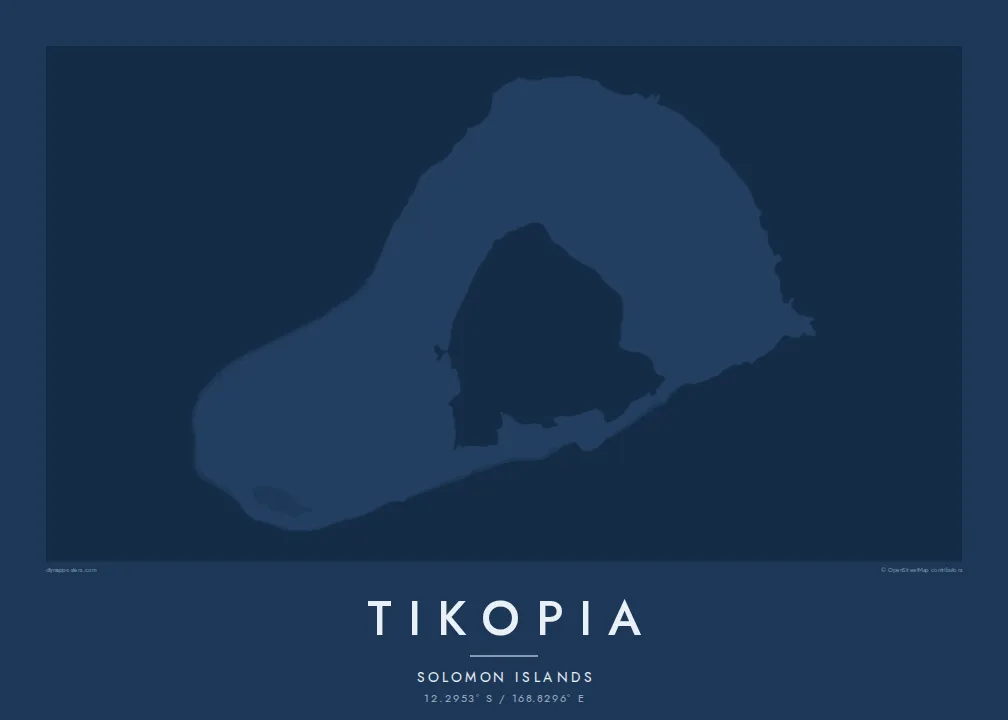
Te Roto fills the old volcanic crater, forming a pale inner shape that gives the island its unusual, almost ring-like appearance from above.
Minimalistiskt kortplakat · Salomonoyggjar
12.2953° S / 168.8296° E
A tiny volcanic island in the Solomon Islands, its old crater holding a lake beside steep hills and coastal villages.



Ein býur, fimm stemningar
Trýst á ein stíl fyri at síggja hann á veggnum. Allir stílar kosta tað sama — sum prent, í ramma ella sum HD-fílur.
 Veruligar pixlar · 24 × 36″ prentfíla
Prentskarpt
Hetta er ein 100% útskurður av teirri veruligu prentfíluni. Hvør plakat — prentað, í ramma ella niðurhalað — verður gjørd á okkara ambætarum við 300 DPI, upp til 7,200 × 10,800 pixlar, so eisini tær smæstu gøtur halda seg skarpar á einum 24 × 36″ prenti.
Á veggnum


Kortið
Tikopia is a small, remote island in Temotu Province of the Solomon Islands, far to the southeast of the main chain. From above it is compact and roughly oval, the remnant of an extinct volcano whose crater now holds a lake, Te Roto. Steep hills rise around the crater, and the land falls toward the sea on the other sides.
The people of Tikopia are Polynesian, although the island lies within Melanesia, and their villages sit on the flatter land along the coast and near the lake. There are no roads for vehicles, so the map is shaped by paths, gardens and the edge of the reef that surrounds the island.
The island is widely known through the work of anthropologist Raymond Firth, whose studies of Tikopian society became classics of the field. In 2002 Cyclone Zoe struck the island, and the community's recovery drew wide attention. A Tikopia map poster shows a small, carefully used landscape in the open Pacific, with the lake at its heart.
Te Roto fills the old volcanic crater, forming a pale inner shape that gives the island its unusual, almost ring-like appearance from above.
The old crater rim rises into steep hills, the highest ground on the island, drawn as tight contours between the lake and the sea.
A narrow reef follows the coastline, framing the island with a second outline and separating the shallow shore from the open ocean beyond.
Ger tað til títt
Legg ein dag, eitt navn ella egnan tekst afturat, skift stíl, stødd ella snið.
Ókeypis forskoðanin er í lágari upploysing og hevur vatnmerki. Prent og HD-fílur verða gjørdar við 300 DPI, upp til 7,200 × 10,800 px, uttan vatnmerki.
Hví Tikopia
Tikopia is a map for Solomon Islanders, for students and readers of Pacific anthropology and for anyone who values small, self-reliant communities. Its compact shape with a lake at its centre makes a gentle, balanced image on any wall.
Personalise the title, subtitle and coordinates line, and choose Classic black & white, Noir, Paper, Blueprint or Sand. Buy HD files for $9, each size a 300 DPI PNG and print-ready PDF, or order a printed poster from a partner near you.
Panta Tikopia-plakatið| Prentstødd | Upploysn | Fílur |
|---|---|---|
| 30 × 40 cm (11.8 × 15.7″) | 3,543 × 4,724 px | PNG · PDF |
| 29.7 × 42 cm (A3, 11.7 × 16.5″) | 3,508 × 4,961 px | PNG · PDF |
| 42 × 59.4 cm (A2, 16.5 × 23.4″) | 4,961 × 7,016 px | PNG · PDF |
| 45.7 × 61 cm (18 × 24″) | 5,400 × 7,200 px | PNG · PDF |
| 50 × 70 cm (19.7 × 27.6″) | 5,906 × 8,268 px | PNG · PDF |
| 61 × 91.4 cm (24 × 36″) | 7,200 × 10,800 px | PNG · PDF |
Til samanberingar er ókeypis forsýningin 900 px breið, við vatnmerki og ætlað til skerm. HD-fílurnar hava upp til 8 ferðir so høga upploysn í hvørja átt og verða prentaðar reint í fullari plakatstødd.
Vel ein stíl ovast á síðuni, og vel síðani Prentað Plakat — eina stødd og, um tú vil, eina ramma — ella Digital HD-Fílur. Tað tekur bara eitt stig at ganga til kassa, og pantanarsíðan tín dagførist so skjótt sum gjaldið er gjøgnumført.
Tað verður prentað á 200 gsm matt kvalitetspappír í einari av seks støddum, frá 30 × 40 cm til 24 × 36″. Prentaðar plakatir byrja á {printFrom}, sending íroknað.
Ja. Vel eina ramma av massivum træi í svørtum, hvítum, natúrligum eik ella dekkum træi. Hon kemur við glassi, sum ikki brotnar, og er klár at hongja upp. Plakatir í ramma byrja á {framedFrom}, sending íroknað.
Sending er ókeypis um allan heimin. Hvør plakat verður prentað av tí næstu av okkara prentpartnarum í 30+ londum og kemur vanliga innan 3–7 arbeiðsdagar. Tú kanst fylgja við støðu og sporing undir Mínar Pantanir.
Send okkum eitt mynd innan 14 dagar eftir móttøku, og vit prenta tað umaftur ókeypis ella endurgjalda tær.
Ja. Í ritlinum á hesi síðu kanst tú broyta heitið, undirheitið og koordinatlinjuna til hvat sum helst, og velja stíl og stødd. Prentaðar, ramma- og digitalar pantanir brúka allar sama honnun, sum tú hevur gjørt.
Fyri $9 fært tú 300 DPI PNG- og prentklárar PDF-fílur í øllum seks støddum, uttan vatnmerki, so tú kanst prenta hvar sum helst. Ikki vís enn? Halda niður eina ókeypis forskoðan við vatnmerki fyrst.
