Lincoln Highway
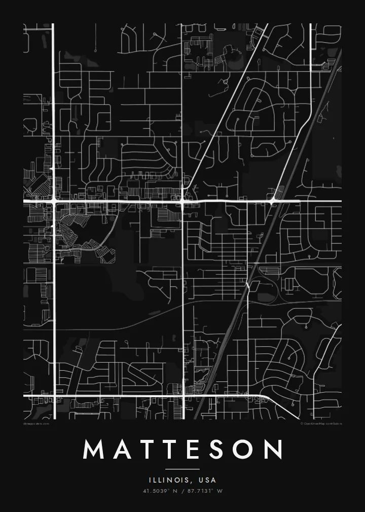
US 30 crosses the village east to west along the route of the Lincoln Highway, the early twentieth-century road linking New York and San Francisco. On the poster it is one of the longest straight lines.
Affiche carte minimaliste · États-Unis
41.5039° N / 87.7131° W
A south-suburban Chicago grid where Interstate 57, the Lincoln Highway and the Metra Electric line cut clean lines across former prairie.



Une ville, cinq ambiances
Touchez un style pour le voir sur le mur. Tous les styles coûtent le même prix — imprimé, encadré ou en fichiers HD.
 Pixels réels · fichier d'impression 24 × 36″
Netteté d'impression
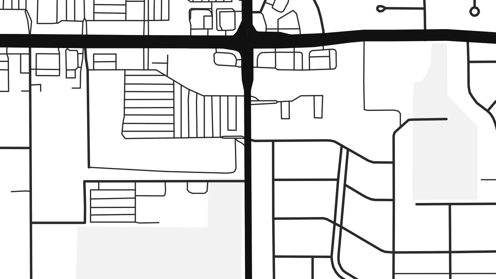
Ceci est un recadrage à 100 % du fichier d'impression réel. Chaque poster — imprimé, encadré ou téléchargé — est généré sur nos serveurs à 300 DPI, jusqu'à 7,200 × 10,800 pixels, pour que même les plus petites ruelles restent nettes sur un tirage 24 × 36″.
Au mur


La carte
Matteson sits on the flat land south of Chicago, where the old prairie was divided into survey-mile squares long before the houses arrived. From above, that pattern is still easy to read. Section-line roads run straight north–south and east–west, and the residential streets inside each square form the loops, cul-de-sacs and short crescents typical of postwar Illinois suburbs.
The village began as a railroad settlement and is named after Joel Matteson, a governor of Illinois in the 1850s. The rail corridor still runs through town and now carries Metra Electric commuter trains toward downtown Chicago. On the map it reads as a long, unbroken line, and most streets meet it at right angles instead of crossing it at random.
Two major roads frame the picture. Interstate 57 runs north–south through the village with its interchange ramps, and US 30, the historic Lincoln Highway, runs east–west along one of the country's earliest coast-to-coast routes. A Matteson map poster shows where a transcontinental road, a commuter railway and quiet residential blocks meet, all in one orderly composition.
US 30 crosses the village east to west along the route of the Lincoln Highway, the early twentieth-century road linking New York and San Francisco. On the poster it is one of the longest straight lines.
The interstate runs north–south through the village. Its interchange ramps are the most curved, sculptural shapes on an otherwise rectilinear map.
Between the section-line roads, subdivisions use curving drives and cul-de-sacs. Each square mile gets its own pattern of rounded lines inside a rigid outer frame.
Personnalisez-la
Ajoutez une date, un nom ou votre propre phrase, changez de style, de format ou d'orientation.
L'aperçu gratuit est en basse résolution avec un filigrane. Les impressions et fichiers HD sont générés à 300 DPI, jusqu'à 7,200 × 10,800 px, sans filigrane.
Pourquoi Matteson
For people who grew up in the south suburbs or rode the Metra from here, the map is a quiet record of daily routes: the station, the highway ramps, the street where the family house stood. It suits a hallway, a home office or a first apartment in the city.
You can set your own title, subtitle and coordinates line, for example a family name or a move-in date, and choose Classic black & white, Noir, Paper, Blueprint or Sand. The $9 digital download includes six print sizes as 300 DPI PNG and PDF files. Printed and framed versions ship from partners in 30+ countries.
Commander le poster Matteson| Format d'impression | Résolution | Fichiers |
|---|---|---|
| 30 × 40 cm11.8 × 15.7″ | 3,543 × 4,724 px | PNG · PDF |
| 29.7 × 42 cm (A3)11.7 × 16.5″ | 3,508 × 4,961 px | PNG · PDF |
| 42 × 59.4 cm (A2)16.5 × 23.4″ | 4,961 × 7,016 px | PNG · PDF |
| 45.7 × 61 cm18 × 24″ | 5,400 × 7,200 px | PNG · PDF |
| 50 × 70 cm19.7 × 27.6″ | 5,906 × 8,268 px | PNG · PDF |
| 61 × 91.4 cm24 × 36″ | 7,200 × 10,800 px | PNG · PDF |
À titre de comparaison, l'aperçu gratuit fait 900 px de large, porte un filigrane et est destiné aux écrans. Les fichiers HD offrent jusqu'à 8× plus de résolution dans chaque direction et s'impriment parfaitement en taille réelle.
Choisissez un style en haut de la page, puis sélectionnez Poster Imprimé — une taille et, si vous le souhaitez, un cadre — ou les Fichiers Numériques HD. Le paiement se fait en une seule étape, et votre page de commande se met à jour dès que le paiement est validé.
Il est imprimé sur papier mat premium 200 g/m² dans l'une des six tailles, de 30 × 40 cm à 24 × 36″. Les posters imprimés démarrent à $39, livraison incluse.
Oui. Choisissez un cadre en bois massif noir, blanc, chêne naturel ou bois foncé. Il est livré avec un verre incassable et prêt à accrocher. Les posters encadrés démarrent à $99, livraison incluse.
La livraison est gratuite dans plus de 60 pays. Chaque affiche est imprimée par le partenaire d'impression le plus proche parmi nos partenaires répartis dans plus de 30 pays, et arrive généralement en 3 à 7 jours ouvrés. Vous pouvez suivre le statut et le suivi de colis dans Mes commandes. Quelques pays demandent de 2 à 5 semaines, et si nous ne livrons pas encore chez vous, le site vous le indique avant le paiement.
Envoyez-nous une photo dans les 14 jours suivant la livraison et nous le réimprimerons gratuitement ou vous rembourserons.
Oui. Dans l'éditeur de cette page, modifiez le titre, le sous-titre et la ligne de coordonnées comme vous le souhaitez, puis choisissez un style et une taille. Les commandes imprimées, encadrées et numériques utilisent exactement votre design.
Pour $9, vous obtenez des fichiers PNG 300 DPI et PDF prêts à imprimer dans les six tailles, sans filigrane, à imprimer partout. Pas encore sûr ? Téléchargez d'abord un aperçu gratuit avec filigrane.
