Streets on the ridges
Roads follow the tops and flanks of the hills, bending with the terrain. From above they form a loose, branching pattern instead of a grid.
Postè kat minimalis · Palestinian Territories
31.5159° N / 35.1642° E
A hilltop town east of Hebron, its streets spread over ridges that fall away towards the Judean desert


Yon vil, senk atmosfè
Peze yon style pou wè li sou mi a. Chak style koute menm pri — enprime, ankadre oswa kòm fichye HD.
 Piksèl reyèl · fichye enpresyon 24 × 36″
Byen klè pou enprime
Sa a se yon zoom 100% sou vrè fichye enpresyon an. Chak afich — enprime, ankadre oswa telechaje — jenere sou sèvè nou yo nan 300 DPI, jiska 7,200 × 10,800 piksèl, konsa menm pi piti wout yo rete klè sou yon enpresyon 24 × 36″.
Sou mi a


Kat la
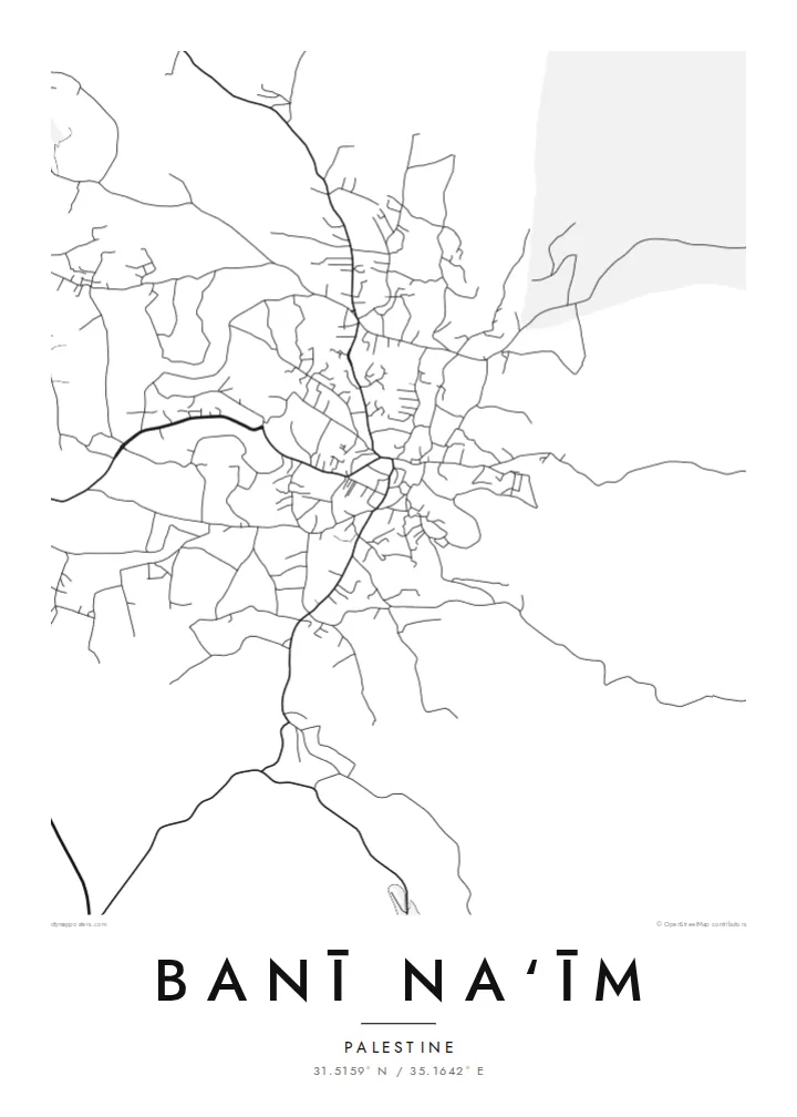
Banī Na‘īm lies on high ground east of Hebron, in the southern West Bank. From above, the town spreads across a series of hills, with streets following the ridges and curving down the slopes instead of forming a regular grid. Houses cluster densely near the older core and loosen out towards the edges. Beyond them, the land drops away eastward into increasingly dry terrain.
The town is known for a mosque traditionally associated with the tomb of the prophet Lot, which has long made it a place of local religious significance. To the east the highlands give way to the Judean desert and, further on, the Dead Sea basin. On the map this shows up as a steady thinning of roads and buildings as the land becomes more arid.
A Banī Na‘īm map poster traces how the town fits its hills: winding roads, dense clusters of houses and the open ground around them. In black and white the contours of the settlement become clear, even without drawn topography. It suits people from the town and its many families abroad, who carry a strong attachment to its streets and its view towards the desert.
Roads follow the tops and flanks of the hills, bending with the terrain. From above they form a loose, branching pattern instead of a grid.
Near the traditional centre, around the mosque associated with Lot, buildings sit closely together and lanes become shorter and denser.
Eastward, the built area thins out and roads become sparse as the highlands descend towards the Judean desert and the Dead Sea basin.
Fè l pou ou
Ajoute yon dat, yon non oswa pwòp fraz pa w, chanje estil, gwosè oswa oryantasyon.
Apèsi gratis la se nan rezolisyon ba avèk yon watèrmak. Enpresyon ak fichye HD yo jenere nan 300 DPI, jiska 7,200 × 10,800 px, san watèrmak.
Poukisa Banī Na‘īm
For families from Banī Na‘īm, near or far, a map of the town is a way to keep its streets and hills in daily view. It makes a quiet, meaningful gift for a new home or a relative abroad.
Personalise the title and subtitle with a family name or date, and keep or edit the coordinates line. Choose Classic black & white, Noir, Paper, Blueprint or Sand. Sand suits the warm stone of the landscape.
Kòmande afich Banī Na‘īm a| Gwosè enpresyon | Rezolisyon | Fichye |
|---|---|---|
| 30 × 40 cm11.8 × 15.7″ | 3,543 × 4,724 px | PNG · PDF |
| 29.7 × 42 cm (A3)11.7 × 16.5″ | 3,508 × 4,961 px | PNG · PDF |
| 42 × 59.4 cm (A2)16.5 × 23.4″ | 4,961 × 7,016 px | PNG · PDF |
| 45.7 × 61 cm18 × 24″ | 5,400 × 7,200 px | PNG · PDF |
| 50 × 70 cm19.7 × 27.6″ | 5,906 × 8,268 px | PNG · PDF |
| 61 × 91.4 cm24 × 36″ | 7,200 × 10,800 px | PNG · PDF |
Pou konpare, apèsi gratis la gen 900 px lajè, li gen filigràn epi li fèt pou ekran. Fichye HD yo gen jiska 8 fwa plis rezolisyon nan chak direksyon epi yo enprime pwòp nan gwosè postè konplè.
Chwazi yon style anlè paj la, epi chwazi Afich Enprime — yon gwosè epi, si w vle, yon kad — oswa Fichye Dijital HD. Peman an fèt nan yon sèl etap, epi paj kòmand ou a mete ajou kou peman an konfime.
Li enprime sou papye mat premium 200 gsm nan youn nan sis gwosè, soti nan 30 × 40 cm rive nan 24 × 36″. Afich enprime yo kòmanse nan $39, livrezon enkli.
Wi. Chwazi yon kad an bwa solid nan koulè nwa, blan, chenn natirèl oswa bwa fonse. Li vin ak yon vit ki pa kase epi li pare pou pandye. Afich ankadre yo kòmanse nan $99, livrezon enkli.
Livrezon gratis nan plis pase 60 peyi. Chak afich enprime pa patnè enprimeri ki pi pre w la nan plis pase 30 peyi, e anjeneral li rive nan 3 a 7 jou ouvrab. Ou ka suiv estati a ak swivi kolis la nan Kòmand mwen yo. Kèk peyi pran 2 a 5 semèn, e kote nou poko livre, sit la di w sa anvan w peye.
Voye nou yon foto nan 14 jou apre livrezon an epi nou ap reenprime li gratis oswa remèt ou lajan w.
Wi. Nan editè a sou paj sa a, chanje tit la, soutit la ak liy kowòdone yo pou nenpòt sa w vle, epi chwazi yon style ak yon gwosè. Kòmand enprime, ankadre ak dijital yo tout itilize egzakteman desen w lan.
Pou $9 ou jwenn fichye PNG 300 DPI ak PDF pare-pou-enprime nan tout sis gwosè yo, san watèrmak, pou enprime kote w vle. Pa sèten toujou? Telechaje yon apèsi gratis ak watèrmak anvan.
Toupre
