Gezira and Roda
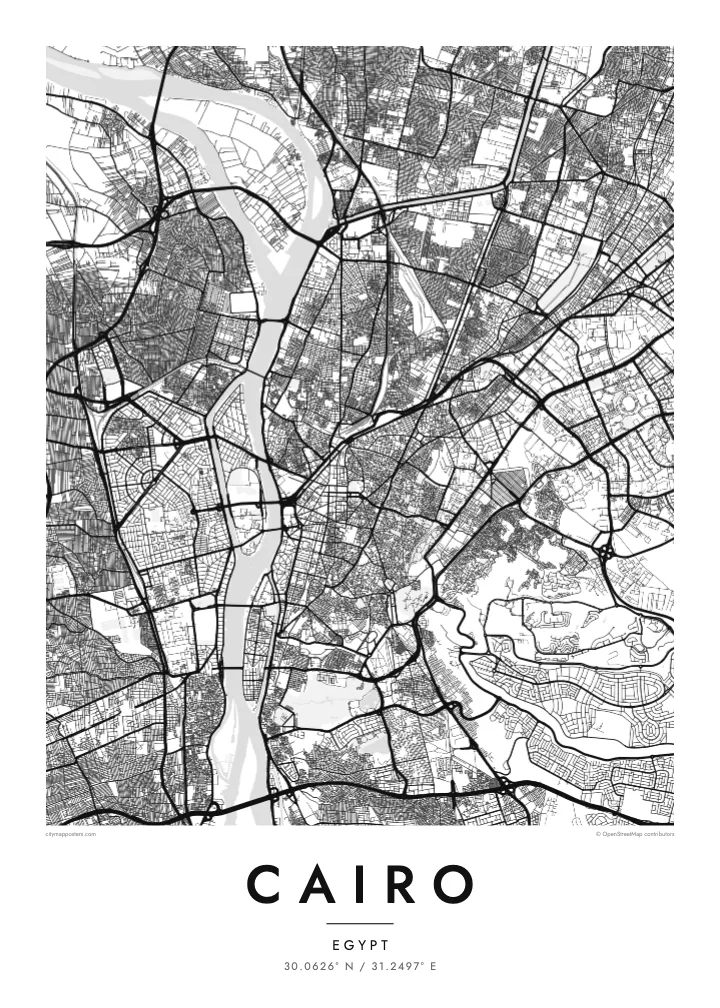
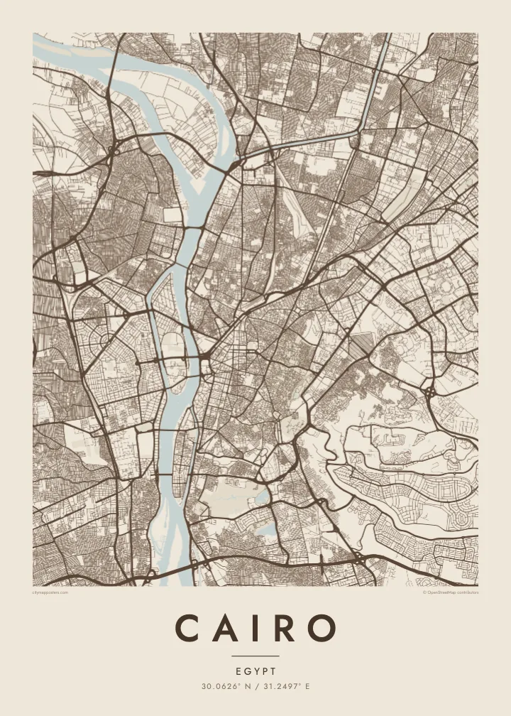
Two elongated islands in the Nile. Gezira holds Zamalek's leafy streets and sports grounds; Roda lies to the south near Old Cairo. Both show clearly as shaped land within the river.
Postè kat minimalis · Egypt
30.0626° N / 31.2497° E
The Nile running north through a vast city, parting around Gezira and Roda, with the old Islamic quarter dense to the east.
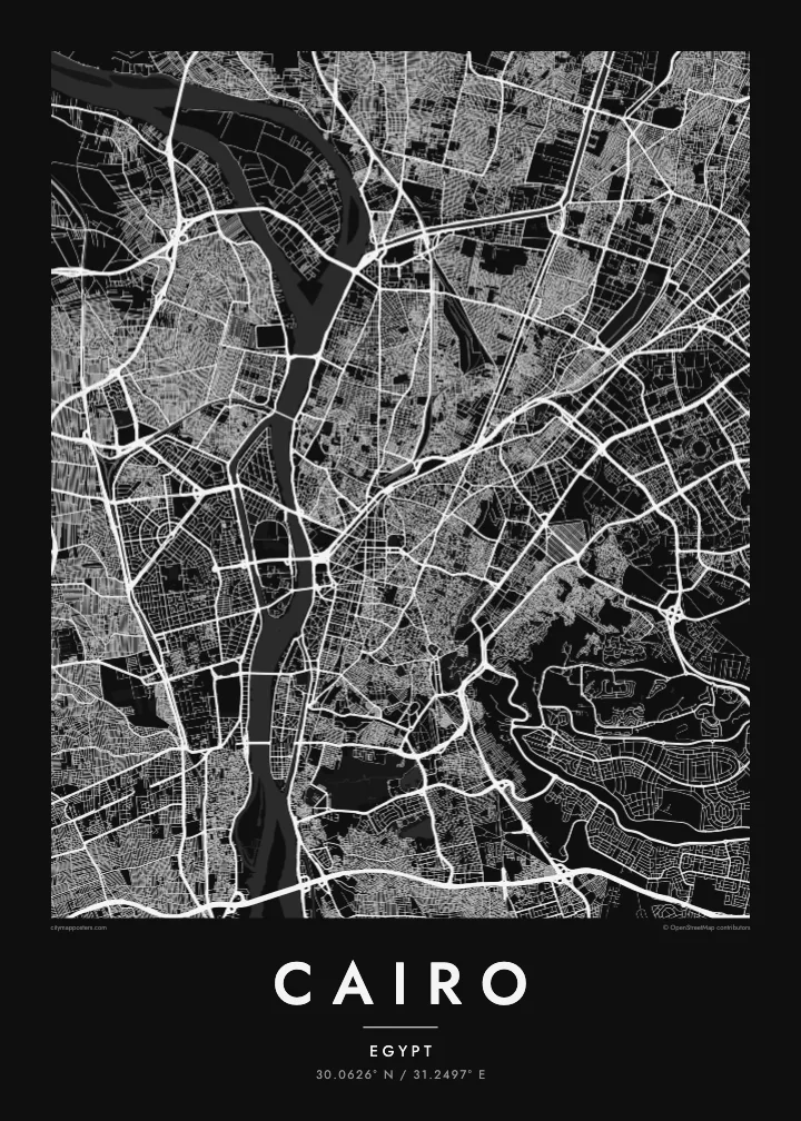
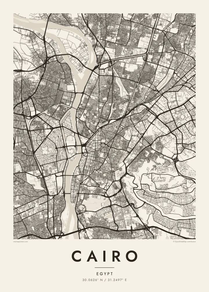
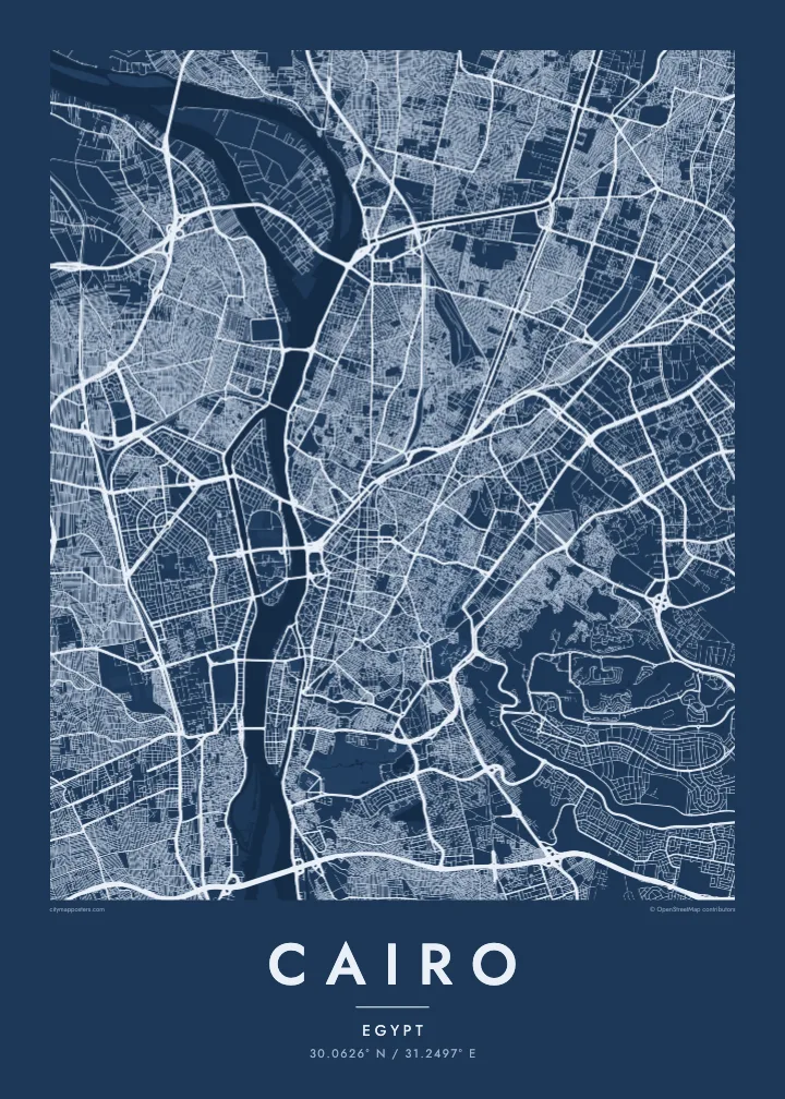
Yon vil, senk atmosfè
Peze yon style pou wè li sou mi a. Chak style koute menm pri — enprime, ankadre oswa kòm fichye HD.
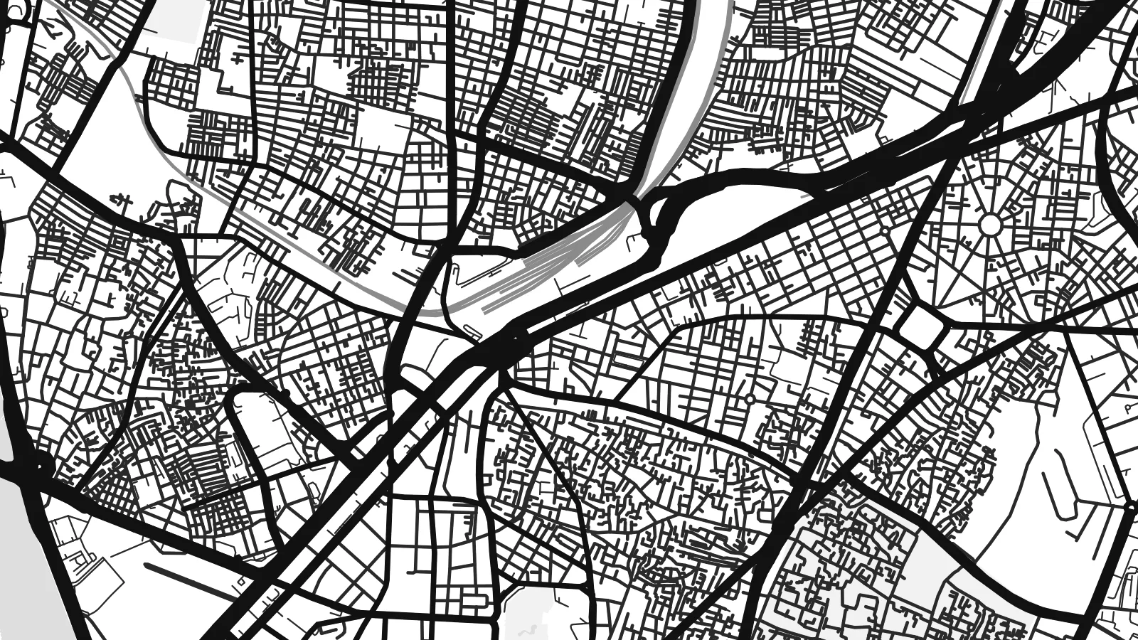 Piksèl reyèl · fichye enpresyon 24 × 36″
Byen klè pou enprime
Sa a se yon zoom 100% sou vrè fichye enpresyon an. Chak afich — enprime, ankadre oswa telechaje — jenere sou sèvè nou yo nan 300 DPI, jiska 7,200 × 10,800 piksèl, konsa menm pi piti wout yo rete klè sou yon enpresyon 24 × 36″.
Sou mi a


Kat la
Cairo is organised around the Nile, which flows north through the city in a broad channel before fanning out into the delta beyond. Two long islands sit in the river: Gezira, home to Zamalek and the Cairo Tower, and Roda further south. Bridges tie them to both banks, so the map reads as a sequence of crossings stacked along the water.
East of the river, downtown was laid out in the nineteenth century under Khedive Ismail, with boulevards and squares arranged in a European manner around what is now Tahrir Square. Further east the streets change completely. Historic Cairo, a UNESCO World Heritage Site, is a close web of lanes, mosques and courtyards leading up to the Citadel on its spur of the Mokattam hills.
The Pyramids of Giza stand on the desert plateau west of the river, at the edge of the wider metropolitan area, and the city's ring road loops out toward them. A Cairo map poster brings these layers together: the medieval street pattern, the planned downtown and the Nile, which in black and white becomes the calm centre of a very dense composition.
Two elongated islands in the Nile. Gezira holds Zamalek's leafy streets and sports grounds; Roda lies to the south near Old Cairo. Both show clearly as shaped land within the river.
The old city east of downtown, with Al-Muizz Street, Khan el-Khalili and hundreds of mosques. Its narrow, irregular lanes form the most intricate texture anywhere on the map.
Saladin's twelfth-century citadel sits on a rise at the foot of the Mokattam hills, where the dense street pattern gives way to open ground and the long ridge to the east.
Fè l pou ou
Ajoute yon dat, yon non oswa pwòp fraz pa w, chanje estil, gwosè oswa oryantasyon.
Apèsi gratis la se nan rezolisyon ba avèk yon watèrmak. Enpresyon ak fichye HD yo jenere nan 300 DPI, jiska 7,200 × 10,800 px, san watèrmak.
Poukisa Cairo
Cairo is one of those cities that stays with people, whether they grew up in Heliopolis, studied at a university downtown or spent a week between the museums and the old markets. A map of its streets is a quieter reminder than any souvenir.
Write your own title and subtitle, keep or edit the coordinates line, and choose one of five styles. Sand suits the desert light, while Noir gives the river strong contrast. Printed posters on matte paper ship from partners in more than 30 countries.
Kòmande afich Cairo a| Gwosè enpresyon | Rezolisyon | Fichye |
|---|---|---|
| 30 × 40 cm (11.8 × 15.7″) | 3,543 × 4,724 px | PNG · PDF |
| 29.7 × 42 cm (A3, 11.7 × 16.5″) | 3,508 × 4,961 px | PNG · PDF |
| 42 × 59.4 cm (A2, 16.5 × 23.4″) | 4,961 × 7,016 px | PNG · PDF |
| 45.7 × 61 cm (18 × 24″) | 5,400 × 7,200 px | PNG · PDF |
| 50 × 70 cm (19.7 × 27.6″) | 5,906 × 8,268 px | PNG · PDF |
| 61 × 91.4 cm (24 × 36″) | 7,200 × 10,800 px | PNG · PDF |
Pou konpare, apèsi gratis la gen 900 px lajè, li gen filigràn epi li fèt pou ekran. Fichye HD yo gen jiska 8 fwa plis rezolisyon nan chak direksyon epi yo enprime pwòp nan gwosè postè konplè.
Chwazi yon style anlè paj la, epi chwazi Afich Enprime — yon gwosè epi, si w vle, yon kad — oswa Fichye Dijital HD. Peman an fèt nan yon sèl etap, epi paj kòmand ou a mete ajou kou peman an konfime.
Li enprime sou papye mat premium 200 gsm nan youn nan sis gwosè, soti nan 30 × 40 cm rive nan 24 × 36″. Afich enprime yo kòmanse nan {printFrom}, livrezon enkli.
Wi. Chwazi yon kad an bwa solid nan koulè nwa, blan, chenn natirèl oswa bwa fonse. Li vin ak yon vit ki pa kase epi li pare pou pandye. Afich ankadre yo kòmanse nan {framedFrom}, livrezon enkli.
Livrezon an gratis nan tout mond lan. Se pi pwòch nan patnè enprimri nou yo nan plis pase 30 peyi ki enprime chak afich la, epi li anjeneral rive nan 3–7 jou ouvrab. Ou ka swiv estati ak swivi kolis la nan Kòmand mwen yo. Gen kèk peyi ki pran 2–5 semèn, e kote nou poko livre a, sit la di w anvan ou peye.
Voye nou yon foto nan 14 jou apre livrezon an epi nou ap reenprime li gratis oswa remèt ou lajan w.
Wi. Nan editè a sou paj sa a, chanje tit la, soutit la ak liy kowòdone yo pou nenpòt sa w vle, epi chwazi yon style ak yon gwosè. Kòmand enprime, ankadre ak dijital yo tout itilize egzakteman desen w lan.
Pou $9 ou jwenn fichye PNG 300 DPI ak PDF pare-pou-enprime nan tout sis gwosè yo, san watèrmak, pou enprime kote w vle. Pa sèten toujou? Telechaje yon apèsi gratis ak watèrmak anvan.
