Humber Arm
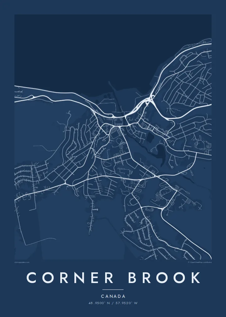
The long inlet runs inland from the Bay of Islands and ends at the city, giving the map a strong band of water along its lower edge.
Postè kat minimalis · Canada
48.9500° N / 57.9520° W
A city built on steep slopes above the Humber Arm, with its paper mill on the waterfront and streets winding uphill.



Yon vil, senk atmosfè
Peze yon style pou wè li sou mi a. Chak style koute menm pri — enprime, ankadre oswa kòm fichye HD.
 Piksèl reyèl · fichye enpresyon 24 × 36″
Byen klè pou enprime
Sa a se yon zoom 100% sou vrè fichye enpresyon an. Chak afich — enprime, ankadre oswa telechaje — jenere sou sèvè nou yo nan 300 DPI, jiska 7,200 × 10,800 piksèl, konsa menm pi piti wout yo rete klè sou yon enpresyon 24 × 36″.
Sou mi a


Kat la
Corner Brook sits on the west coast of Newfoundland at the head of the Humber Arm, a long, fjord-like inlet of the Bay of Islands. The city is built on hillsides that rise sharply from the water, so its streets rarely run straight for long. From above they bend and double back across the slopes, while the industrial waterfront takes up the shoreline below.
The pulp and paper mill dominates that waterfront. It has shaped the city since the 1920s and is still its best-known landmark. Corner Brook formed from several separate communities that merged in 1956, and the older centres can still be read in the street pattern, as clusters of denser streets separated by steep ground and wooded gullies.
Captain James Cook surveyed this coast in the 1760s, and a monument to him overlooks the city. Marble Mountain ski resort lies a short way up the Humber Valley. A Corner Brook map poster works best with plenty of water in the frame, so the Humber Arm can be seen cutting inland between the hills.
The long inlet runs inland from the Bay of Islands and ends at the city, giving the map a strong band of water along its lower edge.
Roads curve and climb across steep ground in layered, contour-like lines, so the city looks nothing like a flat grid.
The paper mill occupies a broad stretch of the shoreline, and its large industrial footprint anchors the centre of the city on the map.
Fè l pou ou
Ajoute yon dat, yon non oswa pwòp fraz pa w, chanje estil, gwosè oswa oryantasyon.
Apèsi gratis la se nan rezolisyon ba avèk yon watèrmak. Enpresyon ak fichye HD yo jenere nan 300 DPI, jiska 7,200 × 10,800 px, san watèrmak.
Poukisa Corner Brook
Newfoundlanders who have moved to the mainland or further away often keep strong ties to home, and people speak of Corner Brook with real attachment. A print of the Humber Arm and the hills around it is a steady reminder of that.
Add a neighbourhood, a family name or a year to the title and subtitle, and keep the coordinates as a precise marker. Noir and Blueprint suit the dramatic terrain well, and all five styles come as printed posters or print-ready files.
Kòmande afich Corner Brook a| Gwosè enpresyon | Rezolisyon | Fichye |
|---|---|---|
| 30 × 40 cm (11.8 × 15.7″) | 3,543 × 4,724 px | PNG · PDF |
| 29.7 × 42 cm (A3, 11.7 × 16.5″) | 3,508 × 4,961 px | PNG · PDF |
| 42 × 59.4 cm (A2, 16.5 × 23.4″) | 4,961 × 7,016 px | PNG · PDF |
| 45.7 × 61 cm (18 × 24″) | 5,400 × 7,200 px | PNG · PDF |
| 50 × 70 cm (19.7 × 27.6″) | 5,906 × 8,268 px | PNG · PDF |
| 61 × 91.4 cm (24 × 36″) | 7,200 × 10,800 px | PNG · PDF |
Pou konpare, apèsi gratis la gen 900 px lajè, li gen filigràn epi li fèt pou ekran. Fichye HD yo gen jiska 8 fwa plis rezolisyon nan chak direksyon epi yo enprime pwòp nan gwosè postè konplè.
Chwazi yon style anlè paj la, epi chwazi Afich Enprime — yon gwosè epi, si w vle, yon kad — oswa Fichye Dijital HD. Peman an fèt nan yon sèl etap, epi paj kòmand ou a mete ajou kou peman an konfime.
Li enprime sou papye mat premium 200 gsm nan youn nan sis gwosè, soti nan 30 × 40 cm rive nan 24 × 36″. Afich enprime yo kòmanse nan {printFrom}, livrezon enkli.
Wi. Chwazi yon kad an bwa solid nan koulè nwa, blan, chenn natirèl oswa bwa fonse. Li vin ak yon vit ki pa kase epi li pare pou pandye. Afich ankadre yo kòmanse nan {framedFrom}, livrezon enkli.
Livrezon an gratis nan tout mond lan. Se pi pwòch nan patnè enprimri nou yo nan plis pase 30 peyi ki enprime chak afich la, epi li anjeneral rive nan 3–7 jou ouvrab. Ou ka swiv estati ak swivi kolis la nan Kòmand mwen yo. Gen kèk peyi ki pran 2–5 semèn, e kote nou poko livre a, sit la di w anvan ou peye.
Voye nou yon foto nan 14 jou apre livrezon an epi nou ap reenprime li gratis oswa remèt ou lajan w.
Wi. Nan editè a sou paj sa a, chanje tit la, soutit la ak liy kowòdone yo pou nenpòt sa w vle, epi chwazi yon style ak yon gwosè. Kòmand enprime, ankadre ak dijital yo tout itilize egzakteman desen w lan.
Pou $9 ou jwenn fichye PNG 300 DPI ak PDF pare-pou-enprime nan tout sis gwosè yo, san watèrmak, pou enprime kote w vle. Pa sèten toujou? Telechaje yon apèsi gratis ak watèrmak anvan.
