Krk Bridge
Two concrete arches leap from the mainland to the island via a rocky islet. They form the single fixed link at the northern tip.
Postè kat minimalis · Croatia
45.0902° N / 14.6256° E
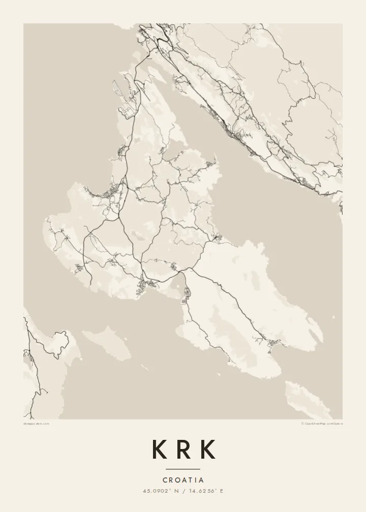
A broad, stony island in the Kvarner Gulf, bridged to the mainland and scalloped with deep bays




Yon vil, senk atmosfè
Peze yon style pou wè li sou mi a. Chak style koute menm pri — enprime, ankadre oswa kòm fichye HD.
 Piksèl reyèl · fichye enpresyon 24 × 36″
Byen klè pou enprime
Sa a se yon zoom 100% sou vrè fichye enpresyon an. Chak afich — enprime, ankadre oswa telechaje — jenere sou sèvè nou yo nan 300 DPI, jiska 7,200 × 10,800 piksèl, konsa menm pi piti wout yo rete klè sou yon enpresyon 24 × 36″.
Sou mi a


Kat la
Krk sits in the Kvarner Gulf close to Rijeka, and it is one of the two largest islands in the Adriatic. Its outline is irregular. The north is wider, low and greener, while the south-east rises into bare limestone ridges above the long valley of Baška. The coast is scalloped by bays, the largest of which reach deep into the island at Punat and Soline.
In the north, the Krk Bridge links the island to the mainland. Opened in 1980, it runs in two concrete arches via a small islet, and Rijeka airport sits on the island near its landing. The towns are strung along the shore: Omišalj on its hill, Malinska and Njivice on the western coast, and the walled town of Krk on the south-west.
A Krk map poster also takes in the enclosed bay of Punat with the small islet of Košljun and its Franciscan monastery. In the south, Baška is where the Baška tablet was found. This stone slab carries one of the earliest inscriptions in Croatian, in the Glagolitic script, and is often cited as a founding text of the language.
Two concrete arches leap from the mainland to the island via a rocky islet. They form the single fixed link at the northern tip.
An almost enclosed bay south-east of Krk town, with the small islet of Košljun in the middle. On the map it looks like an inland lake.
A compact walled town on the south-west coast, with narrow streets inside the old defences and a small harbour on the waterfront.
Fè l pou ou
Ajoute yon dat, yon non oswa pwòp fraz pa w, chanje estil, gwosè oswa oryantasyon.
Apèsi gratis la se nan rezolisyon ba avèk yon watèrmak. Enpresyon ak fichye HD yo jenere nan 300 DPI, jiska 7,200 × 10,800 px, san watèrmak.
Poukisa Krk
Krk is where many families have spent summers for generations, arriving over the bridge from Rijeka. The island's bays and ridges give a poster plenty of detail without crowding, and it looks right in both large and small frames.
Add your own title, subtitle and coordinates line, such as a village name or a year. Choose Classic black & white, Noir, Paper, Blueprint or Sand, then get HD files for $9 or a printed poster with an optional wooden frame.
Kòmande afich Krk a| Gwosè enpresyon | Rezolisyon | Fichye |
|---|---|---|
| 30 × 40 cm (11.8 × 15.7″) | 3,543 × 4,724 px | PNG · PDF |
| 29.7 × 42 cm (A3, 11.7 × 16.5″) | 3,508 × 4,961 px | PNG · PDF |
| 42 × 59.4 cm (A2, 16.5 × 23.4″) | 4,961 × 7,016 px | PNG · PDF |
| 45.7 × 61 cm (18 × 24″) | 5,400 × 7,200 px | PNG · PDF |
| 50 × 70 cm (19.7 × 27.6″) | 5,906 × 8,268 px | PNG · PDF |
| 61 × 91.4 cm (24 × 36″) | 7,200 × 10,800 px | PNG · PDF |
Pou konpare, apèsi gratis la gen 900 px lajè, li gen filigràn epi li fèt pou ekran. Fichye HD yo gen jiska 8 fwa plis rezolisyon nan chak direksyon epi yo enprime pwòp nan gwosè postè konplè.
Chwazi yon style anlè paj la, epi chwazi Afich Enprime — yon gwosè epi, si w vle, yon kad — oswa Fichye Dijital HD. Peman an fèt nan yon sèl etap, epi paj kòmand ou a mete ajou kou peman an konfime.
Li enprime sou papye mat premium 200 gsm nan youn nan sis gwosè, soti nan 30 × 40 cm rive nan 24 × 36″. Afich enprime yo kòmanse nan {printFrom}, livrezon enkli.
Wi. Chwazi yon kad an bwa solid nan koulè nwa, blan, chenn natirèl oswa bwa fonse. Li vin ak yon vit ki pa kase epi li pare pou pandye. Afich ankadre yo kòmanse nan {framedFrom}, livrezon enkli.
Livrezon gratis toupatou nan mond lan. Chak afich enprime nan patnè enpresyon ki pi pre nan plis pase 30 peyi, e li rive jeneralman nan 3–7 jou ouvrab. Ou ka swiv estati ak suivi anba My Orders.
Voye nou yon foto nan 14 jou apre livrezon an epi nou ap reenprime li gratis oswa remèt ou lajan w.
Wi. Nan editè a sou paj sa a, chanje tit la, soutit la ak liy kowòdone yo pou nenpòt sa w vle, epi chwazi yon style ak yon gwosè. Kòmand enprime, ankadre ak dijital yo tout itilize egzakteman desen w lan.
Pou $9 ou jwenn fichye PNG 300 DPI ak PDF pare-pou-enprime nan tout sis gwosè yo, san watèrmak, pou enprime kote w vle. Pa sèten toujou? Telechaje yon apèsi gratis ak watèrmak anvan.
