Parallel rail lines
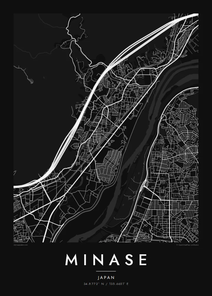
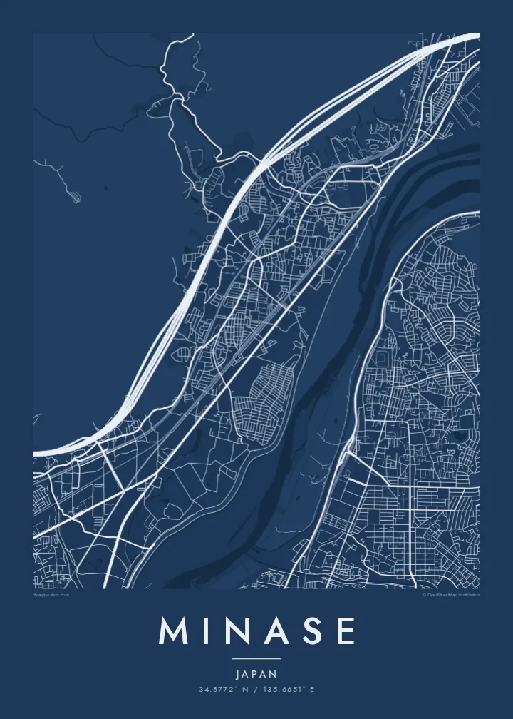
Several railways run side by side through the narrow corridor. They draw long, confident lines across the map from Kyoto toward Osaka.
Postè kat minimalis · Japan
34.8772° N / 135.6651° E
A narrow corridor between hills and the Yodo River, threaded with railways where Osaka and Kyoto almost meet.



Yon vil, senk atmosfè
Peze yon style pou wè li sou mi a. Chak style koute menm pri — enprime, ankadre oswa kòm fichye HD.
 Piksèl reyèl · fichye enpresyon 24 × 36″
Byen klè pou enprime
Sa a se yon zoom 100% sou vrè fichye enpresyon an. Chak afich — enprime, ankadre oswa telechaje — jenere sou sèvè nou yo nan 300 DPI, jiska 7,200 × 10,800 piksèl, konsa menm pi piti wout yo rete klè sou yon enpresyon 24 × 36″.
Sou mi a


Kat la
Minase is a district of Shimamoto in the north-east of Osaka Prefecture, close to the border with Kyoto. The map here is defined by a squeeze. Wooded hills press down from the north-west, and the broad Yodo River and its floodplain spread to the south-east. Between them is a slim strip of flat land that roads, homes and several parallel rail lines all share.
The district gives its name to Minase Shrine, dedicated to Emperor Go-Toba, who kept a detached palace here in the early thirteenth century. The shrine's spring water is widely known, and people come with bottles to fill. A little further along the valley lies Yamazaki, long associated with whisky distilling because of its soft water and misty climate.
A Minase map poster fits one of Japan's busiest transport corridors into a very compact frame. The Shinkansen, JR and Hankyu lines run side by side, the river lies beyond them, and quiet residential streets sit tucked in between. The long, straight rail lines against the folded hills give the print strong graphic tension.
Several railways run side by side through the narrow corridor. They draw long, confident lines across the map from Kyoto toward Osaka.
The wide river and its embankments fill the south-eastern side, a broad band of open space just downstream of where three rivers join.
Forested slopes rise directly behind the residential streets, giving the northern edge of the map a soft, empty texture that frames the town.
Fè l pou ou
Ajoute yon dat, yon non oswa pwòp fraz pa w, chanje estil, gwosè oswa oryantasyon.
Apèsi gratis la se nan rezolisyon ba avèk yon watèrmak. Enpresyon ak fichye HD yo jenere nan 300 DPI, jiska 7,200 × 10,800 px, san watèrmak.
Poukisa Minase
Minase suits people who have lived along the Kyoto–Osaka line, commuted through it every day, or visited the shrine and nearby distilleries. The map reads as a concentrated portrait of the Kansai corridor, elegant enough for a small apartment wall.
Set your own title and subtitle, perhaps a street name or a year, and personalise the coordinates line. Paper and Sand have a gentle, handmade feel, while Noir and Blueprint suit a sharper interior. Classic black & white is always a clean choice.
Kòmande afich Minase a| Gwosè enpresyon | Rezolisyon | Fichye |
|---|---|---|
| 30 × 40 cm (11.8 × 15.7″) | 3,543 × 4,724 px | PNG · PDF |
| 29.7 × 42 cm (A3, 11.7 × 16.5″) | 3,508 × 4,961 px | PNG · PDF |
| 42 × 59.4 cm (A2, 16.5 × 23.4″) | 4,961 × 7,016 px | PNG · PDF |
| 45.7 × 61 cm (18 × 24″) | 5,400 × 7,200 px | PNG · PDF |
| 50 × 70 cm (19.7 × 27.6″) | 5,906 × 8,268 px | PNG · PDF |
| 61 × 91.4 cm (24 × 36″) | 7,200 × 10,800 px | PNG · PDF |
Pou konpare, apèsi gratis la gen 900 px lajè, li gen filigràn epi li fèt pou ekran. Fichye HD yo gen jiska 8 fwa plis rezolisyon nan chak direksyon epi yo enprime pwòp nan gwosè postè konplè.
Chwazi yon style anlè paj la, epi chwazi Afich Enprime — yon gwosè epi, si w vle, yon kad — oswa Fichye Dijital HD. Peman an fèt nan yon sèl etap, epi paj kòmand ou a mete ajou kou peman an konfime.
Li enprime sou papye mat premium 200 gsm nan youn nan sis gwosè, soti nan 30 × 40 cm rive nan 24 × 36″. Afich enprime yo kòmanse nan {printFrom}, livrezon enkli.
Wi. Chwazi yon kad an bwa solid nan koulè nwa, blan, chenn natirèl oswa bwa fonse. Li vin ak yon vit ki pa kase epi li pare pou pandye. Afich ankadre yo kòmanse nan {framedFrom}, livrezon enkli.
Livrezon an gratis nan tout mond lan. Se pi pwòch nan patnè enprimri nou yo nan plis pase 30 peyi ki enprime chak afich la, epi li anjeneral rive nan 3–7 jou ouvrab. Ou ka swiv estati ak swivi kolis la nan Kòmand mwen yo. Gen kèk peyi ki pran 2–5 semèn, e kote nou poko livre a, sit la di w anvan ou peye.
Voye nou yon foto nan 14 jou apre livrezon an epi nou ap reenprime li gratis oswa remèt ou lajan w.
Wi. Nan editè a sou paj sa a, chanje tit la, soutit la ak liy kowòdone yo pou nenpòt sa w vle, epi chwazi yon style ak yon gwosè. Kòmand enprime, ankadre ak dijital yo tout itilize egzakteman desen w lan.
Pou $9 ou jwenn fichye PNG 300 DPI ak PDF pare-pou-enprime nan tout sis gwosè yo, san watèrmak, pou enprime kote w vle. Pa sèten toujou? Telechaje yon apèsi gratis ak watèrmak anvan.
