Lake Biwa shoreline
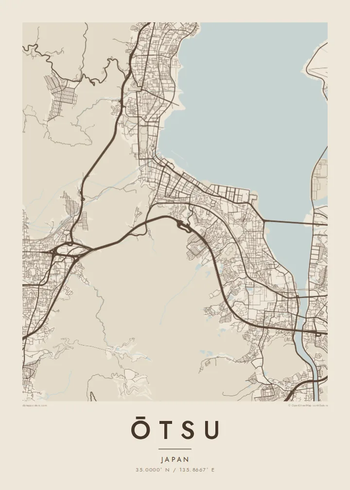
The lake fills a large part of the frame, and the city follows its edge in a long, gently curving strip of streets, promenades and reclaimed waterfront.
Postè kat minimalis · Japan
35.0000° N / 135.8667° E
A long lakeside city on the southern tip of Lake Biwa, pressed between the water and the slopes of Mount Hiei


Yon vil, senk atmosfè
Peze yon style pou wè li sou mi a. Chak style koute menm pri — enprime, ankadre oswa kòm fichye HD.
 Piksèl reyèl · fichye enpresyon 24 × 36″
Byen klè pou enprime
Sa a se yon zoom 100% sou vrè fichye enpresyon an. Chak afich — enprime, ankadre oswa telechaje — jenere sou sèvè nou yo nan 300 DPI, jiska 7,200 × 10,800 piksèl, konsa menm pi piti wout yo rete klè sou yon enpresyon 24 × 36″.
Sou mi a


Kat la
Ōtsu, the capital of Shiga Prefecture, stretches along the southwestern shore of Lake Biwa, the largest lake in Japan. The city is long and narrow: a band of streets and rail lines squeezed between the lake and the wooded ridges that separate it from Kyoto. On a map the shoreline and the mountains define almost every neighbourhood.
The city's roots run deep. In the seventh century it briefly served as the imperial capital under Emperor Tenji, and above it, on Mount Hiei, stands Enryaku-ji, the head temple of Tendai Buddhism. Closer to the water are Mii-dera and, to the south, Ishiyama-dera, where Murasaki Shikibu is said to have begun The Tale of Genji.
At the lake's southern end the Seta River flows out beneath the old Seta bridge, and the Lake Biwa Canal leaves the city through tunnels towards Kyoto. An Ōtsu map poster traces these lines of water and movement: the shore, the river, the canal and the roads that have linked the lake to the old capital for centuries.
The lake fills a large part of the frame, and the city follows its edge in a long, gently curving strip of streets, promenades and reclaimed waterfront.
At the southern tip the lake narrows into the Seta River, its only natural outlet, crossed by the long Seta no Karahashi bridge that has stood at this point in various forms for centuries.
Behind the city the ground rises sharply into Mount Hiei and the neighbouring hills, where the street grid gives way to forest and winding temple roads.
Fè l pou ou
Ajoute yon dat, yon non oswa pwòp fraz pa w, chanje estil, gwosè oswa oryantasyon.
Apèsi gratis la se nan rezolisyon ba avèk yon watèrmak. Enpresyon ak fichye HD yo jenere nan 300 DPI, jiska 7,200 × 10,800 px, san watèrmak.
Poukisa Ōtsu
Ōtsu appeals to anyone who loves the meeting of water and mountains, and to those who know it from temple visits, lakeside walks or a daily commute to Kyoto. The long shoreline composition works especially well on a tall portrait format.
Personalise the title, subtitle and coordinates, perhaps with a date or a lakeside address, and select one of five styles: Classic black & white, Noir, Paper, Blueprint or Sand. Each style gives the broad shape of the lake a different weight against the streets.
Kòmande afich Ōtsu a| Gwosè enpresyon | Rezolisyon | Fichye |
|---|---|---|
| 30 × 40 cm (11.8 × 15.7″) | 3,543 × 4,724 px | PNG · PDF |
| 29.7 × 42 cm (A3, 11.7 × 16.5″) | 3,508 × 4,961 px | PNG · PDF |
| 42 × 59.4 cm (A2, 16.5 × 23.4″) | 4,961 × 7,016 px | PNG · PDF |
| 45.7 × 61 cm (18 × 24″) | 5,400 × 7,200 px | PNG · PDF |
| 50 × 70 cm (19.7 × 27.6″) | 5,906 × 8,268 px | PNG · PDF |
| 61 × 91.4 cm (24 × 36″) | 7,200 × 10,800 px | PNG · PDF |
Pou konpare, apèsi gratis la gen 900 px lajè, li gen filigràn epi li fèt pou ekran. Fichye HD yo gen jiska 8 fwa plis rezolisyon nan chak direksyon epi yo enprime pwòp nan gwosè postè konplè.
Chwazi yon style anlè paj la, epi chwazi Afich Enprime — yon gwosè epi, si w vle, yon kad — oswa Fichye Dijital HD. Peman an fèt nan yon sèl etap, epi paj kòmand ou a mete ajou kou peman an konfime.
Li enprime sou papye mat premium 200 gsm nan youn nan sis gwosè, soti nan 30 × 40 cm rive nan 24 × 36″. Afich enprime yo kòmanse nan {printFrom}, livrezon enkli.
Wi. Chwazi yon kad an bwa solid nan koulè nwa, blan, chenn natirèl oswa bwa fonse. Li vin ak yon vit ki pa kase epi li pare pou pandye. Afich ankadre yo kòmanse nan {framedFrom}, livrezon enkli.
Livrezon gratis toupatou nan mond lan. Chak afich enprime nan patnè enpresyon ki pi pre nan plis pase 30 peyi, e li rive jeneralman nan 3–7 jou ouvrab. Ou ka swiv estati ak suivi anba My Orders.
Voye nou yon foto nan 14 jou apre livrezon an epi nou ap reenprime li gratis oswa remèt ou lajan w.
Wi. Nan editè a sou paj sa a, chanje tit la, soutit la ak liy kowòdone yo pou nenpòt sa w vle, epi chwazi yon style ak yon gwosè. Kòmand enprime, ankadre ak dijital yo tout itilize egzakteman desen w lan.
Pou $9 ou jwenn fichye PNG 300 DPI ak PDF pare-pou-enprime nan tout sis gwosè yo, san watèrmak, pou enprime kote w vle. Pa sèten toujou? Telechaje yon apèsi gratis ak watèrmak anvan.
