Gulf of Aden shore
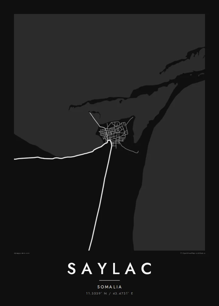
The coastline runs low and uneven along the town's edge, with shallows and inlets that turn the boundary between land and water into a fine, irregular line on the print.
Postè kat minimalis · Somalia
11.3539° N / 43.4731° E
An old port on the Gulf of Aden, low and compact, with a flat shoreline and scattered islands offshore.



Yon vil, senk atmosfè
Peze yon style pou wè li sou mi a. Chak style koute menm pri — enprime, ankadre oswa kòm fichye HD.
 Piksèl reyèl · fichye enpresyon 24 × 36″
Byen klè pou enprime
Sa a se yon zoom 100% sou vrè fichye enpresyon an. Chak afich — enprime, ankadre oswa telechaje — jenere sou sèvè nou yo nan 300 DPI, jiska 7,200 × 10,800 piksèl, konsa menm pi piti wout yo rete klè sou yon enpresyon 24 × 36″.
Sou mi a


Kat la
Saylac, also known as Zeila, stands in the Awdal region on the north-western coast of Somalia, close to the border with Djibouti. It is one of the oldest ports on the Horn of Africa, recorded for centuries as a trading town that linked the interior with Arabia and the wider Indian Ocean. Today it is a small settlement, and its map is dominated by the meeting of sand and sea.
From above the town is a tight cluster of low buildings on a flat stretch of coast, with sandy tracks running inland across a dry plain. The shoreline is shallow and irregular, and a group of small islands lies offshore. Among the older structures is a mosque traditionally described as having two prayer niches, one facing Jerusalem and one facing Mecca.
A Saylac map poster is a portrait of a place where geography explains history: a piece of coast near the mouth of the Red Sea trade routes. The white space of water and desert frames the settlement, and the scattered islands add small points of interest across the sheet. It suits anyone with roots in the region or an interest in old trading ports.
The coastline runs low and uneven along the town's edge, with shallows and inlets that turn the boundary between land and water into a fine, irregular line on the print.
Several small islands sit off the coast, appearing as isolated shapes in open water and giving the seaward half of the map a light, scattered rhythm.
The settlement is small and dense, its lanes packed close together near the water, reflecting a long history as a harbour town rather than a planned modern layout.
Fè l pou ou
Ajoute yon dat, yon non oswa pwòp fraz pa w, chanje estil, gwosè oswa oryantasyon.
Apèsi gratis la se nan rezolisyon ba avèk yon watèrmak. Enpresyon ak fichye HD yo jenere nan 300 DPI, jiska 7,200 × 10,800 px, san watèrmak.
Poukisa Saylac
Saylac speaks to people from the Awdal region and the Somali diaspora, and to readers of Horn of Africa history who know the name Zeila from old travel accounts. The map turns a remote coastal town into a clear, quiet image of shore, sand and street.
Personalise the title, subtitle and coordinates line, perhaps with the name Zeila or a family date, and choose Classic black & white, Noir, Paper, Blueprint or Sand. Digital HD files are $9 with six print sizes included, and printed posters ship from partners in more than 30 countries.
Kòmande afich Saylac a| Gwosè enpresyon | Rezolisyon | Fichye |
|---|---|---|
| 30 × 40 cm11.8 × 15.7″ | 3,543 × 4,724 px | PNG · PDF |
| 29.7 × 42 cm (A3)11.7 × 16.5″ | 3,508 × 4,961 px | PNG · PDF |
| 42 × 59.4 cm (A2)16.5 × 23.4″ | 4,961 × 7,016 px | PNG · PDF |
| 45.7 × 61 cm18 × 24″ | 5,400 × 7,200 px | PNG · PDF |
| 50 × 70 cm19.7 × 27.6″ | 5,906 × 8,268 px | PNG · PDF |
| 61 × 91.4 cm24 × 36″ | 7,200 × 10,800 px | PNG · PDF |
Pou konpare, apèsi gratis la gen 900 px lajè, li gen filigràn epi li fèt pou ekran. Fichye HD yo gen jiska 8 fwa plis rezolisyon nan chak direksyon epi yo enprime pwòp nan gwosè postè konplè.
Chwazi yon style anlè paj la, epi chwazi Afich Enprime — yon gwosè epi, si w vle, yon kad — oswa Fichye Dijital HD. Peman an fèt nan yon sèl etap, epi paj kòmand ou a mete ajou kou peman an konfime.
Li enprime sou papye mat premium 200 gsm nan youn nan sis gwosè, soti nan 30 × 40 cm rive nan 24 × 36″. Afich enprime yo kòmanse nan $39, livrezon enkli.
Wi. Chwazi yon kad an bwa solid nan koulè nwa, blan, chenn natirèl oswa bwa fonse. Li vin ak yon vit ki pa kase epi li pare pou pandye. Afich ankadre yo kòmanse nan $99, livrezon enkli.
Livrezon gratis nan plis pase 60 peyi. Chak afich enprime pa patnè enprimeri ki pi pre w la nan plis pase 30 peyi, e anjeneral li rive nan 3 a 7 jou ouvrab. Ou ka suiv estati a ak swivi kolis la nan Kòmand mwen yo. Kèk peyi pran 2 a 5 semèn, e kote nou poko livre, sit la di w sa anvan w peye.
Voye nou yon foto nan 14 jou apre livrezon an epi nou ap reenprime li gratis oswa remèt ou lajan w.
Wi. Nan editè a sou paj sa a, chanje tit la, soutit la ak liy kowòdone yo pou nenpòt sa w vle, epi chwazi yon style ak yon gwosè. Kòmand enprime, ankadre ak dijital yo tout itilize egzakteman desen w lan.
Pou $9 ou jwenn fichye PNG 300 DPI ak PDF pare-pou-enprime nan tout sis gwosè yo, san watèrmak, pou enprime kote w vle. Pa sèten toujou? Telechaje yon apèsi gratis ak watèrmak anvan.
