Lake Tefé shore
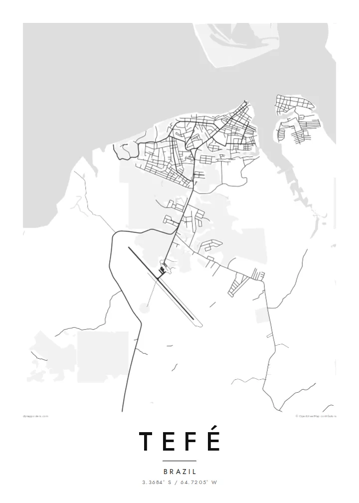
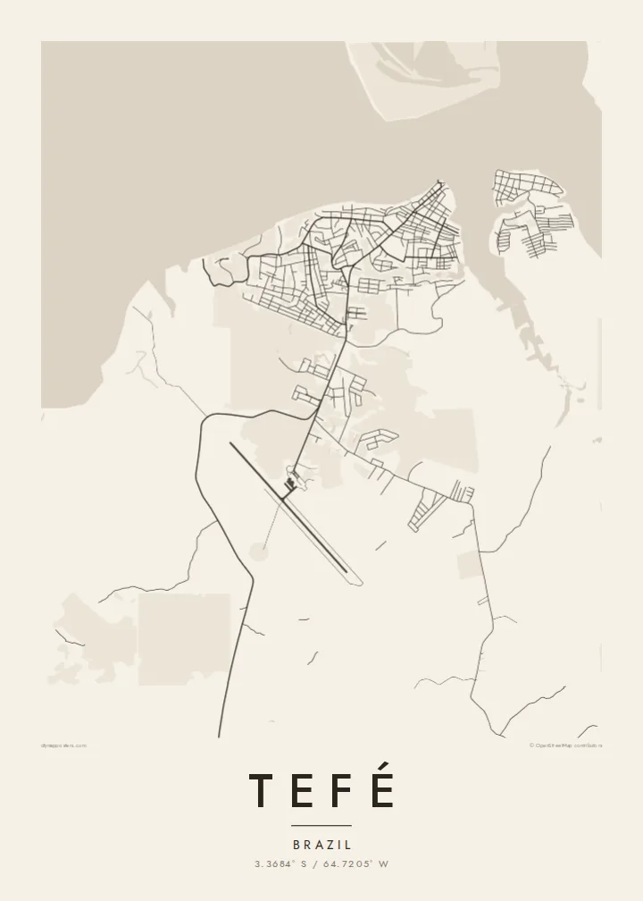
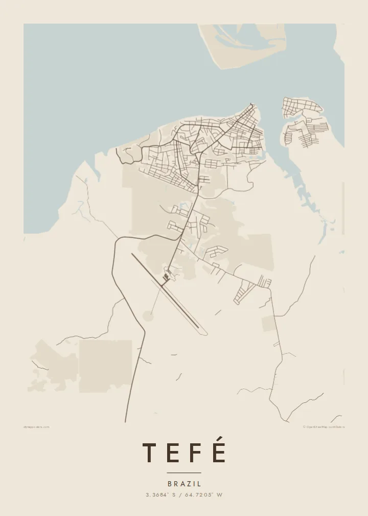
The town faces a broad lake that connects to the Solimões, and its waterfront edge is the strongest line on the map.
Postè kat minimalis · Brazil
3.3684° S / 64.7205° W
A river town on the shore of Lake Tefé, surrounded by Amazon forest and channels of water


Yon vil, senk atmosfè
Peze yon style pou wè li sou mi a. Chak style koute menm pri — enprime, ankadre oswa kòm fichye HD.
 Piksèl reyèl · fichye enpresyon 24 × 36″
Byen klè pou enprime
Sa a se yon zoom 100% sou vrè fichye enpresyon an. Chak afich — enprime, ankadre oswa telechaje — jenere sou sèvè nou yo nan 300 DPI, jiska 7,200 × 10,800 piksèl, konsa menm pi piti wout yo rete klè sou yon enpresyon 24 × 36″.
Sou mi a


Kat la
Tefé lies in the middle of Brazil's Amazonas state, on the shore of Lake Tefé, a wide body of water that opens onto the Solimões, as the Amazon is called in this stretch. There is no road link to Manaus, so the town depends on boats and flights. On a map it is a compact cluster of streets set against water on one side and forest on the others.
The town is the base of the Mamirauá Institute, which studies the flooded várzea forests of the nearby reserves, and the region is known for research on river dolphins and seasonal flooding. Water levels here change a great deal through the year, moving the shoreline and reshaping the channels that connect the lake to the main river.
A Tefé map poster works almost like a sketch of the Amazon itself: a small grid of streets, a lake edge, and wide empty ground where the forest continues beyond the frame. The contrast is striking in black and white. It shows how much of this landscape belongs to water and trees, and how tightly the town holds onto its shore.
The town faces a broad lake that connects to the Solimões, and its waterfront edge is the strongest line on the map.
With no road connection to the wider region, the streets stay close together, forming a small, dense grid that ends abruptly at forest and water.
Around the town, the map opens into forest and seasonally flooded ground, with channels and lakes that change shape through the year.
Fè l pou ou
Ajoute yon dat, yon non oswa pwòp fraz pa w, chanje estil, gwosè oswa oryantasyon.
Apèsi gratis la se nan rezolisyon ba avèk yon watèrmak. Enpresyon ak fichye HD yo jenere nan 300 DPI, jiska 7,200 × 10,800 px, san watèrmak.
Poukisa Tefé
Tefé is a place people rarely reach by accident. A print of it suits researchers who worked on the rivers, families from Amazonas, or anyone who simply wants the lake and forest on their wall.
You can set a title, add a subtitle with a date or expedition name, and edit the coordinates line. Choose between Classic black & white, Noir, Paper, Blueprint and Sand. Blueprint suits a map this full of water.
Kòmande afich Tefé a| Gwosè enpresyon | Rezolisyon | Fichye |
|---|---|---|
| 30 × 40 cm (11.8 × 15.7″) | 3,543 × 4,724 px | PNG · PDF |
| 29.7 × 42 cm (A3, 11.7 × 16.5″) | 3,508 × 4,961 px | PNG · PDF |
| 42 × 59.4 cm (A2, 16.5 × 23.4″) | 4,961 × 7,016 px | PNG · PDF |
| 45.7 × 61 cm (18 × 24″) | 5,400 × 7,200 px | PNG · PDF |
| 50 × 70 cm (19.7 × 27.6″) | 5,906 × 8,268 px | PNG · PDF |
| 61 × 91.4 cm (24 × 36″) | 7,200 × 10,800 px | PNG · PDF |
Pou konpare, apèsi gratis la gen 900 px lajè, li gen filigràn epi li fèt pou ekran. Fichye HD yo gen jiska 8 fwa plis rezolisyon nan chak direksyon epi yo enprime pwòp nan gwosè postè konplè.
Chwazi yon style anlè paj la, epi chwazi Afich Enprime — yon gwosè epi, si w vle, yon kad — oswa Fichye Dijital HD. Peman an fèt nan yon sèl etap, epi paj kòmand ou a mete ajou kou peman an konfime.
Li enprime sou papye mat premium 200 gsm nan youn nan sis gwosè, soti nan 30 × 40 cm rive nan 24 × 36″. Afich enprime yo kòmanse nan {printFrom}, livrezon enkli.
Wi. Chwazi yon kad an bwa solid nan koulè nwa, blan, chenn natirèl oswa bwa fonse. Li vin ak yon vit ki pa kase epi li pare pou pandye. Afich ankadre yo kòmanse nan {framedFrom}, livrezon enkli.
Livrezon gratis toupatou nan mond lan. Chak afich enprime nan patnè enpresyon ki pi pre nan plis pase 30 peyi, e li rive jeneralman nan 3–7 jou ouvrab. Ou ka swiv estati ak suivi anba My Orders.
Voye nou yon foto nan 14 jou apre livrezon an epi nou ap reenprime li gratis oswa remèt ou lajan w.
Wi. Nan editè a sou paj sa a, chanje tit la, soutit la ak liy kowòdone yo pou nenpòt sa w vle, epi chwazi yon style ak yon gwosè. Kòmand enprime, ankadre ak dijital yo tout itilize egzakteman desen w lan.
Pou $9 ou jwenn fichye PNG 300 DPI ak PDF pare-pou-enprime nan tout sis gwosè yo, san watèrmak, pou enprime kote w vle. Pa sèten toujou? Telechaje yon apèsi gratis ak watèrmak anvan.
