Irrigation grid
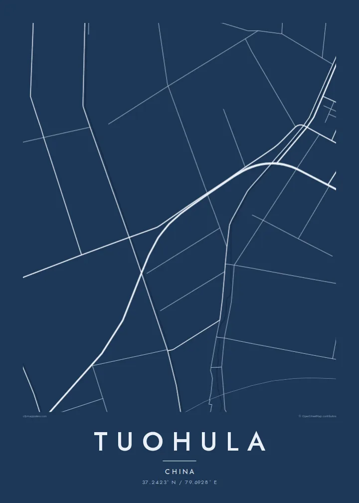
Canals and field roads divide the oasis into long, regular strips, a pattern shaped by water distribution that reads on the poster as a finely ruled geometric surface.
Postè kat minimalis · China
37.2423° N / 79.6928° E
An oasis settlement on the southern rim of the Taklamakan, drawn in irrigation channels, tree-lined roads and long field strips.



Yon vil, senk atmosfè
Peze yon style pou wè li sou mi a. Chak style koute menm pri — enprime, ankadre oswa kòm fichye HD.
 Piksèl reyèl · fichye enpresyon 24 × 36″
Byen klè pou enprime
Sa a se yon zoom 100% sou vrè fichye enpresyon an. Chak afich — enprime, ankadre oswa telechaje — jenere sou sèvè nou yo nan 300 DPI, jiska 7,200 × 10,800 piksèl, konsa menm pi piti wout yo rete klè sou yon enpresyon 24 × 36″.
Sou mi a


Kat la
Tuohula lies in the Hotan area of southern Xinjiang, within the band of oases along the northern foot of the Kunlun Mountains, at the edge of the Taklamakan Desert. Life here depends on meltwater rivers coming down from the mountains, and that dependence is written clearly on any map of the place.
Within the oasis, roads, canals and field boundaries form a closely ruled pattern of long rectangles, typically lined with rows of trees that act as windbreaks. Houses string along the roads rather than gathering into one dense centre. Beyond the last irrigated plots the lines stop abruptly, and the map turns to open desert with almost no markings.
A Tuohula map poster is a study in contrast between cultivated order and empty ground. It suits anyone interested in the oases of the Tarim Basin, where settlements have long depended on careful water management. The result is an unusually graphic print in which the edge of the green zone becomes the main subject.
Canals and field roads divide the oasis into long, regular strips, a pattern shaped by water distribution that reads on the poster as a finely ruled geometric surface.
Homes line the roads in continuous ribbons instead of forming a compact town, so the built-up area shows as linear strokes running through the fields.
Where irrigation ends, the map falls almost silent. The sharp boundary between farmed land and the Taklamakan is the most striking line in the composition.
Fè l pou ou
Ajoute yon dat, yon non oswa pwòp fraz pa w, chanje estil, gwosè oswa oryantasyon.
Apèsi gratis la se nan rezolisyon ba avèk yon watèrmak. Enpresyon ak fichye HD yo jenere nan 300 DPI, jiska 7,200 × 10,800 px, san watèrmak.
Poukisa Tuohula
For people from the Hotan region, the pattern of fields and channels around their village is deeply familiar. For others, the map is a striking abstract image of a community holding its ground at the edge of one of the world's great deserts.
Personalise the title, subtitle and coordinates, and pick one of five styles. Sand and Paper suit the desert setting. Digital files cost $9 and cover six print sizes, and printed posters on matte paper ship from partners in more than 30 countries.
Kòmande afich Tuohula a| Gwosè enpresyon | Rezolisyon | Fichye |
|---|---|---|
| 30 × 40 cm (11.8 × 15.7″) | 3,543 × 4,724 px | PNG · PDF |
| 29.7 × 42 cm (A3, 11.7 × 16.5″) | 3,508 × 4,961 px | PNG · PDF |
| 42 × 59.4 cm (A2, 16.5 × 23.4″) | 4,961 × 7,016 px | PNG · PDF |
| 45.7 × 61 cm (18 × 24″) | 5,400 × 7,200 px | PNG · PDF |
| 50 × 70 cm (19.7 × 27.6″) | 5,906 × 8,268 px | PNG · PDF |
| 61 × 91.4 cm (24 × 36″) | 7,200 × 10,800 px | PNG · PDF |
Pou konpare, apèsi gratis la gen 900 px lajè, li gen filigràn epi li fèt pou ekran. Fichye HD yo gen jiska 8 fwa plis rezolisyon nan chak direksyon epi yo enprime pwòp nan gwosè postè konplè.
Chwazi yon style anlè paj la, epi chwazi Afich Enprime — yon gwosè epi, si w vle, yon kad — oswa Fichye Dijital HD. Peman an fèt nan yon sèl etap, epi paj kòmand ou a mete ajou kou peman an konfime.
Li enprime sou papye mat premium 200 gsm nan youn nan sis gwosè, soti nan 30 × 40 cm rive nan 24 × 36″. Afich enprime yo kòmanse nan $39, livrezon enkli.
Wi. Chwazi yon kad an bwa solid nan koulè nwa, blan, chenn natirèl oswa bwa fonse. Li vin ak yon vit ki pa kase epi li pare pou pandye. Afich ankadre yo kòmanse nan $99, livrezon enkli.
Livrezon an gratis nan tout mond lan. Se pi pwòch nan patnè enprimri nou yo nan plis pase 30 peyi ki enprime chak afich la, epi li anjeneral rive nan 3–7 jou ouvrab. Ou ka swiv estati ak swivi kolis la nan Kòmand mwen yo. Gen kèk peyi ki pran 2–5 semèn, e kote nou poko livre a, sit la di w anvan ou peye.
Voye nou yon foto nan 14 jou apre livrezon an epi nou ap reenprime li gratis oswa remèt ou lajan w.
Wi. Nan editè a sou paj sa a, chanje tit la, soutit la ak liy kowòdone yo pou nenpòt sa w vle, epi chwazi yon style ak yon gwosè. Kòmand enprime, ankadre ak dijital yo tout itilize egzakteman desen w lan.
Pou $9 ou jwenn fichye PNG 300 DPI ak PDF pare-pou-enprime nan tout sis gwosè yo, san watèrmak, pou enprime kote w vle. Pa sèten toujou? Telechaje yon apèsi gratis ak watèrmak anvan.
