Three rivers meet
The Waimata and Taruheru join in the city centre to form the Tūranganui, a very short river whose confluence gives the map its focal point.
Poster peta minimalis · Selandia Baru
38.6533° S / 178.0042° E
A bayside city where three short rivers meet the sea beneath Titirangi, among the first cities in the world to see sunrise.

Satu kota, lima nuansa
Ketuk salah satu gaya untuk melihatnya di dinding. Semua gaya harganya sama — baik cetak, berbingkai, maupun file HD.
 Piksel asli · file cetak 24 × 36″
Tajam saat dicetak
Ini adalah crop 100% dari file cetak asli. Setiap poster — dicetak, berbingkai, atau diunduh — dirender di server kami dengan 300 DPI, hingga 7,200 × 10,800 piksel, sehingga jalan sekecil apa pun tetap tajam pada cetakan 24 × 36″.
Di dinding


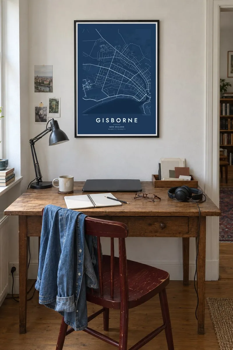
Peta
Gisborne sits on the shore of Poverty Bay, on the east coast of New Zealand's North Island, in the region known as Tairāwhiti. Because it lies so far east, close to the 180th meridian, it is often described as one of the first cities in the world to greet the new day. On a map, it opens directly onto the curve of the bay.
Water shapes the city. The Waimata and Taruheru rivers meet in the centre to form the Tūranganui, one of the shortest rivers in the country, which runs to the harbour after only a short distance. Bridges link the neighbourhoods on each bank. To the east, Titirangi, also called Kaiti Hill, rises above the port.
Gisborne is where Captain James Cook first landed in New Zealand in 1769, near the foot of Titirangi, and where Māori voyaging traditions go back much further. A Gisborne map poster shows the meeting rivers, the harbour, the grid of the town centre and the long sweep of beach, all within one frame.
The Waimata and Taruheru join in the city centre to form the Tūranganui, a very short river whose confluence gives the map its focal point.
Kaiti Hill rises on the eastern side of the harbour, its open slopes contrasting with the port and the streets below.
A long, smooth coastline curves along the bay, and beachside streets follow it. It forms a clean outer edge to the composition.
Jadikan milik Anda
Tambahkan tanggal, nama, atau kalimat Anda sendiri, lalu ganti gaya, ukuran, atau orientasi.
Pratinjau gratis beresolusi rendah dan berwatermark. Cetakan dan file HD dirender dengan 300 DPI, hingga 7,200 × 10,800 px, tanpa watermark.
Mengapa Gisborne
Gisborne draws surfers, winemakers, family visitors and people with deep roots in Tairāwhiti. A map of the rivers and bay they know becomes a daily reminder of the east coast light.
Change the title, subtitle and coordinates, for example by adding Tūranganui-a-Kiwa or a special date. Choose from Classic black & white, Noir, Paper, Blueprint and Sand. Try the free 900 px preview first, then buy the HD files or a print.
Pesan poster Gisborne| Ukuran cetak | Resolusi | File |
|---|---|---|
| 30 × 40 cm11.8 × 15.7″ | 3,543 × 4,724 px | PNG · PDF |
| 29.7 × 42 cm (A3)11.7 × 16.5″ | 3,508 × 4,961 px | PNG · PDF |
| 42 × 59.4 cm (A2)16.5 × 23.4″ | 4,961 × 7,016 px | PNG · PDF |
| 45.7 × 61 cm18 × 24″ | 5,400 × 7,200 px | PNG · PDF |
| 50 × 70 cm19.7 × 27.6″ | 5,906 × 8,268 px | PNG · PDF |
| 61 × 91.4 cm24 × 36″ | 7,200 × 10,800 px | PNG · PDF |
Sebagai perbandingan, pratinjau gratis lebarnya 900 px, bertanda watermark, dan ditujukan untuk layar. File HD memiliki resolusi hingga 8× lebih besar di setiap sisi dan tercetak jernih dalam ukuran poster penuh.
Pilih gaya di bagian atas halaman, lalu pilih Poster Cetak — beserta ukuran dan, jika suka, bingkai — atau File Digital HD. Checkout hanya satu langkah, dan halaman pesanan Anda langsung diperbarui begitu pembayaran berhasil.
Dicetak di atas kertas doff premium 200 gsm dalam salah satu dari enam ukuran, mulai dari 30 × 40 cm hingga 24 × 36″. Poster cetak mulai dari $39, sudah termasuk ongkos kirim.
Tentu. Pilih bingkai kayu solid berwarna hitam, putih, oak natural, atau kayu gelap. Dilengkapi kaca anti pecah dan siap digantung. Poster berbingkai mulai dari $99, sudah termasuk ongkos kirim.
Gratis ongkir ke 60+ negara. Setiap poster dicetak oleh mitra cetak terdekat kami di 30+ negara dan biasanya tiba dalam 3–7 hari kerja. Anda bisa memantau status dan pelacakan di Pesanan Saya. Beberapa negara membutuhkan waktu 2–5 minggu, dan jika kami belum mengirim ke negara Anda, situs akan memberi tahu sebelum Anda membayar.
Kirimkan foto kepada kami dalam 14 hari sejak pengiriman diterima, dan kami akan mencetak ulang secara gratis atau mengembalikan uang Anda.
Tentu. Di editor pada halaman ini, ubah judul, subjudul, dan baris koordinat sesuai keinginan Anda, lalu pilih gaya dan ukuran. Pesanan cetak, berbingkai, maupun digital semuanya menggunakan desain Anda persis.
Dengan $9 Anda mendapatkan file PNG 300 DPI dan PDF siap cetak dalam keenam ukuran, tanpa watermark, untuk dicetak di mana saja. Belum yakin? Unduh dulu pratinjau gratis berwatermark.
