Sepetiba Bay
The wide, sheltered bay forms the town's southern edge. Its long shoreline, islands and inlets give the map a large and calm expanse of water.
Poster peta minimalis · Brasil
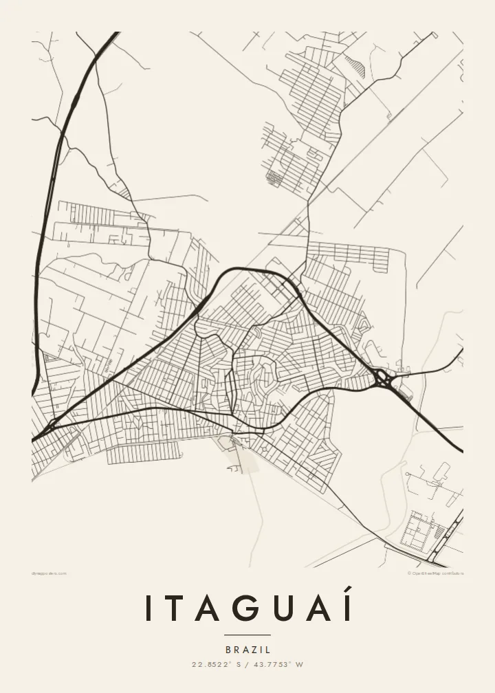
22.8522° S / 43.7753° W
A coastal town on Sepetiba Bay, where the street grid meets port terminals, mangroves and green hills




Satu kota, lima nuansa
Ketuk salah satu gaya untuk melihatnya di dinding. Semua gaya harganya sama — baik cetak, berbingkai, maupun file HD.
 Piksel asli · file cetak 24 × 36″
Tajam saat dicetak
Ini adalah crop 100% dari file cetak asli. Setiap poster — dicetak, berbingkai, atau diunduh — dirender di server kami dengan 300 DPI, hingga 7,200 × 10,800 piksel, sehingga jalan sekecil apa pun tetap tajam pada cetakan 24 × 36″.
Di dinding


Peta
Itaguaí lies on the shores of Sepetiba Bay, west of the city of Rio de Janeiro, and its map has three layers: coast, town and hills. The urban area spreads over the lowland between the bay and the forested slopes of the Serra do Mar foothills. Streets form irregular grids that stretch towards the water, and rivers wind down to the bay through low, marshy ground.
The bay is home to the Port of Itaguaí, one of Brazil's significant ports, known especially for iron ore and container traffic. Its long piers and terminals reach into the water. The Brazilian Navy also has a submarine construction and base complex on the bay here. These industrial forms sit alongside mangroves and small islands.
An Itaguaí map poster shows a landscape where heavy industry and nature share the same shoreline. The piers extend as straight, deliberate lines, the coast curves around them, and the hills close the view inland. It makes a varied and balanced print.
The wide, sheltered bay forms the town's southern edge. Its long shoreline, islands and inlets give the map a large and calm expanse of water.
Long piers and terminal areas project into the bay. On the poster they appear as sharp, straight shapes that contrast with the natural coastline.
Forested hills rise behind the lowland where the town lies. They limit the built-up area and give the composition a clear inland boundary.
Jadikan milik Anda
Tambahkan tanggal, nama, atau kalimat Anda sendiri, lalu ganti gaya, ukuran, atau orientasi.
Pratinjau gratis beresolusi rendah dan berwatermark. Cetakan dan file HD dirender dengan 300 DPI, hingga 7,200 × 10,800 px, tanpa watermark.
Mengapa Itaguaí
Itaguaí's mix of bay, port and town makes a map that tells a story of work and coastline together. It suits people who live or work here, and anyone with a connection to the Costa Verde area.
Add your own title, subtitle and coordinates, perhaps marking a move or a family event, and choose Classic black & white, Noir, Paper, Blueprint or Sand. Printed posters are available on matte paper, with an optional wooden frame.
Pesan poster Itaguaí| Ukuran cetak | Resolusi | File |
|---|---|---|
| 30 × 40 cm11.8 × 15.7″ | 3,543 × 4,724 px | PNG · PDF |
| 29.7 × 42 cm (A3)11.7 × 16.5″ | 3,508 × 4,961 px | PNG · PDF |
| 42 × 59.4 cm (A2)16.5 × 23.4″ | 4,961 × 7,016 px | PNG · PDF |
| 45.7 × 61 cm18 × 24″ | 5,400 × 7,200 px | PNG · PDF |
| 50 × 70 cm19.7 × 27.6″ | 5,906 × 8,268 px | PNG · PDF |
| 61 × 91.4 cm24 × 36″ | 7,200 × 10,800 px | PNG · PDF |
Sebagai perbandingan, pratinjau gratis lebarnya 900 px, bertanda watermark, dan ditujukan untuk layar. File HD memiliki resolusi hingga 8× lebih besar di setiap sisi dan tercetak jernih dalam ukuran poster penuh.
Pilih gaya di bagian atas halaman, lalu pilih Poster Cetak — beserta ukuran dan, jika suka, bingkai — atau File Digital HD. Checkout hanya satu langkah, dan halaman pesanan Anda langsung diperbarui begitu pembayaran berhasil.
Dicetak di atas kertas doff premium 200 gsm dalam salah satu dari enam ukuran, mulai dari 30 × 40 cm hingga 24 × 36″. Poster cetak mulai dari $39, sudah termasuk ongkos kirim.
Tentu. Pilih bingkai kayu solid berwarna hitam, putih, oak natural, atau kayu gelap. Dilengkapi kaca anti pecah dan siap digantung. Poster berbingkai mulai dari $99, sudah termasuk ongkos kirim.
Gratis ongkir ke 60+ negara. Setiap poster dicetak oleh mitra cetak terdekat kami di 30+ negara dan biasanya tiba dalam 3–7 hari kerja. Anda bisa memantau status dan pelacakan di Pesanan Saya. Beberapa negara membutuhkan waktu 2–5 minggu, dan jika kami belum mengirim ke negara Anda, situs akan memberi tahu sebelum Anda membayar.
Kirimkan foto kepada kami dalam 14 hari sejak pengiriman diterima, dan kami akan mencetak ulang secara gratis atau mengembalikan uang Anda.
Tentu. Di editor pada halaman ini, ubah judul, subjudul, dan baris koordinat sesuai keinginan Anda, lalu pilih gaya dan ukuran. Pesanan cetak, berbingkai, maupun digital semuanya menggunakan desain Anda persis.
Dengan $9 Anda mendapatkan file PNG 300 DPI dan PDF siap cetak dalam keenam ukuran, tanpa watermark, untuk dicetak di mana saja. Belum yakin? Unduh dulu pratinjau gratis berwatermark.
