Svatá Hora
The pilgrimage complex sits on a hill at the edge of town. Its compact, enclosed shape and access roads make it a clear landmark on the map.
Poster peta minimalis · Ceko
49.6899° N / 14.0104° E
A former mining town in the Bohemian uplands, with a hilltop pilgrimage church, a winding old core and forested Brdy slopes nearby.



Satu kota, lima nuansa
Ketuk salah satu gaya untuk melihatnya di dinding. Semua gaya harganya sama — baik cetak, berbingkai, maupun file HD.
 Piksel asli · file cetak 24 × 36″
Tajam saat dicetak
Ini adalah crop 100% dari file cetak asli. Setiap poster — dicetak, berbingkai, atau diunduh — dirender di server kami dengan 300 DPI, hingga 7,200 × 10,800 piksel, sehingga jalan sekecil apa pun tetap tajam pada cetakan 24 × 36″.
Di dinding


Peta
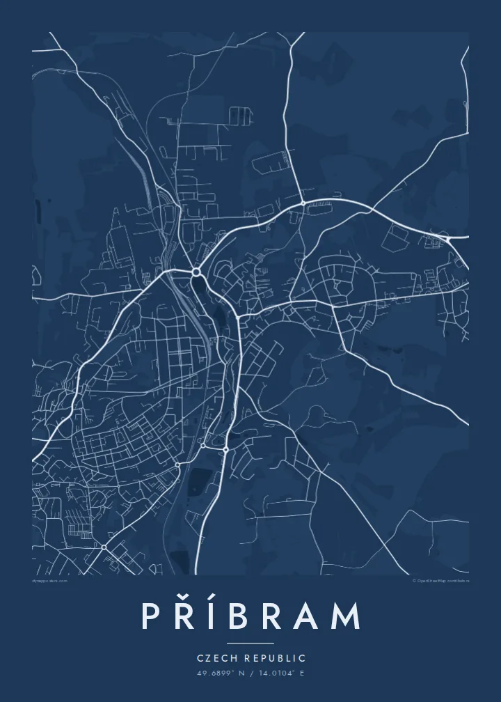
Příbram lies in Central Bohemia on the edge of the Brdy highlands, southwest of Prague. From above, the town extends over uneven ground. An older centre with curving streets sits on one side, housing estates from the second half of the twentieth century fill the slopes around it, and forest closes in towards the west and south.
Mining shaped the town for centuries. Silver was extracted in the Březové Hory area for a long time, and after the Second World War the region became a centre of uranium mining. The mining museum preserves shafts and buildings from that history. Above the town stands Svatá Hora, a Baroque pilgrimage site whose hill is visible across the area.
A Příbram map poster captures that layered history: the old streets, the orderly estate blocks, the traces of former mining districts and the dark green edge of the Brdy woods. It is a map with slopes and texture rather than flat grids, and it rewards a closer look.
The pilgrimage complex sits on a hill at the edge of town. Its compact, enclosed shape and access roads make it a clear landmark on the map.
The former silver-mining district sits beside the centre. Its streets follow the terrain and old workings rather than a plan, adding irregular texture to the sheet.
Wooded hills rise to the west and south. On the poster they appear as open, quiet space around the town and frame the built-up area.
Jadikan milik Anda
Tambahkan tanggal, nama, atau kalimat Anda sendiri, lalu ganti gaya, ukuran, atau orientasi.
Pratinjau gratis beresolusi rendah dan berwatermark. Cetakan dan file HD dirender dengan 300 DPI, hingga 7,200 × 10,800 px, tanpa watermark.
Mengapa Příbram
Příbram is a place with a strong identity, shaped by mining and pilgrimage. For people who grew up there or have family roots in the region, a framed map says a lot without words.
Personalise the title, subtitle and coordinates line, for example with the name of a neighbourhood or a year. Choose one of five styles. Noir suits the town's mining past, while Paper feels gentler.
Pesan poster Příbram| Ukuran cetak | Resolusi | File |
|---|---|---|
| 30 × 40 cm11.8 × 15.7″ | 3,543 × 4,724 px | PNG · PDF |
| 29.7 × 42 cm (A3)11.7 × 16.5″ | 3,508 × 4,961 px | PNG · PDF |
| 42 × 59.4 cm (A2)16.5 × 23.4″ | 4,961 × 7,016 px | PNG · PDF |
| 45.7 × 61 cm18 × 24″ | 5,400 × 7,200 px | PNG · PDF |
| 50 × 70 cm19.7 × 27.6″ | 5,906 × 8,268 px | PNG · PDF |
| 61 × 91.4 cm24 × 36″ | 7,200 × 10,800 px | PNG · PDF |
Sebagai perbandingan, pratinjau gratis lebarnya 900 px, bertanda watermark, dan ditujukan untuk layar. File HD memiliki resolusi hingga 8× lebih besar di setiap sisi dan tercetak jernih dalam ukuran poster penuh.
Pilih gaya di bagian atas halaman, lalu pilih Poster Cetak — beserta ukuran dan, jika suka, bingkai — atau File Digital HD. Checkout hanya satu langkah, dan halaman pesanan Anda langsung diperbarui begitu pembayaran berhasil.
Dicetak di atas kertas doff premium 200 gsm dalam salah satu dari enam ukuran, mulai dari 30 × 40 cm hingga 24 × 36″. Poster cetak mulai dari $39, sudah termasuk ongkos kirim.
Tentu. Pilih bingkai kayu solid berwarna hitam, putih, oak natural, atau kayu gelap. Dilengkapi kaca anti pecah dan siap digantung. Poster berbingkai mulai dari $99, sudah termasuk ongkos kirim.
Gratis ongkir ke 60+ negara. Setiap poster dicetak oleh mitra cetak terdekat kami di 30+ negara dan biasanya tiba dalam 3–7 hari kerja. Anda bisa memantau status dan pelacakan di Pesanan Saya. Beberapa negara membutuhkan waktu 2–5 minggu, dan jika kami belum mengirim ke negara Anda, situs akan memberi tahu sebelum Anda membayar.
Kirimkan foto kepada kami dalam 14 hari sejak pengiriman diterima, dan kami akan mencetak ulang secara gratis atau mengembalikan uang Anda.
Tentu. Di editor pada halaman ini, ubah judul, subjudul, dan baris koordinat sesuai keinginan Anda, lalu pilih gaya dan ukuran. Pesanan cetak, berbingkai, maupun digital semuanya menggunakan desain Anda persis.
Dengan $9 Anda mendapatkan file PNG 300 DPI dan PDF siap cetak dalam keenam ukuran, tanpa watermark, untuk dicetak di mana saja. Belum yakin? Unduh dulu pratinjau gratis berwatermark.
