Grande Île
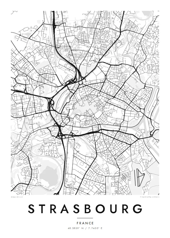
The historic centre sits on an island ringed by the Ill, a dense oval of streets around the cathedral that anchors the whole map.
Poster peta minimalis · Prancis
48.5839° N / 7.7455° E
An island old town wrapped by the Ill, with canals, a cathedral quarter and the Rhine's wide port to the east.


Satu kota, lima nuansa
Ketuk salah satu gaya untuk melihatnya di dinding. Semua gaya harganya sama — baik cetak, berbingkai, maupun file HD.
 Piksel asli · file cetak 24 × 36″
Tajam saat dicetak
Ini adalah crop 100% dari file cetak asli. Setiap poster — dicetak, berbingkai, atau diunduh — dirender di server kami dengan 300 DPI, hingga 7,200 × 10,800 piksel, sehingga jalan sekecil apa pun tetap tajam pada cetakan 24 × 36″.
Di dinding


Peta
Strasbourg's historic centre is an island. The Grande Île, encircled by two arms of the Ill, holds the cathedral, the medieval lanes and the half-timbered quarter of La Petite France. There, the river splits into canals around covered bridges and locks. From above, this oval of dense streets ringed by water is the clearest shape on the map, and it has been a UNESCO World Heritage Site since 1988.
Beyond the island lies the Neustadt, built during the German period after 1871, with broad avenues and planned squares. It was added to the UNESCO listing in 2017. Further out, the European Parliament and other European institutions stand beside the water. To the east, the Rhine port and its long basins face Germany, with bridges crossing to Kehl.
A Strasbourg map poster combines several distinct cities in one frame: the medieval island, the German imperial district, the European quarter and the industrial harbour. Rivers and canals give the composition its structure, and tram lines thread across it. In black and white, the layers of different eras become especially easy to read.
The historic centre sits on an island ringed by the Ill, a dense oval of streets around the cathedral that anchors the whole map.
At the island's western tip, the river divides into canals, locks and covered bridges, producing a delicate tangle of water and lanes.
To the east, long port basins and the broad Rhine mark the border with Germany and add bold geometric shapes to the composition.
Jadikan milik Anda
Tambahkan tanggal, nama, atau kalimat Anda sendiri, lalu ganti gaya, ukuran, atau orientasi.
Pratinjau gratis beresolusi rendah dan berwatermark. Cetakan dan file HD dirender dengan 300 DPI, hingga 7,200 × 10,800 px, tanpa watermark.
Mengapa Strasbourg
Many people pass through Strasbourg to study, to work at the European institutions or to visit a winter market, and its island centre is instantly recognisable. A map makes a precise souvenir of a city that sits between two cultures.
Personalise the title, subtitle and coordinates line with a date or a neighbourhood. Choose Classic black & white, Noir, Paper, Blueprint or Sand, then download six print sizes for $9 or order a printed poster shipped from a print partner near you.
Pesan poster Strasbourg| Ukuran cetak | Resolusi | File |
|---|---|---|
| 30 × 40 cm11.8 × 15.7″ | 3,543 × 4,724 px | PNG · PDF |
| 29.7 × 42 cm (A3)11.7 × 16.5″ | 3,508 × 4,961 px | PNG · PDF |
| 42 × 59.4 cm (A2)16.5 × 23.4″ | 4,961 × 7,016 px | PNG · PDF |
| 45.7 × 61 cm18 × 24″ | 5,400 × 7,200 px | PNG · PDF |
| 50 × 70 cm19.7 × 27.6″ | 5,906 × 8,268 px | PNG · PDF |
| 61 × 91.4 cm24 × 36″ | 7,200 × 10,800 px | PNG · PDF |
Sebagai perbandingan, pratinjau gratis lebarnya 900 px, bertanda watermark, dan ditujukan untuk layar. File HD memiliki resolusi hingga 8× lebih besar di setiap sisi dan tercetak jernih dalam ukuran poster penuh.
Pilih gaya di bagian atas halaman, lalu pilih Poster Cetak — beserta ukuran dan, jika suka, bingkai — atau File Digital HD. Checkout hanya satu langkah, dan halaman pesanan Anda langsung diperbarui begitu pembayaran berhasil.
Dicetak di atas kertas doff premium 200 gsm dalam salah satu dari enam ukuran, mulai dari 30 × 40 cm hingga 24 × 36″. Poster cetak mulai dari $39, sudah termasuk ongkos kirim.
Tentu. Pilih bingkai kayu solid berwarna hitam, putih, oak natural, atau kayu gelap. Dilengkapi kaca anti pecah dan siap digantung. Poster berbingkai mulai dari $99, sudah termasuk ongkos kirim.
Gratis ongkir ke 60+ negara. Setiap poster dicetak oleh mitra cetak terdekat kami di 30+ negara dan biasanya tiba dalam 3–7 hari kerja. Anda bisa memantau status dan pelacakan di Pesanan Saya. Beberapa negara membutuhkan waktu 2–5 minggu, dan jika kami belum mengirim ke negara Anda, situs akan memberi tahu sebelum Anda membayar.
Kirimkan foto kepada kami dalam 14 hari sejak pengiriman diterima, dan kami akan mencetak ulang secara gratis atau mengembalikan uang Anda.
Tentu. Di editor pada halaman ini, ubah judul, subjudul, dan baris koordinat sesuai keinginan Anda, lalu pilih gaya dan ukuran. Pesanan cetak, berbingkai, maupun digital semuanya menggunakan desain Anda persis.
Dengan $9 Anda mendapatkan file PNG 300 DPI dan PDF siap cetak dalam keenam ukuran, tanpa watermark, untuk dicetak di mana saja. Belum yakin? Unduh dulu pratinjau gratis berwatermark.
