Horseshoe harbour
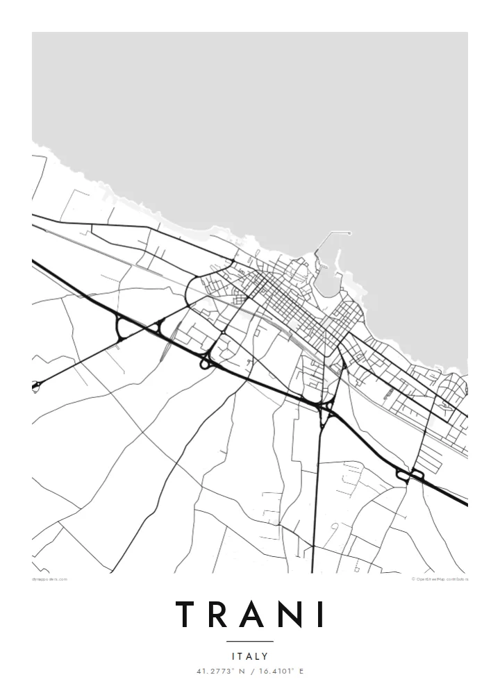
A small, almost enclosed harbour sits at the heart of the old town. Its curved quays give the map a distinctive and immediately recognisable shape.
Poster peta minimalis · Italia
41.2773° N / 16.4101° E
An Adriatic port town curving around a small horseshoe harbour, with a cathedral standing right at the sea's edge


Satu kota, lima nuansa
Ketuk salah satu gaya untuk melihatnya di dinding. Semua gaya harganya sama — baik cetak, berbingkai, maupun file HD.
 Piksel asli · file cetak 24 × 36″
Tajam saat dicetak
Ini adalah crop 100% dari file cetak asli. Setiap poster — dicetak, berbingkai, atau diunduh — dirender di server kami dengan 300 DPI, hingga 7,200 × 10,800 piksel, sehingga jalan sekecil apa pun tetap tajam pada cetakan 24 × 36″.
Di dinding


Peta
Trani lies on the Adriatic coast of Apulia, north of Bari. The map centres on its small, almost enclosed harbour, a horseshoe of quays lined with old buildings. The historic town spreads out around it in narrow lanes of pale local stone. To the west, a stretch of coastline leads to the cathedral and the castle, and newer districts extend inland in a more regular grid.
The Cathedral of San Nicola Pellegrino is among the finest Romanesque churches in southern Italy, and it stands almost alone on the waterfront. Nearby is the castle built under Frederick II. The town once had a significant medieval Jewish community, and its historic quarter still has synagogues from that period. Trani stone, a fine limestone, is quarried in the area.
A Trani map poster shows the tight curve of the harbour, the lanes of the old town around it, the open waterfront of the cathedral and the orderly blocks behind. The Adriatic forms a strong edge along one side. The print suits anyone who has spent summer evenings by this harbour.
A small, almost enclosed harbour sits at the heart of the old town. Its curved quays give the map a distinctive and immediately recognisable shape.
San Nicola Pellegrino stands in an open space right on the sea's edge. It interrupts the coastline with a clear, solitary presence.
Narrow, irregular streets fill the historic centre around the harbour. They contrast with the more regular grid of newer districts further inland.
Jadikan milik Anda
Tambahkan tanggal, nama, atau kalimat Anda sendiri, lalu ganti gaya, ukuran, atau orientasi.
Pratinjau gratis beresolusi rendah dan berwatermark. Cetakan dan file HD dirender dengan 300 DPI, hingga 7,200 × 10,800 px, tanpa watermark.
Mengapa Trani
Trani is a place of weddings, holidays and long summers by the sea for many people. A map of its harbour and old town is a quiet reminder of those days, and an elegant object in its own right.
Personalise the title, subtitle and coordinates line, perhaps with a wedding date. Then choose Classic black & white, Noir, Paper, Blueprint or Sand. Paper and Sand echo the colour of the local stone.
Pesan poster Trani| Ukuran cetak | Resolusi | File |
|---|---|---|
| 30 × 40 cm (11.8 × 15.7″) | 3,543 × 4,724 px | PNG · PDF |
| 29.7 × 42 cm (A3, 11.7 × 16.5″) | 3,508 × 4,961 px | PNG · PDF |
| 42 × 59.4 cm (A2, 16.5 × 23.4″) | 4,961 × 7,016 px | PNG · PDF |
| 45.7 × 61 cm (18 × 24″) | 5,400 × 7,200 px | PNG · PDF |
| 50 × 70 cm (19.7 × 27.6″) | 5,906 × 8,268 px | PNG · PDF |
| 61 × 91.4 cm (24 × 36″) | 7,200 × 10,800 px | PNG · PDF |
Sebagai perbandingan, pratinjau gratis lebarnya 900 px, bertanda watermark, dan ditujukan untuk layar. File HD memiliki resolusi hingga 8× lebih besar di setiap sisi dan tercetak jernih dalam ukuran poster penuh.
Pilih gaya di bagian atas halaman, lalu pilih Poster Cetak — beserta ukuran dan, jika suka, bingkai — atau File Digital HD. Checkout hanya satu langkah, dan halaman pesanan Anda langsung diperbarui begitu pembayaran berhasil.
Dicetak di atas kertas doff premium 200 gsm dalam salah satu dari enam ukuran, mulai dari 30 × 40 cm hingga 24 × 36″. Poster cetak mulai dari {printFrom}, sudah termasuk ongkos kirim.
Tentu. Pilih bingkai kayu solid berwarna hitam, putih, oak natural, atau kayu gelap. Dilengkapi kaca anti pecah dan siap digantung. Poster berbingkai mulai dari {framedFrom}, sudah termasuk ongkos kirim.
Pengiriman gratis ke seluruh dunia. Setiap poster dicetak oleh mitra cetak terdekat kami di 30+ negara dan biasanya tiba dalam 3–7 hari kerja. Status dan pelacakan pesanan bisa dipantau di Pesanan Saya. Beberapa negara memerlukan waktu 2–5 minggu, dan jika kami belum melayani pengiriman ke negara Anda, situs akan memberi tahu sebelum Anda membayar.
Kirimkan foto kepada kami dalam 14 hari sejak pengiriman diterima, dan kami akan mencetak ulang secara gratis atau mengembalikan uang Anda.
Tentu. Di editor pada halaman ini, ubah judul, subjudul, dan baris koordinat sesuai keinginan Anda, lalu pilih gaya dan ukuran. Pesanan cetak, berbingkai, maupun digital semuanya menggunakan desain Anda persis.
Dengan $9 Anda mendapatkan file PNG 300 DPI dan PDF siap cetak dalam keenam ukuran, tanpa watermark, untuk dicetak di mana saja. Belum yakin? Unduh dulu pratinjau gratis berwatermark.
