Sultanate quarter
The historic heart of the Ouaddaï capital, with an irregular web of lanes around the old palace and mosque sites. It is the densest, least geometric part of the map.
Minimalískt kortaplakat · Tsjad
13.8292° N / 20.8324° E
A low, sprawling Sahelian town of sandy lanes and walled compounds, crossed by seasonal wadis on the eastern Chadian plain


Ein borg, fimm stemningar
Ýttu á stíl til að sjá hann á veggnum. Allir stílar kosta það sama — prentaðir, innrammaðir eða sem HD skrár.
 Raunstærð í pixlum · 24 × 36″ prentskrá
Skarpt í prentun
Þetta er 100% útklipping úr raunverulegu prentskránni. Hvert plakat — prentað, innrammað eða niðurhalað — er unnið á netþjónum okkar í 300 DPI, allt að 7,200 × 10,800 pixlum, svo jafnvel minnstu göturnar haldast skarpar á 24 × 36″ prenti.
Á veggnum


Kortið
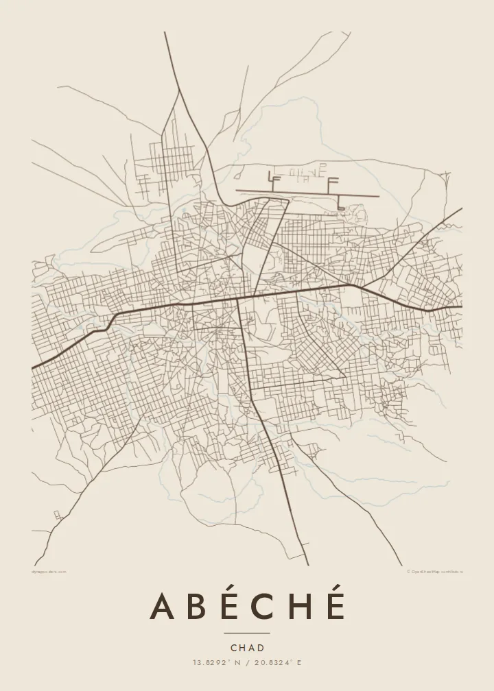
Abéché is the main city of eastern Chad and the capital of Ouaddaï province. It stands on a dry plain far from the sea, and on a map it spreads out loosely rather than climbing upward. Lanes run between walled family compounds, and a handful of wider roads head out toward the rest of the region. Sandy wadis flow here only after the rains.
The town has a long political history. In the mid-nineteenth century it became the capital of the Ouaddaï Sultanate, one of the powerful Sahelian states of the region, and remains of the sultans' residence and old mosques still stand in the historic core. More recently Abéché has served as a logistics base for humanitarian operations in eastern Chad.
An Abéché map poster shows a city that does not follow a strict grid. The oldest quarters are made of irregular blocks, while the newer districts sit in looser rectangles farther out. The airport runway forms a clean, straight line on the edge. The result is an honest picture of a desert-edge town whose shape comes from climate, trade routes and centuries of regional power.
The historic heart of the Ouaddaï capital, with an irregular web of lanes around the old palace and mosque sites. It is the densest, least geometric part of the map.
Dry riverbeds wind through and around the town. They are drawn as soft, meandering bands that carry water only briefly during the rainy season.
A long, straight runway sits beside the built-up area. Its hard geometry contrasts with the organic street pattern and acts as a strong graphic anchor.
Gerðu það að þínu
Bættu við dagsetningu, nafni eða eigin texta, skiptu um stíl, stærð eða stefnu.
Ókeypis forskoðunin er í lágri upplausn með vatnsmerki. Prentanir og HD skrár eru unnar í 300 DPI, allt að 7,200 × 10,800 px, án vatnsmerkis.
Af hverju Abéché
Abéché is a place people carry with them: aid workers, researchers and families from Ouaddaï often have a lasting tie to it. A map poster keeps that connection in a calm, understated form that works in almost any room.
Add a personal title, the years you spent there or the coordinates, and choose from Classic black & white, Noir, Paper, Blueprint or Sand. Sand and Paper suit the dry, earthen character of the city especially well.
Panta Abéché plakatið| Prentstærð | Upplausn | Skrár |
|---|---|---|
| 30 × 40 cm (11.8 × 15.7″) | 3,543 × 4,724 px | PNG · PDF |
| 29.7 × 42 cm (A3, 11.7 × 16.5″) | 3,508 × 4,961 px | PNG · PDF |
| 42 × 59.4 cm (A2, 16.5 × 23.4″) | 4,961 × 7,016 px | PNG · PDF |
| 45.7 × 61 cm (18 × 24″) | 5,400 × 7,200 px | PNG · PDF |
| 50 × 70 cm (19.7 × 27.6″) | 5,906 × 8,268 px | PNG · PDF |
| 61 × 91.4 cm (24 × 36″) | 7,200 × 10,800 px | PNG · PDF |
Til samanburðar er ókeypis forskoðunin 900 px á breidd, með vatnsmerki og ætluð fyrir skjái. HD-skrárnar eru með allt að 8× meiri upplausn í hvora átt og prentast hreint í fullri plakatstærð.
Veldu stíl efst á síðunni og veldu síðan Prentað plakat — stærð og ramma ef þú vilt — eða Stafrænar HD skrár. Greiðsluferlið tekur eitt skref og pöntunarsíðan þín uppfærist um leið og greiðslan gengur í gegn.
Það er prentað á vandaðan 200 g/m² mattan pappír í einni af sex stærðum, frá 30 × 40 cm upp í 24 × 36″. Prentuð plaköt kosta frá $39, með sendingu innifalinni.
Já. Veldu ramma úr massífum við í svörtu, hvítu, náttúrulegri eik eða dökkum viði. Hann kemur með höggheldu gleri og er tilbúinn til að hengja upp. Innrömmuð plaköt kosta frá $99, með sendingu innifalinni.
Frí sending um allan heim. Hvert plakat er prentað hjá næsta prentsamstarfsaðila okkar í yfir 30 löndum og berst yfirleitt innan 3–7 virkra daga. Þú getur fylgst með stöðu og rakningu undir Pantanirnar mínar. Sums staðar tekur sendingin 2–5 vikur og ef við sendum ekki enn þangað lætur vefurinn þig vita áður en þú greiðir.
Sendu okkur mynd innan 14 daga frá afhendingu og við prentum það aftur ókeypis eða endurgreiðum þér.
Já. Í ritlinum á þessari síðu getur þú breytt titlinum, undirtitlinum og hnitalínunni í hvað sem þú vilt, og valið stíl og stærð. Prentaðar, innrammaðar og stafrænar pantanir nota allar nákvæmlega þína hönnun.
Fyrir $9 færðu 300 DPI PNG og prentunartilbúnar PDF skrár í öllum sex stærðum, án vatnsmerkis, til að prenta hvar sem er. Ekki alveg viss? Náðu fyrst í ókeypis forskoðun með vatnsmerki.
