Thames meanders
Between Westminster and Greenwich the river swings through a run of sharp bends, including the horseshoe loop around the Isle of Dogs, one of the most recognisable shapes on any city map.
Minimalískt kortaplakat · Bretland
51.5085° N / 0.1257° W
No grid and no plan, just a winding river and centuries of villages that grew together into one enormous city.


Ein borg, fimm stemningar
Ýttu á stíl til að sjá hann á veggnum. Allir stílar kosta það sama — prentaðir, innrammaðir eða sem HD skrár.
 Raunstærð í pixlum · 24 × 36″ prentskrá
Skarpt í prentun
Þetta er 100% útklipping úr raunverulegu prentskránni. Hvert plakat — prentað, innrammað eða niðurhalað — er unnið á netþjónum okkar í 300 DPI, allt að 7,200 × 10,800 pixlum, svo jafnvel minnstu göturnar haldast skarpar á 24 × 36″ prenti.
Á veggnum


Kortið
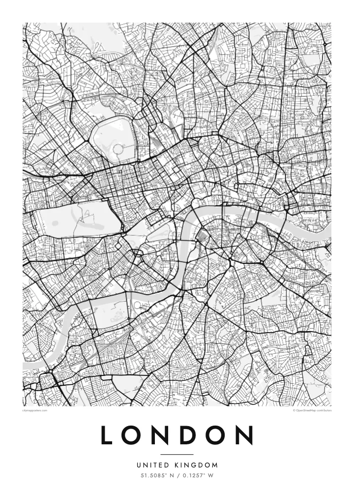
London has never had a master plan, and its street map shows it. There is no grid and no dominant axis, only a web of roads that once linked separate villages such as Hampstead, Chelsea and Islington before the city absorbed them. Street names still hint at those origins, and the map reads less like a design than a record of slow accumulation.
The Thames gives it shape. The river snakes from west to east in a series of tight loops, the deepest wrapping around the Isle of Dogs, where Canary Wharf now stands. Upstream sits the City of London, the Square Mile where the Romans founded Londinium, still a separate jurisdiction with its own dense knot of lanes around St Paul's.
Green space breaks up the pattern more than in most capitals. Hyde Park and Kensington Gardens form one broad block in the west, Regent's Park adds its neat Inner Circle to the north, and Hampstead Heath spreads wild and irregular beyond. On a London map poster these parks read as open pauses in an otherwise restless texture of streets.
Between Westminster and Greenwich the river swings through a run of sharp bends, including the horseshoe loop around the Isle of Dogs, one of the most recognisable shapes on any city map.
The City of London, where the Roman settlement began, still follows much of its medieval street pattern of narrow lanes and courts, rebuilt on the old lines after the Great Fire of 1666.
Opened in the early nineteenth century, the canal curves across north London from Little Venice to Limehouse, passing Camden and the edge of Regent's Park as a thin, continuous line of water.
Gerðu það að þínu
Bættu við dagsetningu, nafni eða eigin texta, skiptu um stíl, stærð eða stefnu.
Ókeypis forskoðunin er í lágri upplausn með vatnsmerki. Prentanir og HD skrár eru unnar í 300 DPI, allt að 7,200 × 10,800 px, án vatnsmerkis.
Af hverju London
London is a city people pass through as often as they settle in, which makes its map a natural keepsake. It can mark a first job, a flatshare in Hackney, years of commuting on the Underground, or a single trip that stayed with you long after the flight home.
Personalise the poster with a title and a date of your choosing, then settle on one of five styles: Classic black & white, Noir, Paper, Blueprint or Sand. Blueprint suits the engineering of the bridges, while Paper and Sand soften the maze of streets for a quieter room.
Panta London plakatið| Prentstærð | Upplausn | Skrár |
|---|---|---|
| 30 × 40 cm11.8 × 15.7″ | 3,543 × 4,724 px | PNG · PDF |
| 29.7 × 42 cm (A3)11.7 × 16.5″ | 3,508 × 4,961 px | PNG · PDF |
| 42 × 59.4 cm (A2)16.5 × 23.4″ | 4,961 × 7,016 px | PNG · PDF |
| 45.7 × 61 cm18 × 24″ | 5,400 × 7,200 px | PNG · PDF |
| 50 × 70 cm19.7 × 27.6″ | 5,906 × 8,268 px | PNG · PDF |
| 61 × 91.4 cm24 × 36″ | 7,200 × 10,800 px | PNG · PDF |
Til samanburðar er ókeypis forskoðunin 900 px á breidd, með vatnsmerki og ætluð fyrir skjái. HD-skrárnar eru með allt að 8× meiri upplausn í hvora átt og prentast hreint í fullri plakatstærð.
Veldu stíl efst á síðunni og veldu síðan Prentað plakat — stærð og ramma ef þú vilt — eða Stafrænar HD skrár. Greiðsluferlið tekur eitt skref og pöntunarsíðan þín uppfærist um leið og greiðslan gengur í gegn.
Það er prentað á vandaðan 200 g/m² mattan pappír í einni af sex stærðum, frá 30 × 40 cm upp í 24 × 36″. Prentuð plaköt kosta frá $39, með sendingu innifalinni.
Já. Veldu ramma úr massífum við í svörtu, hvítu, náttúrulegri eik eða dökkum viði. Hann kemur með höggheldu gleri og er tilbúinn til að hengja upp. Innrömmuð plaköt kosta frá $99, með sendingu innifalinni.
Sendingin er ókeypis til 60+ landa. Hvert veggspjald er prentað hjá næsta prentsamstarfsaðila okkar í 30+ löndum og berst venjulega á 3–7 virkum dögum. Þú getur fylgst með stöðu og rakningu undir Mínar pantanir. Í sumum löndum tekur það 2–5 vikur og ef við sendum ekki enn til þíns lands lætur vefurinn þig vita áður en þú greiðir.
Sendu okkur mynd innan 14 daga frá afhendingu og við prentum það aftur ókeypis eða endurgreiðum þér.
Já. Í ritlinum á þessari síðu getur þú breytt titlinum, undirtitlinum og hnitalínunni í hvað sem þú vilt, og valið stíl og stærð. Prentaðar, innrammaðar og stafrænar pantanir nota allar nákvæmlega þína hönnun.
Fyrir $9 færðu 300 DPI PNG og prentunartilbúnar PDF skrár í öllum sex stærðum, án vatnsmerkis, til að prenta hvar sem er. Ekki alveg viss? Náðu fyrst í ókeypis forskoðun með vatnsmerki.
