Cliff-bound coastline
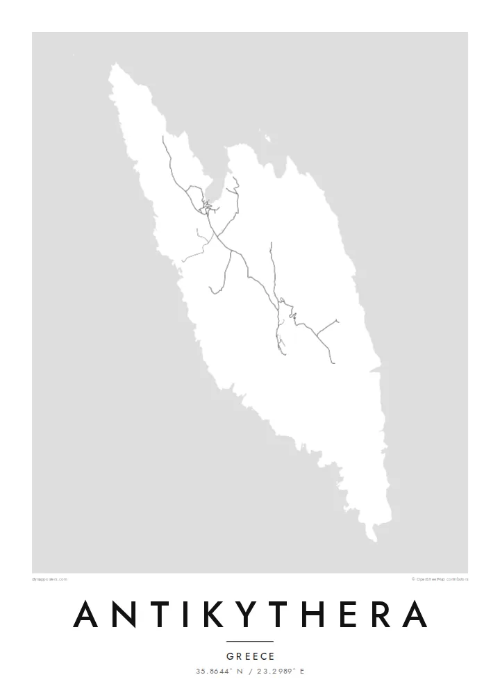
The shoreline is mostly steep rock, with only a few inlets where boats can approach. On the poster the edge of the island appears sharp and irregular, giving the landmass a clear, almost sculpted outline.
Minimalískt kortaplakat · Grikkland
35.8644° N / 23.2989° E
A small, steep-sided island between Kythera and Crete, its rocky outline broken by a few coves and a single harbour.


Ein borg, fimm stemningar
Ýttu á stíl til að sjá hann á veggnum. Allir stílar kosta það sama — prentaðir, innrammaðir eða sem HD skrár.
 Raunstærð í pixlum · 24 × 36″ prentskrá
Skarpt í prentun
Þetta er 100% útklipping úr raunverulegu prentskránni. Hvert plakat — prentað, innrammað eða niðurhalað — er unnið á netþjónum okkar í 300 DPI, allt að 7,200 × 10,800 pixlum, svo jafnvel minnstu göturnar haldast skarpar á 24 × 36″ prenti.
Á veggnum


Kortið
Antikythera sits alone in the strait between Kythera and Crete, a compact wedge of limestone with very little flat ground. From above, the island reads as a rough, elongated shape fringed by cliffs, with a handful of tracks threading between a small harbour settlement and scattered hamlets. The sea takes up most of the frame, and the land becomes a single pale form surrounded by open water.
The island is known worldwide for what was found just offshore. At the start of the twentieth century, sponge divers came across an ancient shipwreck here, and among its cargo was the Antikythera mechanism, a geared bronze device often described as the oldest known analogue computer. The object is now kept in the National Archaeological Museum in Athens, but its name will always point back to this coastline.
An Antikythera map poster is an exercise in restraint. There is no dense grid to fill the paper, only a coastline, a thin network of roads and the contour of the island against a wide field of white or black. The result is quiet and graphic, a shape that people who know the island tend to recognise at once, and that others find simply striking.
The shoreline is mostly steep rock, with only a few inlets where boats can approach. On the poster the edge of the island appears sharp and irregular, giving the landmass a clear, almost sculpted outline.
A small sheltered cove on the northern side serves as the island's port and its link to the ferries. It is where the few roads converge, which makes it the natural focal point of the map.
The waters off the island hold the wreck that yielded the famous mechanism. Nothing marks the spot on a street map, yet the empty sea around the coast carries that story for anyone who knows it.
Gerðu það að þínu
Bættu við dagsetningu, nafni eða eigin texta, skiptu um stíl, stærð eða stefnu.
Ókeypis forskoðunin er í lágri upplausn með vatnsmerki. Prentanir og HD skrár eru unnar í 300 DPI, allt að 7,200 × 10,800 px, án vatnsmerkis.
Af hverju Antikythera
Antikythera appeals to people who care about the history of science, to divers and sailors, and to anyone who has made the long ferry crossing to reach it. The poster is less about streets than about one island standing alone in open sea, a small object with an outsized story.
You can add your own title and subtitle, such as the date of a visit or a line about the mechanism, and adjust the coordinates line. Choose from Classic black & white, Noir, Paper, Blueprint or Sand; Blueprint suits the scientific theme particularly well. Download HD files for $9 or order a printed poster.
Panta Antikythera plakatið| Prentstærð | Upplausn | Skrár |
|---|---|---|
| 30 × 40 cm11.8 × 15.7″ | 3,543 × 4,724 px | PNG · PDF |
| 29.7 × 42 cm (A3)11.7 × 16.5″ | 3,508 × 4,961 px | PNG · PDF |
| 42 × 59.4 cm (A2)16.5 × 23.4″ | 4,961 × 7,016 px | PNG · PDF |
| 45.7 × 61 cm18 × 24″ | 5,400 × 7,200 px | PNG · PDF |
| 50 × 70 cm19.7 × 27.6″ | 5,906 × 8,268 px | PNG · PDF |
| 61 × 91.4 cm24 × 36″ | 7,200 × 10,800 px | PNG · PDF |
Til samanburðar er ókeypis forskoðunin 900 px á breidd, með vatnsmerki og ætluð fyrir skjái. HD-skrárnar eru með allt að 8× meiri upplausn í hvora átt og prentast hreint í fullri plakatstærð.
Veldu stíl efst á síðunni og veldu síðan Prentað plakat — stærð og ramma ef þú vilt — eða Stafrænar HD skrár. Greiðsluferlið tekur eitt skref og pöntunarsíðan þín uppfærist um leið og greiðslan gengur í gegn.
Það er prentað á vandaðan 200 g/m² mattan pappír í einni af sex stærðum, frá 30 × 40 cm upp í 24 × 36″. Prentuð plaköt kosta frá $39, með sendingu innifalinni.
Já. Veldu ramma úr massífum við í svörtu, hvítu, náttúrulegri eik eða dökkum viði. Hann kemur með höggheldu gleri og er tilbúinn til að hengja upp. Innrömmuð plaköt kosta frá $99, með sendingu innifalinni.
Sendingin er ókeypis til 60+ landa. Hvert veggspjald er prentað hjá næsta prentsamstarfsaðila okkar í 30+ löndum og berst venjulega á 3–7 virkum dögum. Þú getur fylgst með stöðu og rakningu undir Mínar pantanir. Í sumum löndum tekur það 2–5 vikur og ef við sendum ekki enn til þíns lands lætur vefurinn þig vita áður en þú greiðir.
Sendu okkur mynd innan 14 daga frá afhendingu og við prentum það aftur ókeypis eða endurgreiðum þér.
Já. Í ritlinum á þessari síðu getur þú breytt titlinum, undirtitlinum og hnitalínunni í hvað sem þú vilt, og valið stíl og stærð. Prentaðar, innrammaðar og stafrænar pantanir nota allar nákvæmlega þína hönnun.
Fyrir $9 færðu 300 DPI PNG og prentunartilbúnar PDF skrár í öllum sex stærðum, án vatnsmerkis, til að prenta hvar sem er. Ekki alveg viss? Náðu fyrst í ókeypis forskoðun með vatnsmerki.
Í nágrenninu
