City walls
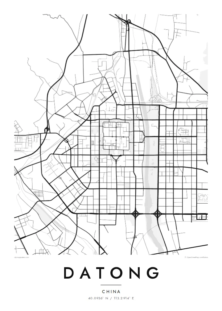
The restored ramparts enclose an almost square old town. The crisp outline anchors the whole map and makes the historic centre instantly recognisable.
Minimalískt kortaplakat · Kína
40.0936° N / 113.2914° E
A walled city on a northern plain, its square old town enclosed by restored ramparts, with the Yungang cliffs to the west.

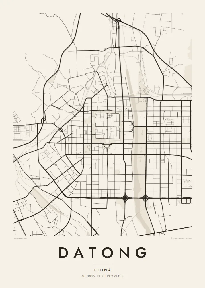


Ein borg, fimm stemningar
Ýttu á stíl til að sjá hann á veggnum. Allir stílar kosta það sama — prentaðir, innrammaðir eða sem HD skrár.
 Raunstærð í pixlum · 24 × 36″ prentskrá
Skarpt í prentun
Þetta er 100% útklipping úr raunverulegu prentskránni. Hvert plakat — prentað, innrammað eða niðurhalað — er unnið á netþjónum okkar í 300 DPI, allt að 7,200 × 10,800 pixlum, svo jafnvel minnstu göturnar haldast skarpar á 24 × 36″ prenti.
Á veggnum


Kortið
Datong lies in the far north of Shanxi, close to the Great Wall, on a high plain beside the Yu River. Its historic centre is one of the clearest shapes on any Chinese city map. Restored city walls form a near-square enclosure, straight streets divide it into quarters, and the modern city spreads out beyond it in every direction.
From the late fourth century the city was Pingcheng, capital of the Northern Wei dynasty. Its importance in that period explains the Yungang Grottoes, a UNESCO World Heritage Site of Buddhist cave temples carved into sandstone cliffs west of the city. Inside the walls, the Nine-Dragon Screen, a large glazed-tile wall, and Huayan Monastery date from later dynasties.
Datong has long been a coal city, and mines and rail yards still shape its surroundings. Within the wider municipality, the Hanging Temple clings to a cliff face near Mount Heng. A Datong map poster focuses on the city itself. The square walled town sits at the centre like a compass rose within a wider grid of modern streets.
The restored ramparts enclose an almost square old town. The crisp outline anchors the whole map and makes the historic centre instantly recognisable.
Inside the walls, main streets divide the old town into quarters, and finer lanes fill each section. This classic northern Chinese plan is clearly readable from above.
The river runs along the eastern side of the city, with parks along its banks and newer districts extending to the opposite shore.
Gerðu það að þínu
Bættu við dagsetningu, nafni eða eigin texta, skiptu um stíl, stærð eða stefnu.
Ókeypis forskoðunin er í lágri upplausn með vatnsmerki. Prentanir og HD skrár eru unnar í 300 DPI, allt að 7,200 × 10,800 px, án vatnsmerkis.
Af hverju Datong
Datong appeals to anyone with ties to northern Shanxi and to people interested in Chinese architecture and city planning. The squared old town is graphic enough to work as a design piece, even for someone who has never visited.
Edit the title, subtitle and coordinates to suit the room or the occasion. Paper and Sand bring out the old-town feel, Classic black & white and Noir keep it sharp, and Blueprint rounds out the five styles. Try the free watermarked preview before you buy.
Panta Datong plakatið| Prentstærð | Upplausn | Skrár |
|---|---|---|
| 30 × 40 cm (11.8 × 15.7″) | 3,543 × 4,724 px | PNG · PDF |
| 29.7 × 42 cm (A3, 11.7 × 16.5″) | 3,508 × 4,961 px | PNG · PDF |
| 42 × 59.4 cm (A2, 16.5 × 23.4″) | 4,961 × 7,016 px | PNG · PDF |
| 45.7 × 61 cm (18 × 24″) | 5,400 × 7,200 px | PNG · PDF |
| 50 × 70 cm (19.7 × 27.6″) | 5,906 × 8,268 px | PNG · PDF |
| 61 × 91.4 cm (24 × 36″) | 7,200 × 10,800 px | PNG · PDF |
Til samanburðar er ókeypis forskoðunin 900 px á breidd, með vatnsmerki og ætluð fyrir skjái. HD-skrárnar eru með allt að 8× meiri upplausn í hvora átt og prentast hreint í fullri plakatstærð.
Veldu stíl efst á síðunni og veldu síðan Prentað plakat — stærð og ramma ef þú vilt — eða Stafrænar HD skrár. Greiðsluferlið tekur eitt skref og pöntunarsíðan þín uppfærist um leið og greiðslan gengur í gegn.
Það er prentað á vandaðan 200 g/m² mattan pappír í einni af sex stærðum, frá 30 × 40 cm upp í 24 × 36″. Prentuð plaköt kosta frá {printFrom}, með sendingu innifalinni.
Já. Veldu ramma úr massífum við í svörtu, hvítu, náttúrulegri eik eða dökkum viði. Hann kemur með höggheldu gleri og er tilbúinn til að hengja upp. Innrömmuð plaköt kosta frá {framedFrom}, með sendingu innifalinni.
Sending er ókeypis um allan heim. Hvert plakat er prentað hjá næsta prentsamstarfsaðila okkar í yfir 30 löndum og berst yfirleitt á 3–7 virkum dögum. Þú getur fylgst með stöðu og sendingarnúmeri undir Pantanirnar mínar.
Sendu okkur mynd innan 14 daga frá afhendingu og við prentum það aftur ókeypis eða endurgreiðum þér.
Já. Í ritlinum á þessari síðu getur þú breytt titlinum, undirtitlinum og hnitalínunni í hvað sem þú vilt, og valið stíl og stærð. Prentaðar, innrammaðar og stafrænar pantanir nota allar nákvæmlega þína hönnun.
Fyrir $9 færðu 300 DPI PNG og prentunartilbúnar PDF skrár í öllum sex stærðum, án vatnsmerkis, til að prenta hvar sem er. Ekki alveg viss? Náðu fyrst í ókeypis forskoðun með vatnsmerki.
