Hillside old town
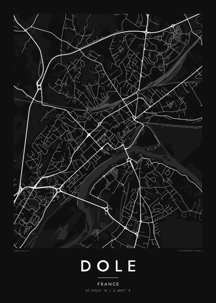
Narrow streets climb the slope toward the collegiate church, forming a dense, irregular core that dominates the centre of the map.
Minimalískt kortaplakat · Frakkland
47.0922° N / 5.4897° E
An old Franche-Comté town on a hillside above the Doubs, with a canal, tanners' channels and a tall collegiate church.



Ein borg, fimm stemningar
Ýttu á stíl til að sjá hann á veggnum. Allir stílar kosta það sama — prentaðir, innrammaðir eða sem HD skrár.
 Raunstærð í pixlum · 24 × 36″ prentskrá
Skarpt í prentun
Þetta er 100% útklipping úr raunverulegu prentskránni. Hvert plakat — prentað, innrammað eða niðurhalað — er unnið á netþjónum okkar í 300 DPI, allt að 7,200 × 10,800 pixlum, svo jafnvel minnstu göturnar haldast skarpar á 24 × 36″ prenti.
Á veggnum


Kortið
Dole lies in the Jura department of Bourgogne-Franche-Comté, on a rise above the Doubs river. The old town is built on the slope, and its streets climb in irregular curves toward the Collégiale Notre-Dame, whose tall bell tower dominates the skyline. On a map the historic centre is a dense knot of lanes and small squares, clearly marked out from the newer districts beyond.
Below the old town, the Doubs and the Rhône–Rhine canal run side by side, and the narrow Canal des Tanneurs, once used by the town's leather workers, runs along the foot of the old quarter. Bridges cross the waterways, and the flat land on the far bank opens toward the large Forêt de Chaux to the east.
Dole was once the capital of the County of Burgundy before the region became part of France, and it is the birthplace of Louis Pasteur, whose childhood home is now a museum by the canal. A Dole map poster shows a hillside old town, a river, a canal and a forest, all close together.
Narrow streets climb the slope toward the collegiate church, forming a dense, irregular core that dominates the centre of the map.
The river and the Rhône–Rhine canal run in parallel below the town, a double line of water crossed by several bridges.
The small tanners' canal runs at the foot of the old quarter, a delicate channel close to Pasteur's birthplace.
Gerðu það að þínu
Bættu við dagsetningu, nafni eða eigin texta, skiptu um stíl, stærð eða stefnu.
Ókeypis forskoðunin er í lágri upplausn með vatnsmerki. Prentanir og HD skrár eru unnar í 300 DPI, allt að 7,200 × 10,800 px, án vatnsmerkis.
Af hverju Dole
Dole suits people from the Jura, admirers of Louis Pasteur, and travellers who have walked along the canals and up to the collegiate church. The mix of old town, river and canal makes a rich composition that works equally well in Paper or Classic black & white.
You can personalise the title, the subtitle and the coordinates line, for example with a wedding date or a family name. Choose from five styles. The $9 HD files include six print sizes, and printed posters come on matte paper, with an optional wooden frame.
Panta Dole plakatið| Prentstærð | Upplausn | Skrár |
|---|---|---|
| 30 × 40 cm (11.8 × 15.7″) | 3,543 × 4,724 px | PNG · PDF |
| 29.7 × 42 cm (A3, 11.7 × 16.5″) | 3,508 × 4,961 px | PNG · PDF |
| 42 × 59.4 cm (A2, 16.5 × 23.4″) | 4,961 × 7,016 px | PNG · PDF |
| 45.7 × 61 cm (18 × 24″) | 5,400 × 7,200 px | PNG · PDF |
| 50 × 70 cm (19.7 × 27.6″) | 5,906 × 8,268 px | PNG · PDF |
| 61 × 91.4 cm (24 × 36″) | 7,200 × 10,800 px | PNG · PDF |
Til samanburðar er ókeypis forskoðunin 900 px á breidd, með vatnsmerki og ætluð fyrir skjái. HD-skrárnar eru með allt að 8× meiri upplausn í hvora átt og prentast hreint í fullri plakatstærð.
Veldu stíl efst á síðunni og veldu síðan Prentað plakat — stærð og ramma ef þú vilt — eða Stafrænar HD skrár. Greiðsluferlið tekur eitt skref og pöntunarsíðan þín uppfærist um leið og greiðslan gengur í gegn.
Það er prentað á vandaðan 200 g/m² mattan pappír í einni af sex stærðum, frá 30 × 40 cm upp í 24 × 36″. Prentuð plaköt kosta frá $39, með sendingu innifalinni.
Já. Veldu ramma úr massífum við í svörtu, hvítu, náttúrulegri eik eða dökkum viði. Hann kemur með höggheldu gleri og er tilbúinn til að hengja upp. Innrömmuð plaköt kosta frá $99, með sendingu innifalinni.
Frí sending um allan heim. Hvert plakat er prentað hjá næsta prentsamstarfsaðila okkar í yfir 30 löndum og berst yfirleitt innan 3–7 virkra daga. Þú getur fylgst með stöðu og rakningu undir Pantanirnar mínar. Sums staðar tekur sendingin 2–5 vikur og ef við sendum ekki enn þangað lætur vefurinn þig vita áður en þú greiðir.
Sendu okkur mynd innan 14 daga frá afhendingu og við prentum það aftur ókeypis eða endurgreiðum þér.
Já. Í ritlinum á þessari síðu getur þú breytt titlinum, undirtitlinum og hnitalínunni í hvað sem þú vilt, og valið stíl og stærð. Prentaðar, innrammaðar og stafrænar pantanir nota allar nákvæmlega þína hönnun.
Fyrir $9 færðu 300 DPI PNG og prentunartilbúnar PDF skrár í öllum sex stærðum, án vatnsmerkis, til að prenta hvar sem er. Ekki alveg viss? Náðu fyrst í ókeypis forskoðun með vatnsmerki.
