The Old City walls
The Ottoman walls, completed under Suleiman the Magnificent in the 1530s, enclose the Old City in an unmistakable outline. Gates such as Damascus Gate and Herod's Gate open onto the northern districts.
Minimalískt kortaplakat · Heimastjórnarsvæði Palestínumanna
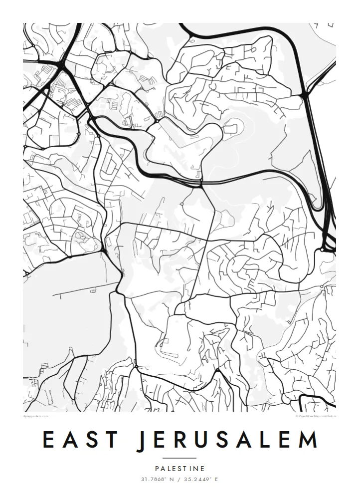
31.7868° N / 35.2449° E
Walled Old City at the centre, the Kidron Valley and Mount of Olives to the east, neighbourhoods spreading north and south


Ein borg, fimm stemningar
Ýttu á stíl til að sjá hann á veggnum. Allir stílar kosta það sama — prentaðir, innrammaðir eða sem HD skrár.
 Raunstærð í pixlum · 24 × 36″ prentskrá
Skarpt í prentun
Þetta er 100% útklipping úr raunverulegu prentskránni. Hvert plakat — prentað, innrammað eða niðurhalað — er unnið á netþjónum okkar í 300 DPI, allt að 7,200 × 10,800 pixlum, svo jafnvel minnstu göturnar haldast skarpar á 24 × 36″ prenti.
Á veggnum


Kortið
From above, East Jerusalem arranges itself around the walled Old City. The walls form a clear, slightly skewed quadrilateral. Roads leave its gates and climb into the hills in every direction. To the east, the ground drops into the Kidron Valley and rises again to the Mount of Olives. Its slopes are marked by terraced cemeteries and a thin line of roads that follows the contours.
North of Damascus Gate, the street pattern becomes denser and more regular. Neighbourhoods such as Sheikh Jarrah spread along the road towards Ramallah. Further out, the map fragments into hilltop quarters separated by wadis and main roads. Because the terrain shapes almost every street, a East Jerusalem map poster reads as much like a relief study as a plan of a city.
The eastern side of the city has been contested since 1967, when Israel took control of the area. Its status remains central to Israeli–Palestinian negotiations. On paper, the lines are quieter. Gates, valleys, ridges and the long road descending towards Jericho are all shown with the same even weight. That lets the geography speak before the politics does.
The Ottoman walls, completed under Suleiman the Magnificent in the 1530s, enclose the Old City in an unmistakable outline. Gates such as Damascus Gate and Herod's Gate open onto the northern districts.
A deep, narrow valley runs north to south between the Old City and the Mount of Olives. On the map it shows as a clean gap between two dense areas of streets.
The ridge east of the Old City carries winding roads and large cemetery grounds. From above, its streets curve with the slope rather than following a grid.
Gerðu það að þínu
Bættu við dagsetningu, nafni eða eigin texta, skiptu um stíl, stærð eða stefnu.
Ókeypis forskoðunin er í lágri upplausn með vatnsmerki. Prentanir og HD skrár eru unnar í 300 DPI, allt að 7,200 × 10,800 px, án vatnsmerkis.
Af hverju East Jerusalem
People who have lived in, studied in or prayed in this part of Jerusalem often want a map that is honest and restrained. A black-and-white plan of streets and slopes keeps the focus on the place itself, not on the headlines.
You can set your own title and add a subtitle with a date, a family name or a line of coordinates. Then choose from five styles: Classic black & white, Noir, Paper, Blueprint or Sand. The same composition can suit a study wall or a quiet hallway.
Panta East Jerusalem plakatið| Prentstærð | Upplausn | Skrár |
|---|---|---|
| 30 × 40 cm11.8 × 15.7″ | 3,543 × 4,724 px | PNG · PDF |
| 29.7 × 42 cm (A3)11.7 × 16.5″ | 3,508 × 4,961 px | PNG · PDF |
| 42 × 59.4 cm (A2)16.5 × 23.4″ | 4,961 × 7,016 px | PNG · PDF |
| 45.7 × 61 cm18 × 24″ | 5,400 × 7,200 px | PNG · PDF |
| 50 × 70 cm19.7 × 27.6″ | 5,906 × 8,268 px | PNG · PDF |
| 61 × 91.4 cm24 × 36″ | 7,200 × 10,800 px | PNG · PDF |
Til samanburðar er ókeypis forskoðunin 900 px á breidd, með vatnsmerki og ætluð fyrir skjái. HD-skrárnar eru með allt að 8× meiri upplausn í hvora átt og prentast hreint í fullri plakatstærð.
Veldu stíl efst á síðunni og veldu síðan Prentað plakat — stærð og ramma ef þú vilt — eða Stafrænar HD skrár. Greiðsluferlið tekur eitt skref og pöntunarsíðan þín uppfærist um leið og greiðslan gengur í gegn.
Það er prentað á vandaðan 200 g/m² mattan pappír í einni af sex stærðum, frá 30 × 40 cm upp í 24 × 36″. Prentuð plaköt kosta frá $39, með sendingu innifalinni.
Já. Veldu ramma úr massífum við í svörtu, hvítu, náttúrulegri eik eða dökkum viði. Hann kemur með höggheldu gleri og er tilbúinn til að hengja upp. Innrömmuð plaköt kosta frá $99, með sendingu innifalinni.
Sendingin er ókeypis til 60+ landa. Hvert veggspjald er prentað hjá næsta prentsamstarfsaðila okkar í 30+ löndum og berst venjulega á 3–7 virkum dögum. Þú getur fylgst með stöðu og rakningu undir Mínar pantanir. Í sumum löndum tekur það 2–5 vikur og ef við sendum ekki enn til þíns lands lætur vefurinn þig vita áður en þú greiðir.
Sendu okkur mynd innan 14 daga frá afhendingu og við prentum það aftur ókeypis eða endurgreiðum þér.
Já. Í ritlinum á þessari síðu getur þú breytt titlinum, undirtitlinum og hnitalínunni í hvað sem þú vilt, og valið stíl og stærð. Prentaðar, innrammaðar og stafrænar pantanir nota allar nákvæmlega þína hönnun.
Fyrir $9 færðu 300 DPI PNG og prentunartilbúnar PDF skrár í öllum sex stærðum, án vatnsmerkis, til að prenta hvar sem er. Ekki alveg viss? Náðu fyrst í ókeypis forskoðun með vatnsmerki.
Í nágrenninu
