Historic downtown
The old centre keeps a compact, irregular street pattern from its early years, where buildings connected with Andrew Johnson's life still stand.
Minimalískt kortaplakat · Bandaríkin
36.1632° N / 82.8310° W
A historic East Tennessee town of winding streets on rolling hills, near the Nolichucky River



Ein borg, fimm stemningar
Ýttu á stíl til að sjá hann á veggnum. Allir stílar kosta það sama — prentaðir, innrammaðir eða sem HD skrár.
 Raunstærð í pixlum · 24 × 36″ prentskrá
Skarpt í prentun
Þetta er 100% útklipping úr raunverulegu prentskránni. Hvert plakat — prentað, innrammað eða niðurhalað — er unnið á netþjónum okkar í 300 DPI, allt að 7,200 × 10,800 pixlum, svo jafnvel minnstu göturnar haldast skarpar á 24 × 36″ prenti.
Á veggnum


Kortið
Greeneville sits in the valley and ridge country of East Tennessee, between the Great Smoky Mountains and the Virginia border. It was founded in the 1780s and is one of the oldest towns in the state. On a map, its older streets curve with the hills around a compact downtown, while newer roads spread outward through farmland.
The town was briefly the capital of the short-lived State of Franklin, an attempt to form a separate state in the 1780s. It is also closely tied to Andrew Johnson, the seventeenth president, who lived and worked there as a tailor, and whose home and grave are preserved as a national historic site.
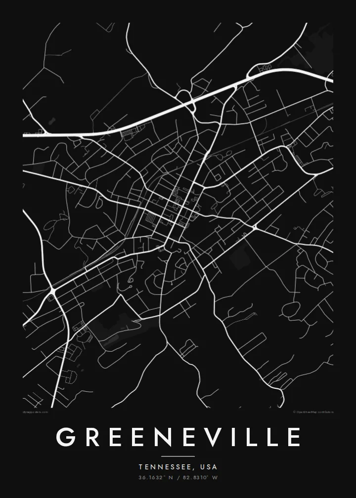
A Greeneville map poster shows a historic centre shaped by the land rather than by a strict grid. Streets bend with the terrain, highways skirt the town, and rural roads follow creeks and ridges into Greene County. The Nolichucky River runs to the south, a further line in the landscape.
The old centre keeps a compact, irregular street pattern from its early years, where buildings connected with Andrew Johnson's life still stand.
Hills and valleys shape the roads, so streets curve and branch instead of forming a grid, giving the map a relaxed, organic outline.
South of town the Nolichucky River winds through the countryside, adding a long, meandering line to the landscape on a wider frame.
Gerðu það að þínu
Bættu við dagsetningu, nafni eða eigin texta, skiptu um stíl, stærð eða stefnu.
Ókeypis forskoðunin er í lágri upplausn með vatnsmerki. Prentanir og HD skrár eru unnar í 300 DPI, allt að 7,200 × 10,800 px, án vatnsmerkis.
Af hverju Greeneville
Greeneville draws history enthusiasts, Tusculum University alumni and families with deep Appalachian roots. A map of its hilly streets holds that sense of place and suits a study, a family home or a gift for someone who has moved away.
Set your own title, subtitle and coordinates line, for example a family name or wedding date. Choose from Classic black & white, Noir, Paper, Blueprint or Sand to fit your space.
Panta Greeneville plakatið| Prentstærð | Upplausn | Skrár |
|---|---|---|
| 30 × 40 cm11.8 × 15.7″ | 3,543 × 4,724 px | PNG · PDF |
| 29.7 × 42 cm (A3)11.7 × 16.5″ | 3,508 × 4,961 px | PNG · PDF |
| 42 × 59.4 cm (A2)16.5 × 23.4″ | 4,961 × 7,016 px | PNG · PDF |
| 45.7 × 61 cm18 × 24″ | 5,400 × 7,200 px | PNG · PDF |
| 50 × 70 cm19.7 × 27.6″ | 5,906 × 8,268 px | PNG · PDF |
| 61 × 91.4 cm24 × 36″ | 7,200 × 10,800 px | PNG · PDF |
Til samanburðar er ókeypis forskoðunin 900 px á breidd, með vatnsmerki og ætluð fyrir skjái. HD-skrárnar eru með allt að 8× meiri upplausn í hvora átt og prentast hreint í fullri plakatstærð.
Veldu stíl efst á síðunni og veldu síðan Prentað plakat — stærð og ramma ef þú vilt — eða Stafrænar HD skrár. Greiðsluferlið tekur eitt skref og pöntunarsíðan þín uppfærist um leið og greiðslan gengur í gegn.
Það er prentað á vandaðan 200 g/m² mattan pappír í einni af sex stærðum, frá 30 × 40 cm upp í 24 × 36″. Prentuð plaköt kosta frá $39, með sendingu innifalinni.
Já. Veldu ramma úr massífum við í svörtu, hvítu, náttúrulegri eik eða dökkum viði. Hann kemur með höggheldu gleri og er tilbúinn til að hengja upp. Innrömmuð plaköt kosta frá $99, með sendingu innifalinni.
Sendingin er ókeypis til 60+ landa. Hvert veggspjald er prentað hjá næsta prentsamstarfsaðila okkar í 30+ löndum og berst venjulega á 3–7 virkum dögum. Þú getur fylgst með stöðu og rakningu undir Mínar pantanir. Í sumum löndum tekur það 2–5 vikur og ef við sendum ekki enn til þíns lands lætur vefurinn þig vita áður en þú greiðir.
Sendu okkur mynd innan 14 daga frá afhendingu og við prentum það aftur ókeypis eða endurgreiðum þér.
Já. Í ritlinum á þessari síðu getur þú breytt titlinum, undirtitlinum og hnitalínunni í hvað sem þú vilt, og valið stíl og stærð. Prentaðar, innrammaðar og stafrænar pantanir nota allar nákvæmlega þína hönnun.
Fyrir $9 færðu 300 DPI PNG og prentunartilbúnar PDF skrár í öllum sex stærðum, án vatnsmerkis, til að prenta hvar sem er. Ekki alveg viss? Náðu fyrst í ókeypis forskoðun með vatnsmerki.
