Central crossroads
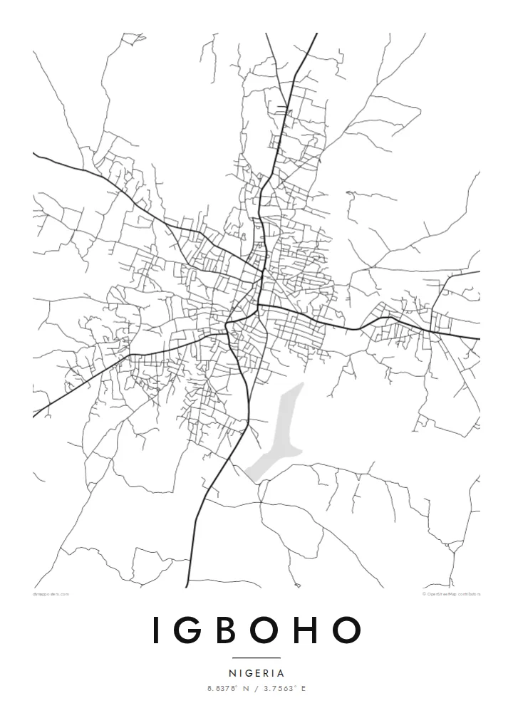
The main roads into town converge near the older core. This junction is the visual anchor of the map, and the rest of Igboho grows out from it in every direction.
Minimalískt kortaplakat · Nígería
8.8378° N / 3.7563° E
A savanna town of red-earth roads and scattered compounds, its streets radiating loosely across the open Oke-Ogun plains.


Ein borg, fimm stemningar
Ýttu á stíl til að sjá hann á veggnum. Allir stílar kosta það sama — prentaðir, innrammaðir eða sem HD skrár.
 Raunstærð í pixlum · 24 × 36″ prentskrá
Skarpt í prentun
Þetta er 100% útklipping úr raunverulegu prentskránni. Hvert plakat — prentað, innrammað eða niðurhalað — er unnið á netþjónum okkar í 300 DPI, allt að 7,200 × 10,800 pixlum, svo jafnvel minnstu göturnar haldast skarpar á 24 × 36″ prenti.
Á veggnum


Kortið
Igboho is in the Oke-Ogun area of northern Oyo State. Here the forest thins into open savanna, and the towns sit far apart along long, straight roads. From above, the town is a loose, organic spread rather than a planned grid. Main roads meet near the old centre, and around them clusters of compounds and smaller lanes fan out, gradually giving way to farmland and bush.
The town has a firm place in Yoruba history. When the Oyo kingdom was driven from its capital, Oyo-Ile, Igboho became the seat of the Alaafins for a period, and several of them are remembered as having been buried there. Today it is the headquarters of Oorelope Local Government Area, and it is a market and farming centre for the surrounding countryside.
An Igboho map poster shows a town that has grown outward from its crossroads. Seen from above, the roads cut clean diagonals across the plain, and the small streets between them form an irregular, hand-drawn texture. With so few large rivers or hills in the frame, the pattern of settlement itself becomes the subject, rendered in fine lines on open space.
The main roads into town converge near the older core. This junction is the visual anchor of the map, and the rest of Igboho grows out from it in every direction.
Between the main roads, short lanes and paths link family compounds in an irregular weave. It is a dense, organic texture that contrasts with the straight regional highways.
Beyond the built-up area the map opens into farmland and savanna. The surrounding space gives the town clear edges and a strong silhouette on the page.
Gerðu það að þínu
Bættu við dagsetningu, nafni eða eigin texta, skiptu um stíl, stærð eða stefnu.
Ókeypis forskoðunin er í lágri upplausn með vatnsmerki. Prentanir og HD skrár eru unnar í 300 DPI, allt að 7,200 × 10,800 px, án vatnsmerkis.
Af hverju Igboho
For people from Igboho, and for its many families living elsewhere in Nigeria and abroad, a map of the town is a direct link to home, to the compound, the market and the roads that lead back to them.
Personalise the title, subtitle and coordinates line with a family name, a quarter or a meaningful date, and pick one of five styles: Classic black and white, Noir, Paper, Blueprint or Sand. Sand suits the warm savanna setting.
Panta Igboho plakatið| Prentstærð | Upplausn | Skrár |
|---|---|---|
| 30 × 40 cm (11.8 × 15.7″) | 3,543 × 4,724 px | PNG · PDF |
| 29.7 × 42 cm (A3, 11.7 × 16.5″) | 3,508 × 4,961 px | PNG · PDF |
| 42 × 59.4 cm (A2, 16.5 × 23.4″) | 4,961 × 7,016 px | PNG · PDF |
| 45.7 × 61 cm (18 × 24″) | 5,400 × 7,200 px | PNG · PDF |
| 50 × 70 cm (19.7 × 27.6″) | 5,906 × 8,268 px | PNG · PDF |
| 61 × 91.4 cm (24 × 36″) | 7,200 × 10,800 px | PNG · PDF |
Til samanburðar er ókeypis forskoðunin 900 px á breidd, með vatnsmerki og ætluð fyrir skjái. HD-skrárnar eru með allt að 8× meiri upplausn í hvora átt og prentast hreint í fullri plakatstærð.
Veldu stíl efst á síðunni og veldu síðan Prentað plakat — stærð og ramma ef þú vilt — eða Stafrænar HD skrár. Greiðsluferlið tekur eitt skref og pöntunarsíðan þín uppfærist um leið og greiðslan gengur í gegn.
Það er prentað á vandaðan 200 g/m² mattan pappír í einni af sex stærðum, frá 30 × 40 cm upp í 24 × 36″. Prentuð plaköt kosta frá {printFrom}, með sendingu innifalinni.
Já. Veldu ramma úr massífum við í svörtu, hvítu, náttúrulegri eik eða dökkum viði. Hann kemur með höggheldu gleri og er tilbúinn til að hengja upp. Innrömmuð plaköt kosta frá {framedFrom}, með sendingu innifalinni.
Sending er ókeypis um allan heim. Hvert plakat er prentað hjá næsta prentsamstarfsaðila okkar í yfir 30 löndum og berst yfirleitt á 3–7 virkum dögum. Þú getur fylgst með stöðu og sendingarnúmeri undir Pantanirnar mínar.
Sendu okkur mynd innan 14 daga frá afhendingu og við prentum það aftur ókeypis eða endurgreiðum þér.
Já. Í ritlinum á þessari síðu getur þú breytt titlinum, undirtitlinum og hnitalínunni í hvað sem þú vilt, og valið stíl og stærð. Prentaðar, innrammaðar og stafrænar pantanir nota allar nákvæmlega þína hönnun.
Fyrir $9 færðu 300 DPI PNG og prentunartilbúnar PDF skrár í öllum sex stærðum, án vatnsmerkis, til að prenta hvar sem er. Ekki alveg viss? Náðu fyrst í ókeypis forskoðun með vatnsmerki.
Í nágrenninu
