Beerenberg
The volcano fills the northern end of the island, and its round, glacier-covered cone gives the map a strong, heavy head. The coastline around it is steep and largely inaccessible.
Minimalískt kortaplakat · Noregur
70.9931° N / 8.5029° W
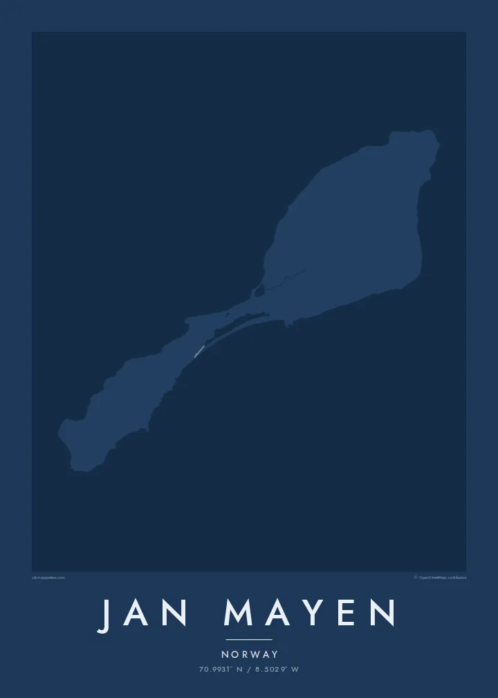
A narrow Arctic island of two volcanic halves joined by a thin neck, crowned by a glaciated volcano in the north.



Ein borg, fimm stemningar
Ýttu á stíl til að sjá hann á veggnum. Allir stílar kosta það sama — prentaðir, innrammaðir eða sem HD skrár.
 Raunstærð í pixlum · 24 × 36″ prentskrá
Skarpt í prentun
Þetta er 100% útklipping úr raunverulegu prentskránni. Hvert plakat — prentað, innrammað eða niðurhalað — er unnið á netþjónum okkar í 300 DPI, allt að 7,200 × 10,800 pixlum, svo jafnvel minnstu göturnar haldast skarpar á 24 × 36″ prenti.
Á veggnum


Kortið
Jan Mayen is a Norwegian volcanic island in the Arctic Ocean, northeast of Iceland. It is long and slender, and its outline falls into two parts: a broad northern section dominated by the volcano Beerenberg, and a lower, narrower southern section, linked by a slim isthmus. Beerenberg is the northernmost active volcano above sea level, and glaciers flow down its flanks toward the sea.
There is no permanent population. A small station staffed by Norwegian personnel handles weather observation and other services, and it accounts for most of the island's few tracks and buildings. A Jan Mayen map poster is therefore almost entirely coastline: capes, lagoons and the round mass of the volcano, with only the faintest trace of anything built by people.
Access is restricted, and the island is rarely visited outside official duty or occasional expeditions. Its isolation is part of its appeal as a subject. The outline, with its heavy northern head and thin southern tail, is one of the more unusual shapes a map poster can hold, and it reads clearly even without streets.
The volcano fills the northern end of the island, and its round, glacier-covered cone gives the map a strong, heavy head. The coastline around it is steep and largely inaccessible.
A narrow neck of land joins the two halves, with small lagoons along its shores. On the poster it is the thinnest point of the outline, easy to trace by eye.
The island's only settlement is a small cluster of buildings and tracks used by station staff. It is the one place where the map shows anything made by people.
Gerðu það að þínu
Bættu við dagsetningu, nafni eða eigin texta, skiptu um stíl, stærð eða stefnu.
Ókeypis forskoðunin er í lágri upplausn með vatnsmerki. Prentanir og HD skrár eru unnar í 300 DPI, allt að 7,200 × 10,800 px, án vatnsmerkis.
Af hverju Jan Mayen
Jan Mayen appeals to people who have served on the station, polar travellers and those who collect remote places. It is a map almost free of roads, which makes the poster feel more like a drawing of land and sea than a guide.
Use the title and subtitle for a posting, an expedition year or simply the island's name, and adjust the coordinates line. Noir and Blueprint suit its Arctic character, though all five styles, including Classic, Paper and Sand, are available. Files include six sizes as PNG and PDF.
Panta Jan Mayen plakatið| Prentstærð | Upplausn | Skrár |
|---|---|---|
| 30 × 40 cm11.8 × 15.7″ | 3,543 × 4,724 px | PNG · PDF |
| 29.7 × 42 cm (A3)11.7 × 16.5″ | 3,508 × 4,961 px | PNG · PDF |
| 42 × 59.4 cm (A2)16.5 × 23.4″ | 4,961 × 7,016 px | PNG · PDF |
| 45.7 × 61 cm18 × 24″ | 5,400 × 7,200 px | PNG · PDF |
| 50 × 70 cm19.7 × 27.6″ | 5,906 × 8,268 px | PNG · PDF |
| 61 × 91.4 cm24 × 36″ | 7,200 × 10,800 px | PNG · PDF |
Til samanburðar er ókeypis forskoðunin 900 px á breidd, með vatnsmerki og ætluð fyrir skjái. HD-skrárnar eru með allt að 8× meiri upplausn í hvora átt og prentast hreint í fullri plakatstærð.
Veldu stíl efst á síðunni og veldu síðan Prentað plakat — stærð og ramma ef þú vilt — eða Stafrænar HD skrár. Greiðsluferlið tekur eitt skref og pöntunarsíðan þín uppfærist um leið og greiðslan gengur í gegn.
Það er prentað á vandaðan 200 g/m² mattan pappír í einni af sex stærðum, frá 30 × 40 cm upp í 24 × 36″. Prentuð plaköt kosta frá $39, með sendingu innifalinni.
Já. Veldu ramma úr massífum við í svörtu, hvítu, náttúrulegri eik eða dökkum viði. Hann kemur með höggheldu gleri og er tilbúinn til að hengja upp. Innrömmuð plaköt kosta frá $99, með sendingu innifalinni.
Sendingin er ókeypis til 60+ landa. Hvert veggspjald er prentað hjá næsta prentsamstarfsaðila okkar í 30+ löndum og berst venjulega á 3–7 virkum dögum. Þú getur fylgst með stöðu og rakningu undir Mínar pantanir. Í sumum löndum tekur það 2–5 vikur og ef við sendum ekki enn til þíns lands lætur vefurinn þig vita áður en þú greiðir.
Sendu okkur mynd innan 14 daga frá afhendingu og við prentum það aftur ókeypis eða endurgreiðum þér.
Já. Í ritlinum á þessari síðu getur þú breytt titlinum, undirtitlinum og hnitalínunni í hvað sem þú vilt, og valið stíl og stærð. Prentaðar, innrammaðar og stafrænar pantanir nota allar nákvæmlega þína hönnun.
Fyrir $9 færðu 300 DPI PNG og prentunartilbúnar PDF skrár í öllum sex stærðum, án vatnsmerkis, til að prenta hvar sem er. Ekki alveg viss? Náðu fyrst í ókeypis forskoðun með vatnsmerki.
