The citadel
The fortress in the historic centre is a small, square shape among the surrounding streets. It is the oldest fixed point on the map and the heart of the old town.
Minimalískt kortaplakat · Tyrkland
38.7322° N / 35.4853° E
A plateau city spreading across open steppe, with the volcanic cone of Mount Erciyes rising to the south


Ein borg, fimm stemningar
Ýttu á stíl til að sjá hann á veggnum. Allir stílar kosta það sama — prentaðir, innrammaðir eða sem HD skrár.
 Raunstærð í pixlum · 24 × 36″ prentskrá
Skarpt í prentun
Þetta er 100% útklipping úr raunverulegu prentskránni. Hvert plakat — prentað, innrammað eða niðurhalað — er unnið á netþjónum okkar í 300 DPI, allt að 7,200 × 10,800 pixlum, svo jafnvel minnstu göturnar haldast skarpar á 24 × 36″ prenti.
Á veggnum


Kortið
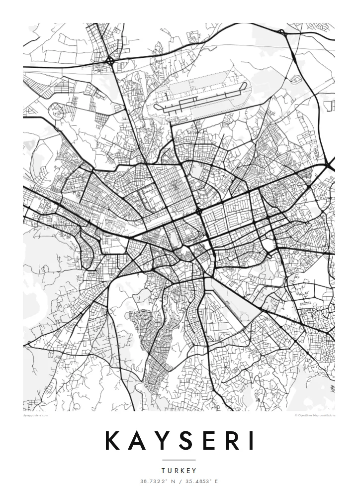
Kayseri lies on the high Anatolian plateau, in the centre of Turkey. The city's broad avenues spread across a wide, largely open plain. To the south rises Mount Erciyes, an extinct volcano and the highest peak in central Anatolia. Its slopes carry a ski resort and form a large empty area on any map of the region.
This has been a significant city since antiquity. It was Caesarea under the Romans, and later a major Seljuk centre. The black basalt citadel still stands at the heart of the old town, surrounded by Seljuk mosques, madrasas and tombs. Not far away is Kültepe, the site of ancient Kanesh, and Cappadocia lies to the west.
A Kayseri map poster captures the compact old core around the citadel and the regular newer districts spreading outward. Main roads run towards the surrounding towns, and the steppe opens beyond them. It is an austere, spacious composition, suited to a city defined as much by its high, open setting as by its buildings.
The fortress in the historic centre is a small, square shape among the surrounding streets. It is the oldest fixed point on the map and the heart of the old town.
The great volcano stands south of the city. Its slopes leave the lower part of the print open and give the composition a sense of scale.
Long, straight roads cross the plain in several directions. They link the city to its industrial zones and neighbouring towns, and give the map a clean, open structure.
Gerðu það að þínu
Bættu við dagsetningu, nafni eða eigin texta, skiptu um stíl, stærð eða stefnu.
Ókeypis forskoðunin er í lágri upplausn með vatnsmerki. Prentanir og HD skrár eru unnar í 300 DPI, allt að 7,200 × 10,800 px, án vatnsmerkis.
Af hverju Kayseri
Kayseri holds meaning for people who grew up with Erciyes on the horizon, and for families who have spread from the city across Turkey and Europe. The map is a way to keep its outline close.
The title, subtitle and coordinates can all be customised with names, dates or short phrases. Choose between Classic black & white, Noir, Paper, Blueprint and Sand.
Panta Kayseri plakatið| Prentstærð | Upplausn | Skrár |
|---|---|---|
| 30 × 40 cm11.8 × 15.7″ | 3,543 × 4,724 px | PNG · PDF |
| 29.7 × 42 cm (A3)11.7 × 16.5″ | 3,508 × 4,961 px | PNG · PDF |
| 42 × 59.4 cm (A2)16.5 × 23.4″ | 4,961 × 7,016 px | PNG · PDF |
| 45.7 × 61 cm18 × 24″ | 5,400 × 7,200 px | PNG · PDF |
| 50 × 70 cm19.7 × 27.6″ | 5,906 × 8,268 px | PNG · PDF |
| 61 × 91.4 cm24 × 36″ | 7,200 × 10,800 px | PNG · PDF |
Til samanburðar er ókeypis forskoðunin 900 px á breidd, með vatnsmerki og ætluð fyrir skjái. HD-skrárnar eru með allt að 8× meiri upplausn í hvora átt og prentast hreint í fullri plakatstærð.
Veldu stíl efst á síðunni og veldu síðan Prentað plakat — stærð og ramma ef þú vilt — eða Stafrænar HD skrár. Greiðsluferlið tekur eitt skref og pöntunarsíðan þín uppfærist um leið og greiðslan gengur í gegn.
Það er prentað á vandaðan 200 g/m² mattan pappír í einni af sex stærðum, frá 30 × 40 cm upp í 24 × 36″. Prentuð plaköt kosta frá $39, með sendingu innifalinni.
Já. Veldu ramma úr massífum við í svörtu, hvítu, náttúrulegri eik eða dökkum viði. Hann kemur með höggheldu gleri og er tilbúinn til að hengja upp. Innrömmuð plaköt kosta frá $99, með sendingu innifalinni.
Sendingin er ókeypis til 60+ landa. Hvert veggspjald er prentað hjá næsta prentsamstarfsaðila okkar í 30+ löndum og berst venjulega á 3–7 virkum dögum. Þú getur fylgst með stöðu og rakningu undir Mínar pantanir. Í sumum löndum tekur það 2–5 vikur og ef við sendum ekki enn til þíns lands lætur vefurinn þig vita áður en þú greiðir.
Sendu okkur mynd innan 14 daga frá afhendingu og við prentum það aftur ókeypis eða endurgreiðum þér.
Já. Í ritlinum á þessari síðu getur þú breytt titlinum, undirtitlinum og hnitalínunni í hvað sem þú vilt, og valið stíl og stærð. Prentaðar, innrammaðar og stafrænar pantanir nota allar nákvæmlega þína hönnun.
Fyrir $9 færðu 300 DPI PNG og prentunartilbúnar PDF skrár í öllum sex stærðum, án vatnsmerkis, til að prenta hvar sem er. Ekki alveg viss? Náðu fyrst í ókeypis forskoðun með vatnsmerki.
