Shire River
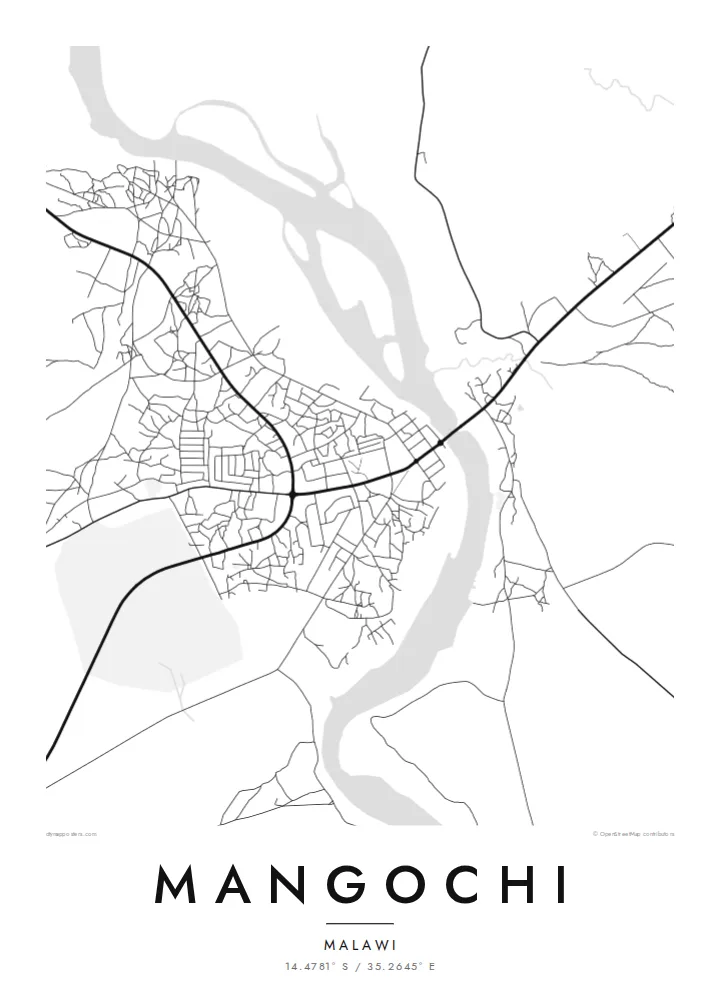
The Shire runs through the town, and its channel divides the map into two banks. A road bridge links them, making it the most important crossing in the area.
Minimalískt kortaplakat · Malaví
14.4781° S / 35.2645° E
A lakeside town at the southern tip of Lake Malawi, where the Shire River begins its course


Ein borg, fimm stemningar
Ýttu á stíl til að sjá hann á veggnum. Allir stílar kosta það sama — prentaðir, innrammaðir eða sem HD skrár.
 Raunstærð í pixlum · 24 × 36″ prentskrá
Skarpt í prentun
Þetta er 100% útklipping úr raunverulegu prentskránni. Hvert plakat — prentað, innrammað eða niðurhalað — er unnið á netþjónum okkar í 300 DPI, allt að 7,200 × 10,800 pixlum, svo jafnvel minnstu göturnar haldast skarpar á 24 × 36″ prenti.
Á veggnum


Kortið
Mangochi lies in southern Malawi, near the point where Lake Malawi narrows and empties into the Shire River. The town stretches along the river's banks, and its map is defined by that water: the channel running south, a road bridge crossing it, and the lakeshore just to the north with beaches and fishing villages along the coast.
Under the colonial administration the town was known as Fort Johnston, and it keeps several reminders of that period, including a clock tower commemorating Queen Victoria. The Lake Malawi Museum in the town tells the story of the lake, its fishing communities and its steamers.
A Mangochi map poster brings the river and the lake together in one frame. The town's streets sit on either side of the Shire, roads lead north along the lakeshore, and the open water gives the design a large calm space. It is a simple, strong composition shaped by geography.
The Shire runs through the town, and its channel divides the map into two banks. A road bridge links them, making it the most important crossing in the area.
Just north of the town, the southern tip of Lake Malawi opens out. The long shoreline and wide water give the top of the poster a clean, open surface.
The central streets, market and older colonial buildings lie close to the river. It is the densest part of the map, with roads branching out toward the lake and the south.
Gerðu það að þínu
Bættu við dagsetningu, nafni eða eigin texta, skiptu um stíl, stærð eða stefnu.
Ókeypis forskoðunin er í lágri upplausn með vatnsmerki. Prentanir og HD skrár eru unnar í 300 DPI, allt að 7,200 × 10,800 px, án vatnsmerkis.
Af hverju Mangochi
For people from Mangochi, and for those who have spent time on the southern lakeshore, a map of the town where the lake becomes a river is both a personal memento and a striking piece of geography.
Add a title and subtitle of your choice and set the coordinates line to a home, a school or a stretch of beach. The poster is available in Classic black & white, Noir, Paper, Blueprint and Sand.
Panta Mangochi plakatið| Prentstærð | Upplausn | Skrár |
|---|---|---|
| 30 × 40 cm11.8 × 15.7″ | 3,543 × 4,724 px | PNG · PDF |
| 29.7 × 42 cm (A3)11.7 × 16.5″ | 3,508 × 4,961 px | PNG · PDF |
| 42 × 59.4 cm (A2)16.5 × 23.4″ | 4,961 × 7,016 px | PNG · PDF |
| 45.7 × 61 cm18 × 24″ | 5,400 × 7,200 px | PNG · PDF |
| 50 × 70 cm19.7 × 27.6″ | 5,906 × 8,268 px | PNG · PDF |
| 61 × 91.4 cm24 × 36″ | 7,200 × 10,800 px | PNG · PDF |
Til samanburðar er ókeypis forskoðunin 900 px á breidd, með vatnsmerki og ætluð fyrir skjái. HD-skrárnar eru með allt að 8× meiri upplausn í hvora átt og prentast hreint í fullri plakatstærð.
Veldu stíl efst á síðunni og veldu síðan Prentað plakat — stærð og ramma ef þú vilt — eða Stafrænar HD skrár. Greiðsluferlið tekur eitt skref og pöntunarsíðan þín uppfærist um leið og greiðslan gengur í gegn.
Það er prentað á vandaðan 200 g/m² mattan pappír í einni af sex stærðum, frá 30 × 40 cm upp í 24 × 36″. Prentuð plaköt kosta frá $39, með sendingu innifalinni.
Já. Veldu ramma úr massífum við í svörtu, hvítu, náttúrulegri eik eða dökkum viði. Hann kemur með höggheldu gleri og er tilbúinn til að hengja upp. Innrömmuð plaköt kosta frá $99, með sendingu innifalinni.
Sendingin er ókeypis til 60+ landa. Hvert veggspjald er prentað hjá næsta prentsamstarfsaðila okkar í 30+ löndum og berst venjulega á 3–7 virkum dögum. Þú getur fylgst með stöðu og rakningu undir Mínar pantanir. Í sumum löndum tekur það 2–5 vikur og ef við sendum ekki enn til þíns lands lætur vefurinn þig vita áður en þú greiðir.
Sendu okkur mynd innan 14 daga frá afhendingu og við prentum það aftur ókeypis eða endurgreiðum þér.
Já. Í ritlinum á þessari síðu getur þú breytt titlinum, undirtitlinum og hnitalínunni í hvað sem þú vilt, og valið stíl og stærð. Prentaðar, innrammaðar og stafrænar pantanir nota allar nákvæmlega þína hönnun.
Fyrir $9 færðu 300 DPI PNG og prentunartilbúnar PDF skrár í öllum sex stærðum, án vatnsmerkis, til að prenta hvar sem er. Ekki alveg viss? Náðu fyrst í ókeypis forskoðun með vatnsmerki.
Í nágrenninu
