San Juan and San Francisco
The two oldest quarters form a tight knot of narrow, irregular streets. They are clearly distinguishable from the more regular modern districts around them.
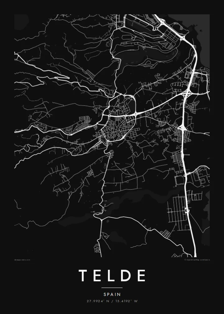
Minimalískt kortaplakat · Spánn
27.9924° N / 15.4192° W
Gran Canaria's second city, spreading from two historic quarters down a slope of ravines to the eastern coast.



Ein borg, fimm stemningar
Ýttu á stíl til að sjá hann á veggnum. Allir stílar kosta það sama — prentaðir, innrammaðir eða sem HD skrár.
 Raunstærð í pixlum · 24 × 36″ prentskrá
Skarpt í prentun
Þetta er 100% útklipping úr raunverulegu prentskránni. Hvert plakat — prentað, innrammað eða niðurhalað — er unnið á netþjónum okkar í 300 DPI, allt að 7,200 × 10,800 pixlum, svo jafnvel minnstu göturnar haldast skarpar á 24 × 36″ prenti.
Á veggnum


Kortið
Telde lies on the eastern side of Gran Canaria, between the island's central highlands and the Atlantic. It is the second-largest municipality on the island. Instead of one compact core it forms a string of districts. They spread across a gently sloping landscape cut by ravines, or barrancos, that run from the hills down to the shore.
Before the Castilian conquest, Telde was one of the island's two indigenous seats of power. Its oldest quarters, San Juan and San Francisco, keep narrow streets and low whitewashed houses, and the Basilica of San Juan Bautista stands at the centre of the former. The coastline includes beaches such as Melenara and La Garita, and Gran Canaria Airport lies just to the south.
A Telde map poster shows a scattered, layered city. There is a historic centre inland, with separate districts spreading across the slope, dry ravines between them, and a rocky coastline along the eastern edge. It is more complex than a typical grid, and that is its appeal.
The two oldest quarters form a tight knot of narrow, irregular streets. They are clearly distinguishable from the more regular modern districts around them.
Dry barrancos run down from the interior to the sea. They leave open corridors that separate the neighbourhoods and give the map strong diagonal lines.
The eastern coast is a series of small bays and headlands. It gives the poster an irregular, detailed edge, with the beach districts clustered along it.
Gerðu það að þínu
Bættu við dagsetningu, nafni eða eigin texta, skiptu um stíl, stærð eða stefnu.
Ókeypis forskoðunin er í lágri upplausn með vatnsmerki. Prentanir og HD skrár eru unnar í 300 DPI, allt að 7,200 × 10,800 px, án vatnsmerkis.
Af hverju Telde
Telde is home for many Canarians and a familiar stop for people who know Gran Canaria beyond the resorts. A print of its districts and ravines is a genuine piece of the island.
Personalise the title, subtitle and coordinates line. The Sand style suits the island's dry landscape, and Noir gives a more modern look. The HD files include six print sizes, and a free watermarked preview is available first.
Panta Telde plakatið| Prentstærð | Upplausn | Skrár |
|---|---|---|
| 30 × 40 cm (11.8 × 15.7″) | 3,543 × 4,724 px | PNG · PDF |
| 29.7 × 42 cm (A3, 11.7 × 16.5″) | 3,508 × 4,961 px | PNG · PDF |
| 42 × 59.4 cm (A2, 16.5 × 23.4″) | 4,961 × 7,016 px | PNG · PDF |
| 45.7 × 61 cm (18 × 24″) | 5,400 × 7,200 px | PNG · PDF |
| 50 × 70 cm (19.7 × 27.6″) | 5,906 × 8,268 px | PNG · PDF |
| 61 × 91.4 cm (24 × 36″) | 7,200 × 10,800 px | PNG · PDF |
Til samanburðar er ókeypis forskoðunin 900 px á breidd, með vatnsmerki og ætluð fyrir skjái. HD-skrárnar eru með allt að 8× meiri upplausn í hvora átt og prentast hreint í fullri plakatstærð.
Veldu stíl efst á síðunni og veldu síðan Prentað plakat — stærð og ramma ef þú vilt — eða Stafrænar HD skrár. Greiðsluferlið tekur eitt skref og pöntunarsíðan þín uppfærist um leið og greiðslan gengur í gegn.
Það er prentað á vandaðan 200 g/m² mattan pappír í einni af sex stærðum, frá 30 × 40 cm upp í 24 × 36″. Prentuð plaköt kosta frá {printFrom}, með sendingu innifalinni.
Já. Veldu ramma úr massífum við í svörtu, hvítu, náttúrulegri eik eða dökkum viði. Hann kemur með höggheldu gleri og er tilbúinn til að hengja upp. Innrömmuð plaköt kosta frá {framedFrom}, með sendingu innifalinni.
Sending er ókeypis um allan heim. Hvert plakat er prentað hjá næsta prentsamstarfsaðila okkar í yfir 30 löndum og berst yfirleitt á 3–7 virkum dögum. Þú getur fylgst með stöðu og sendingarnúmeri undir Pantanirnar mínar.
Sendu okkur mynd innan 14 daga frá afhendingu og við prentum það aftur ókeypis eða endurgreiðum þér.
Já. Í ritlinum á þessari síðu getur þú breytt titlinum, undirtitlinum og hnitalínunni í hvað sem þú vilt, og valið stíl og stærð. Prentaðar, innrammaðar og stafrænar pantanir nota allar nákvæmlega þína hönnun.
Fyrir $9 færðu 300 DPI PNG og prentunartilbúnar PDF skrár í öllum sex stærðum, án vatnsmerkis, til að prenta hvar sem er. Ekki alveg viss? Náðu fyrst í ókeypis forskoðun með vatnsmerki.
Í nágrenninu
