Patuxent River edge
The river runs along the northern side of the old town, where the mill once stood, drawing a soft natural line against the regular streets.
Poster minimalista con mappa · Stati Uniti
39.0993° N / 76.8483° W
A former mill town on the Patuxent River, set between Baltimore and Washington along old and new corridors.


Una città, cinque atmosfere
Tocca uno stile per vederlo a parete. Ogni stile costa lo stesso — stampato, incorniciato o in file HD.
 Pixel reali · file di stampa 24 × 36″
Nitido in stampa
Questo è un ritaglio al 100% del vero file di stampa. Ogni poster — stampato, incorniciato o scaricato — viene renderizzato sui nostri server a 300 DPI, fino a 7,200 × 10,800 pixel, così anche le strade più piccole restano nitide su una stampa 24 × 36″.
Sulla parete


La mappa
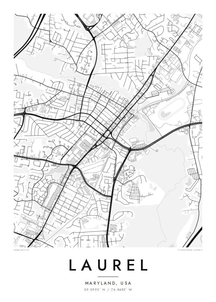
Laurel sits on the Patuxent River in Maryland, roughly midway between Baltimore and Washington. The city grew in the nineteenth century around a cotton mill powered by the river, and its historic Main Street still runs down toward the water. On a map, the river forms a clear boundary to the north, with the older grid of the centre sitting just above later suburban growth.
Route 1 and the railway line connect Laurel to both larger cities, and the city has expanded along those routes. Laurel Park, a thoroughbred racetrack, lies near the town, and the Patuxent Research Refuge, a large area of protected forest and wetland, occupies land to the east, adding broad natural areas to the regional map.
A Laurel map poster shows that mix of older and newer layers: the compact Main Street grid, the curve of the Patuxent, the straight rail line and the suburban streets that grew around them. It is a composition with clear structure, well suited to a minimalist print.
The river runs along the northern side of the old town, where the mill once stood, drawing a soft natural line against the regular streets.
Historic Main Street and the railway line form the backbone of the centre, linking the city's mill-town origins with its role as a commuter town.
The Patuxent Research Refuge and nearby parkland create large calm areas on the map, contrasting with the dense neighbourhoods around the centre.
Personalizzalo
Aggiungi una data, un nome o una frase tua, cambia stile, formato o orientamento.
L'anteprima gratuita è a bassa risoluzione e con filigrana. Stampe e file HD vengono renderizzati a 300 DPI, fino a 7,200 × 10,800 px, senza filigrana.
Perché Laurel
Laurel suits people who have lived between Baltimore and Washington and found a home here, or who remember Main Street from childhood. The map records a real sense of place in a region often seen only from the highway.
Personalise the title, subtitle and coordinates line with a date or a name, and choose from five styles. Paper suits the mill-town history, while Noir gives the river and rail lines a strong graphic contrast.
Ordina il poster Laurel| Formato di stampa | Risoluzione | File |
|---|---|---|
| 30 × 40 cm (11.8 × 15.7″) | 3,543 × 4,724 px | PNG · PDF |
| 29.7 × 42 cm (A3, 11.7 × 16.5″) | 3,508 × 4,961 px | PNG · PDF |
| 42 × 59.4 cm (A2, 16.5 × 23.4″) | 4,961 × 7,016 px | PNG · PDF |
| 45.7 × 61 cm (18 × 24″) | 5,400 × 7,200 px | PNG · PDF |
| 50 × 70 cm (19.7 × 27.6″) | 5,906 × 8,268 px | PNG · PDF |
| 61 × 91.4 cm (24 × 36″) | 7,200 × 10,800 px | PNG · PDF |
Per confronto, l'anteprima gratuita è larga 900 px, ha la filigrana ed è pensata per gli schermi. I file HD hanno fino a 8 volte la risoluzione in ogni direzione e si stampano in modo nitido nel formato poster completo.
Scegli uno stile in cima alla pagina, poi seleziona Poster Stampato — una misura e, se vuoi, una cornice — oppure File Digitali HD. Il checkout richiede un solo passaggio e la pagina del tuo ordine si aggiorna non appena il pagamento va a buon fine.
Viene stampato su carta opaca premium da 200 gsm in una di sei misure, da 30 × 40 cm a 24 × 36″. I poster stampati partono da {printFrom}, spedizione inclusa.
Sì. Scegli una cornice in legno massello nera, bianca, in rovere naturale o legno scuro. Include un vetro infrangibile ed è pronta da appendere. I poster incorniciati partono da {framedFrom}, spedizione inclusa.
La spedizione è gratuita in tutto il mondo. Ogni poster viene stampato dal partner di stampa più vicino tra i nostri, in oltre 30 paesi, e di solito arriva in 3–7 giorni lavorativi. Puoi seguire stato e tracking in I Miei Ordini.
Inviaci una foto entro 14 giorni dalla consegna e lo ristamperemo gratuitamente o ti rimborseremo.
Sì. Nell'editor di questa pagina puoi modificare il titolo, il sottotitolo e la riga delle coordinate come preferisci, e scegliere stile e misura. Gli ordini stampati, incorniciati e digitali usano esattamente il tuo design.
Per $9 ricevi file PNG a 300 DPI e PDF pronti per la stampa in tutte e sei le misure, senza filigrana, da stampare ovunque. Non sei ancora sicuro? Scarica prima un'anteprima gratuita con filigrana.
Nelle vicinanze
