National highway
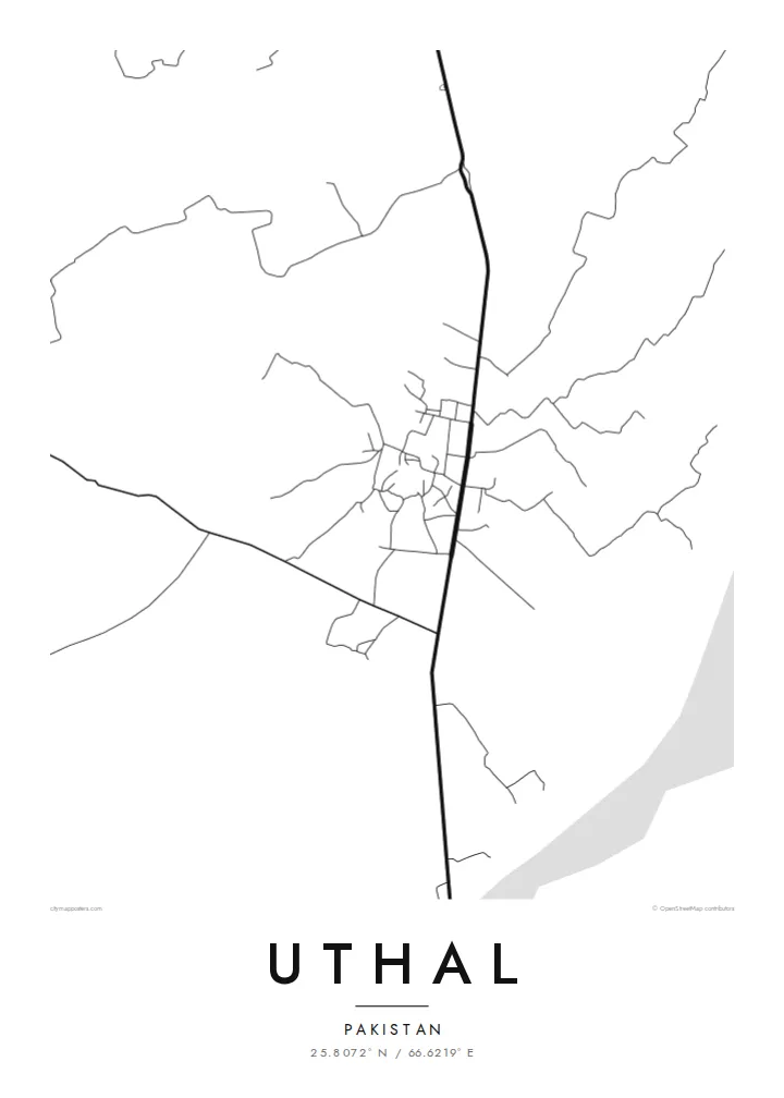
The Karachi–Quetta highway runs through Uthal, and the town has grown along it, making the road the backbone of the whole map.
Poster minimalista con mappa · Pakistan
25.8072° N / 66.6219° E
A Balochistan district town on the Karachi–Quetta road, laid out on a dry plain under bare hills.


Una città, cinque atmosfere
Tocca uno stile per vederlo a parete. Ogni stile costa lo stesso — stampato, incorniciato o in file HD.
 Pixel reali · file di stampa 24 × 36″
Nitido in stampa
Questo è un ritaglio al 100% del vero file di stampa. Ogni poster — stampato, incorniciato o scaricato — viene renderizzato sui nostri server a 300 DPI, fino a 7,200 × 10,800 pixel, così anche le strade più piccole restano nitide su una stampa 24 × 36″.
Sulla parete


La mappa
Uthal is the headquarters of Lasbela district in southern Balochistan, north of the Arabian Sea coast. It lies on the main highway between Karachi and Quetta, and on a map the town gathers along that route, with streets branching off into low-rise neighbourhoods. Around it, the plain is dry and open, crossed by seasonal watercourses, with hills rising toward the horizon.
The town is home to the Lasbela University of Agriculture, Water and Marine Sciences, whose campus forms a distinct area on the edge of town. Uthal serves as an administrative and market centre for the surrounding district, which reaches down to the coast and into the ranges beyond.
A Uthal map poster reflects that setting. The highway provides a strong line that runs through everything, the town's streets form a compact block beside it, and the empty space around it speaks of the arid landscape. It is a clear, uncluttered map, well suited to a minimalist style.
The Karachi–Quetta highway runs through Uthal, and the town has grown along it, making the road the backbone of the whole map.
The Lasbela University campus occupies its own area on the edge of town, with a layout of buildings and paths distinct from the streets around it.
Seasonal watercourses cross the plain around town, appearing as faint, braided lines that fill with water only after rain.
Personalizzalo
Aggiungi una data, un nome o una frase tua, cambia stile, formato o orientamento.
L'anteprima gratuita è a bassa risoluzione e con filigrana. Stampe e file HD vengono renderizzati a 300 DPI, fino a 7,200 × 10,800 px, senza filigrana.
Perché Uthal
For students who spent their university years in Uthal, and for families from Lasbela, this map is a way of keeping a formative place in view. Its clean composition suits an office or a study.
You can add a name, a graduation year or a line in Urdu or Balochi to the title and subtitle, and adjust the coordinates. Pick one of five styles and download the $9 HD files or order a print.
Ordina il poster Uthal| Formato di stampa | Risoluzione | File |
|---|---|---|
| 30 × 40 cm (11.8 × 15.7″) | 3,543 × 4,724 px | PNG · PDF |
| 29.7 × 42 cm (A3, 11.7 × 16.5″) | 3,508 × 4,961 px | PNG · PDF |
| 42 × 59.4 cm (A2, 16.5 × 23.4″) | 4,961 × 7,016 px | PNG · PDF |
| 45.7 × 61 cm (18 × 24″) | 5,400 × 7,200 px | PNG · PDF |
| 50 × 70 cm (19.7 × 27.6″) | 5,906 × 8,268 px | PNG · PDF |
| 61 × 91.4 cm (24 × 36″) | 7,200 × 10,800 px | PNG · PDF |
Per confronto, l'anteprima gratuita è larga 900 px, ha la filigrana ed è pensata per gli schermi. I file HD hanno fino a 8 volte la risoluzione in ogni direzione e si stampano in modo nitido nel formato poster completo.
Scegli uno stile in cima alla pagina, poi seleziona Poster Stampato — una misura e, se vuoi, una cornice — oppure File Digitali HD. Il checkout richiede un solo passaggio e la pagina del tuo ordine si aggiorna non appena il pagamento va a buon fine.
Viene stampato su carta opaca premium da 200 gsm in una di sei misure, da 30 × 40 cm a 24 × 36″. I poster stampati partono da {printFrom}, spedizione inclusa.
Sì. Scegli una cornice in legno massello nera, bianca, in rovere naturale o legno scuro. Include un vetro infrangibile ed è pronta da appendere. I poster incorniciati partono da {framedFrom}, spedizione inclusa.
La spedizione è gratuita in tutto il mondo. Ogni poster viene stampato dal partner di stampa più vicino tra i nostri, in oltre 30 paesi, e di solito arriva in 3–7 giorni lavorativi. Puoi seguire stato e tracking in I Miei Ordini.
Inviaci una foto entro 14 giorni dalla consegna e lo ristamperemo gratuitamente o ti rimborseremo.
Sì. Nell'editor di questa pagina puoi modificare il titolo, il sottotitolo e la riga delle coordinate come preferisci, e scegliere stile e misura. Gli ordini stampati, incorniciati e digitali usano esattamente il tuo design.
Per $9 ricevi file PNG a 300 DPI e PDF pronti per la stampa in tutte e sei le misure, senza filigrana, da stampare ovunque. Non sei ancora sicuro? Scarica prima un'anteprima gratuita con filigrana.
Nelle vicinanze
