Kaleiçi harbour
The old town surrounds a small, almost circular Roman harbour. On the map its winding lanes form a dense cluster against the wider modern streets around it.
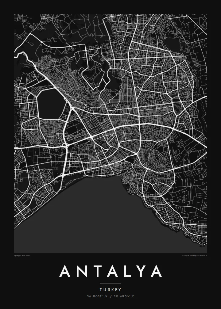
Minimalist map poster · Türkiye
36.9081° N / 30.6956° E
A curving coastline of cliffs and beaches beneath the Taurus Mountains, with a walled old harbour at its centre



One city, five moods
Ekamowa emwit style ouga bwe ouga ekamowa e dedaña ñan bwega. Style otata a kor eangan — eprint, eframe ke HD files.
 Pixel ekwan · 24 × 36″ print file
Print-sharp
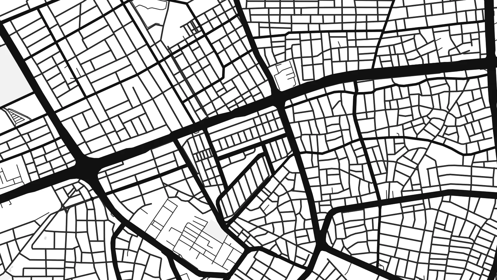
Enin 100% crop eo mai print file eo elango. Poster otata — eprint, eframe ke edownload — erender iaan server bwir e 300 DPI, dedaña ñan 7,200 × 10,800 pixels, bwe lane ekekedik ekwan ebwe crisp iaan print 24 × 36″.
Ituro


The map
Antalya sits on the Gulf of Antalya along Turkey's Mediterranean coast, with the Taurus Mountains rising steeply to the west and north. Much of the city stands on a plateau that ends abruptly at the sea in cliffs. On the map, the shoreline curves around the gulf, with the long Konyaaltı beach to the west and the Lara coast to the east.
The city was founded in the second century BC by Attalus II of Pergamon and named Attaleia after him. At its heart lies Kaleiçi, the old town, wrapped around a small Roman harbour. Hadrian's Gate, built to mark the emperor's visit, still stands in the old walls, and the fluted Yivli Minaret has become one of the city's best-known symbols.
East of the centre, the Düden River spills over the cliffs directly into the sea. An Antalya map poster shows this sequence of coastline, cliffs and old harbour in black and white, with the tight lanes of Kaleiçi set against the broad avenues of the modern city spreading out across the plateau behind the shore.
The old town surrounds a small, almost circular Roman harbour. On the map its winding lanes form a dense cluster against the wider modern streets around it.
The city's plateau ends in cliffs above the sea, with long beaches at Konyaaltı to the west and Lara to the east shaping the coastline on either side.
This triple-arched Roman gate stands in the line of the old walls, marking the boundary between Kaleiçi and the modern boulevard that runs past it.
Make it yours
Add a date, a name or a line of your own, switch style, size or orientation.
Preview ededa low-resolution im watermark. Print im HD files erender iaan 300 DPI, dedaña ñan 7,200 × 10,800 px, ededa watermark.
Why Antalya
Antalya is a map for those who have spent summers on its coast, for residents who know every street of the old town and for anyone who has looked out from the cliffs toward the mountains. Its coastline makes a naturally elegant composition.
Personalise the title, subtitle and coordinates line with a hotel, a holiday date or a name. Five styles are available: Classic black & white, Noir, Paper, Blueprint and Sand. Sand suits the Mediterranean light and the warm stone of the old town.
Oder poster Antalya| Print size | Resolution | Files |
|---|---|---|
| 30 × 40 cm11.8 × 15.7″ | 3,543 × 4,724 px | PNG · PDF |
| 29.7 × 42 cm (A3)11.7 × 16.5″ | 3,508 × 4,961 px | PNG · PDF |
| 42 × 59.4 cm (A2)16.5 × 23.4″ | 4,961 × 7,016 px | PNG · PDF |
| 45.7 × 61 cm18 × 24″ | 5,400 × 7,200 px | PNG · PDF |
| 50 × 70 cm19.7 × 27.6″ | 5,906 × 8,268 px | PNG · PDF |
| 61 × 91.4 cm24 × 36″ | 7,200 × 10,800 px | PNG · PDF |
For comparison, the free preview is 900 px wide, watermarked and meant for screens. The HD files have up to 8× the resolution in each direction and print cleanly at full poster size.
Emwit style iaan capña page, im dogen Printed Poster — size eo, im framme ouga tomwin — ke Digital HD Files. Checkout eaer sit step, im order page bwira eupdate iaan payment eo emej.
Eprint iaan matte paper 200 gsm, iaan size eo eo, mai 30 × 40 cm ñan 24 × 36″. Poster eprint eo emeja iaan $39, shipping ededo.
Eko. Emwit frame wood solid iaan black, white, oak natural ke wood dark. Etaña shatterproof glazing im ready ñan hang. Poster eframe emeja iaan $99, shipping ededo.
Shipping ma free ägen 60+ country. Poster ngaga eo e print ägen print partner nearest ibiema 30+ country, ae e tep ägen 3–7 business day. Ngaga kor status ae tracking ibe My Orders. Country ibiema e tep 2–5 week, ae country ngaga ibe shipping e bwaren, website e ibin oen bwa ngaga pay.
Kabun photo bwira iaan 14 aean mai delivery, im bwira ereprint ededo ke erefund.
Eko. Iaan editor page eanin, ouga change title, subtitle, im coordinates line ñan tomwin ouga koda, im emwit style im size. Order eprint, eframe im digital otata ekamowa design ouga tomwin.
Iaan $9 ouga ereub 300 DPI PNG im PDF print-ready iaan size otata eo, ededa watermark, ñan print ekamowa tomwin. Ouga aewedik? Download preview ededa watermarked kabun.
