Castries Harbour
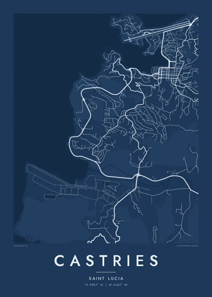
A long, sheltered inlet reaching deep into the island, its shores lined with quays and cruise berths. It gives the map a central, unmistakable form.
Minimalist map poster · St. Lucia
13.9957° N / 61.0061° W
A deep, sheltered harbour on Saint Lucia's northwest coast, ringed by hills, a small airport and a compact rebuilt centre.



One city, five moods
Ekamowa emwit style ouga bwe ouga ekamowa e dedaña ñan bwega. Style otata a kor eangan — eprint, eframe ke HD files.
 Pixel ekwan · 24 × 36″ print file
Print-sharp
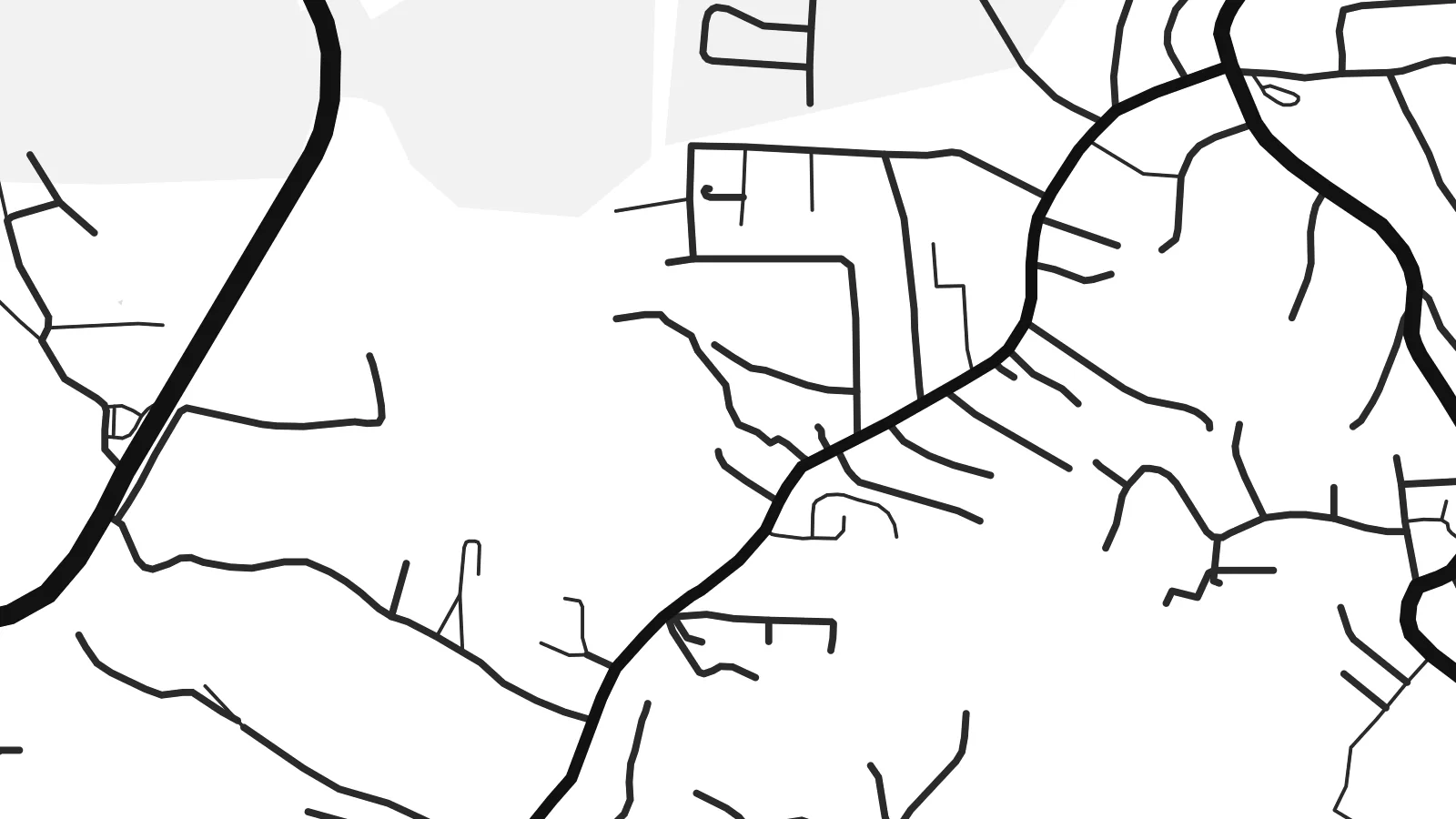
Enin 100% crop eo mai print file eo elango. Poster otata — eprint, eframe ke edownload — erender iaan server bwir e 300 DPI, dedaña ñan 7,200 × 10,800 pixels, bwe lane ekekedik ekwan ebwe crisp iaan print 24 × 36″.
Ituro


The map
Castries is built around one of the best natural harbours in the Caribbean, a long inlet on the northwest coast of Saint Lucia that reaches deep into the land. On a map, the water is the centre of everything. The town wraps around the head of the harbour, quays line both sides, and steep hills rise immediately behind the streets.
The downtown grid is compact and regular, partly because the town was rebuilt after a series of fires, the most destructive in 1948. At its heart is Derek Walcott Square, named after the Nobel Prize-winning poet who was born here. It forms an open block among the streets. Morne Fortune rises above the town to the south, with roads winding up its slopes.
On the northern side of the harbour, the Vigie peninsula carries the runway of George F. L. Charles Airport almost to the sea, and cruise ships berth along the quays. A Castries map poster shows the inlet, the grid and the surrounding high ground together. The result is a clear, balanced composition built around one strong shape of water.
A long, sheltered inlet reaching deep into the island, its shores lined with quays and cruise berths. It gives the map a central, unmistakable form.
The main square of the downtown grid, named after the poet. It appears as a small open block among the regular streets rebuilt after the fires.
North of the harbour, a low peninsula holds the city airport's runway and a stretch of coast. It forms a strong straight line in the upper part of the map.
Make it yours
Add a date, a name or a line of your own, switch style, size or orientation.
Preview ededa low-resolution im watermark. Print im HD files erender iaan 300 DPI, dedaña ñan 7,200 × 10,800 px, ededa watermark.
Why Castries
Saint Lucians abroad, couples who married on the island and visitors who arrived by sea often want to keep Castries close. The harbour gives the poster a natural focus, and the hills around it add depth without clutter.
You can personalise the title and subtitle, add a wedding or travel date, and adjust the coordinates line. Choose one of five styles: Classic black & white, Noir, Paper, Blueprint or Sand. Download the $9 HD files or order a printed poster.
Oder poster Castries| Print size | Resolution | Files |
|---|---|---|
| 30 × 40 cm11.8 × 15.7″ | 3,543 × 4,724 px | PNG · PDF |
| 29.7 × 42 cm (A3)11.7 × 16.5″ | 3,508 × 4,961 px | PNG · PDF |
| 42 × 59.4 cm (A2)16.5 × 23.4″ | 4,961 × 7,016 px | PNG · PDF |
| 45.7 × 61 cm18 × 24″ | 5,400 × 7,200 px | PNG · PDF |
| 50 × 70 cm19.7 × 27.6″ | 5,906 × 8,268 px | PNG · PDF |
| 61 × 91.4 cm24 × 36″ | 7,200 × 10,800 px | PNG · PDF |
For comparison, the free preview is 900 px wide, watermarked and meant for screens. The HD files have up to 8× the resolution in each direction and print cleanly at full poster size.
Emwit style iaan capña page, im dogen Printed Poster — size eo, im framme ouga tomwin — ke Digital HD Files. Checkout eaer sit step, im order page bwira eupdate iaan payment eo emej.
Eprint iaan matte paper 200 gsm, iaan size eo eo, mai 30 × 40 cm ñan 24 × 36″. Poster eprint eo emeja iaan $39, shipping ededo.
Eko. Emwit frame wood solid iaan black, white, oak natural ke wood dark. Etaña shatterproof glazing im ready ñan hang. Poster eframe emeja iaan $99, shipping ededo.
Shipping ma free ägen 60+ country. Poster ngaga eo e print ägen print partner nearest ibiema 30+ country, ae e tep ägen 3–7 business day. Ngaga kor status ae tracking ibe My Orders. Country ibiema e tep 2–5 week, ae country ngaga ibe shipping e bwaren, website e ibin oen bwa ngaga pay.
Kabun photo bwira iaan 14 aean mai delivery, im bwira ereprint ededo ke erefund.
Eko. Iaan editor page eanin, ouga change title, subtitle, im coordinates line ñan tomwin ouga koda, im emwit style im size. Order eprint, eframe im digital otata ekamowa design ouga tomwin.
Iaan $9 ouga ereub 300 DPI PNG im PDF print-ready iaan size otata eo, ededa watermark, ñan print ekamowa tomwin. Ouga aewedik? Download preview ededa watermarked kabun.
