Chain of lakes
Several lakes and tanks sit close together around the town. They form the largest shapes on the map and give Charkhāri its distinctive silhouette.
Minimalist map poster · India
25.4030° N / 79.7488° E
A former princely town in Bundelkhand, framed by a hill fort and a chain of lakes that dominate its map.
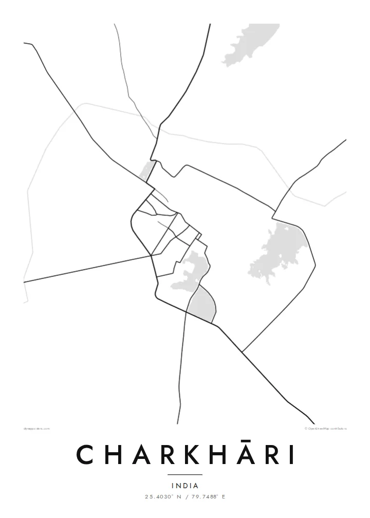


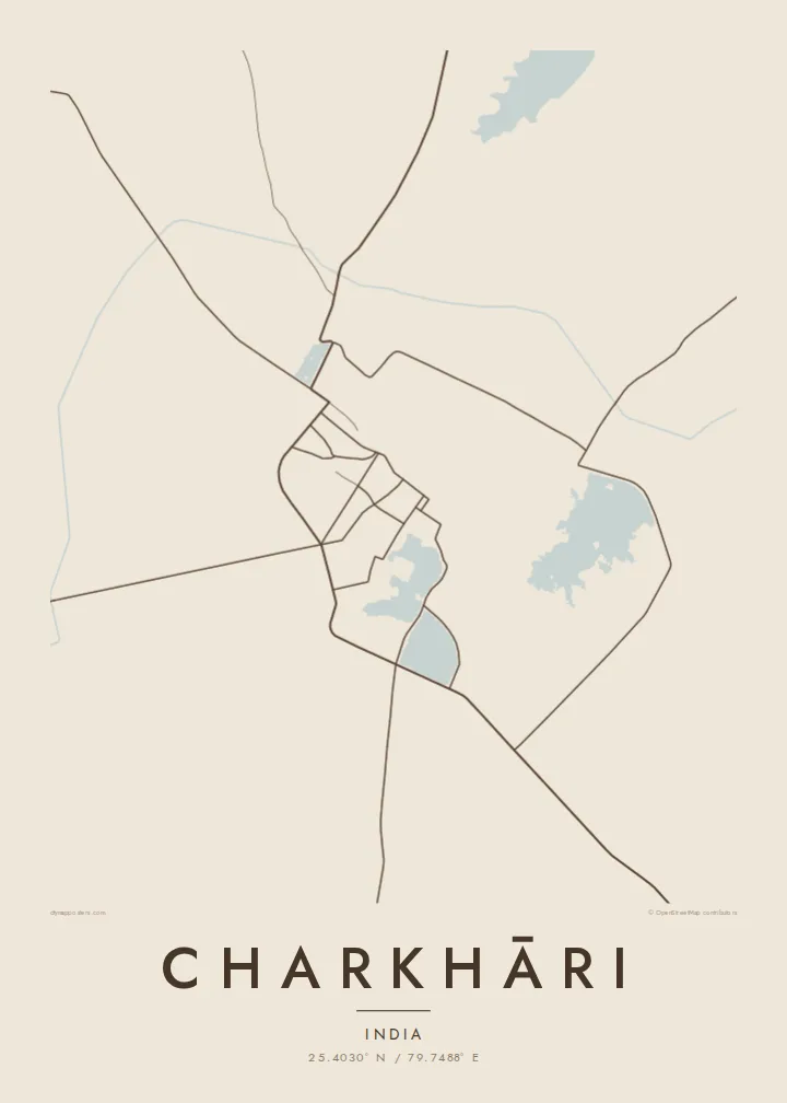
One city, five moods
Ekamowa emwit style ouga bwe ouga ekamowa e dedaña ñan bwega. Style otata a kor eangan — eprint, eframe ke HD files.
 Pixel ekwan · 24 × 36″ print file
Print-sharp
Enin 100% crop eo mai print file eo elango. Poster otata — eprint, eframe ke edownload — erender iaan server bwir e 300 DPI, dedaña ñan 7,200 × 10,800 pixels, bwe lane ekekedik ekwan ebwe crisp iaan print 24 × 36″.
Ituro


The map
Charkhāri lies in Mahoba district, in the Bundelkhand region of southern Uttar Pradesh, and it looks unusual on a map. The town wraps around a series of large lakes and tanks, so its streets bend around water on several sides, and the hill of the old fort rises above them. The plan is defined as much by open water as by buildings.
The lakes are why the town is sometimes called the Kashmir of Bundelkhand. On a Charkhāri map poster, they appear as broad pale shapes linked by embankments and roads. Temples, ghats and the remains of the former royal quarter sit around them, and the rocky, dry country of Bundelkhand stretches beyond.
Charkhāri was the capital of a princely state until Indian independence. Mangalgarh fort stands on the hill above the town, and the reservoirs that still shape Charkhāri date from the same princely era. It remains small and slow-paced, which makes its unusual geography all the more striking from above.
Several lakes and tanks sit close together around the town. They form the largest shapes on the map and give Charkhāri its distinctive silhouette.
The hill fort rises above the town and its lakes. Its outline and approach roads are visible where the map shows the high ground.
Roads run along the edges of the water and across the embankments between the lakes. They draw thin lines that separate one pool from the next.
Make it yours
Add a date, a name or a line of your own, switch style, size or orientation.
Preview ededa low-resolution im watermark. Print im HD files erender iaan 300 DPI, dedaña ñan 7,200 × 10,800 px, ededa watermark.
Why Charkhāri
A map of Charkhāri appeals to people from Bundelkhand, to those interested in India's former princely states, and to anyone drawn to places shaped by water. Few small towns have such a graphic plan, and it holds its own on a wall.
Name the poster, add a subtitle or a family date, and adjust the coordinates line. Classic black & white shows the lakes most sharply, while Paper and Sand give a softer finish. Download six print sizes as PNG and PDF, or order a printed, framed poster.
Oder poster Charkhāri| Print size | Resolution | Files |
|---|---|---|
| 30 × 40 cm11.8 × 15.7″ | 3,543 × 4,724 px | PNG · PDF |
| 29.7 × 42 cm (A3)11.7 × 16.5″ | 3,508 × 4,961 px | PNG · PDF |
| 42 × 59.4 cm (A2)16.5 × 23.4″ | 4,961 × 7,016 px | PNG · PDF |
| 45.7 × 61 cm18 × 24″ | 5,400 × 7,200 px | PNG · PDF |
| 50 × 70 cm19.7 × 27.6″ | 5,906 × 8,268 px | PNG · PDF |
| 61 × 91.4 cm24 × 36″ | 7,200 × 10,800 px | PNG · PDF |
For comparison, the free preview is 900 px wide, watermarked and meant for screens. The HD files have up to 8× the resolution in each direction and print cleanly at full poster size.
Emwit style iaan capña page, im dogen Printed Poster — size eo, im framme ouga tomwin — ke Digital HD Files. Checkout eaer sit step, im order page bwira eupdate iaan payment eo emej.
Eprint iaan matte paper 200 gsm, iaan size eo eo, mai 30 × 40 cm ñan 24 × 36″. Poster eprint eo emeja iaan $39, shipping ededo.
Eko. Emwit frame wood solid iaan black, white, oak natural ke wood dark. Etaña shatterproof glazing im ready ñan hang. Poster eframe emeja iaan $99, shipping ededo.
Eaeoen e ngaaba ngeni ouwa age ngaabe. Ngaeo poster e ibiyaneo ibon e print partner eg ibom ngaen ingi ngae 30+ eben, e naeo e yan ngaae e 3–7 aon wan ewa. Kom ngaa e eain ingi tracking ibon My Orders. Tauweo ebe 2–5 wik, ingi ibon ngaen ibun e ngaeo ngaeigie, e saet e sooe nuwe kom e pae.
Kabun photo bwira iaan 14 aean mai delivery, im bwira ereprint ededo ke erefund.
Eko. Iaan editor page eanin, ouga change title, subtitle, im coordinates line ñan tomwin ouga koda, im emwit style im size. Order eprint, eframe im digital otata ekamowa design ouga tomwin.
Iaan $9 ouga ereub 300 DPI PNG im PDF print-ready iaan size otata eo, ededa watermark, ñan print ekamowa tomwin. Ouga aewedik? Download preview ededa watermarked kabun.
