Colliery landscape
Mining areas leave large irregular shapes around the town, which contrast with the finer housing streets. The map shows how work and settlement grew up side by side.
Minimalist map poster · India
23.5728° N / 85.6535° E
A mining-belt town in the Damodar basin, its streets spreading between rail lines, coal workings and low hills




One city, five moods
Ekamowa emwit style ouga bwe ouga ekamowa e dedaña ñan bwega. Style otata a kor eangan — eprint, eframe ke HD files.
 Pixel ekwan · 24 × 36″ print file
Print-sharp
Enin 100% crop eo mai print file eo elango. Poster otata — eprint, eframe ke edownload — erender iaan server bwir e 300 DPI, dedaña ñan 7,200 × 10,800 pixels, bwe lane ekekedik ekwan ebwe crisp iaan print 24 × 36″.
Ituro


The map
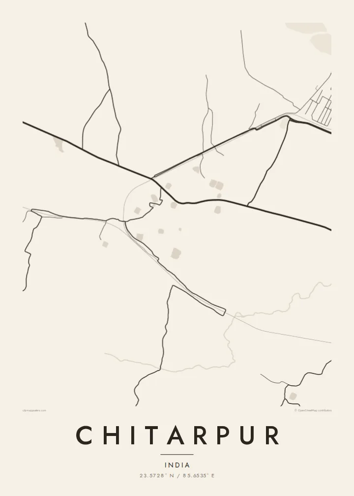
Chitarpur is a town in Ramgarh district, Jharkhand, in a part of the Chota Nagpur plateau shaped by coal. From above, the layout follows function more than design. Clusters of housing sit near roads and rail links, open ground separates the neighbourhoods, and the large scars of mining activity lie around the edges.
The Damodar river system drains this region. Its broad channels and tributaries loop across the plateau, and settlements along them grew as coal extraction expanded through the twentieth century. On a map the rivers give a sense of order to a landscape that otherwise breaks into fragments: villages, colliery townships, fields and patches of scrub.
The temple at Rajrappa, at the meeting of the Damodar and Bhairavi rivers, lies in the same district and draws pilgrims from across the state. A Chitarpur map poster sets the town within that wider plateau setting: roads leading to the mines and markets, a railway line cutting across, and the river country close by.
Mining areas leave large irregular shapes around the town, which contrast with the finer housing streets. The map shows how work and settlement grew up side by side.
A railway and main roads cross the area in long lines that connect Chitarpur to the rest of the coalfield and to the wider Jharkhand network.
Rivers and their broad sandy beds wind through the district, adding sweeping curves to a map otherwise made up of scattered, angular settlements.
Make it yours
Add a date, a name or a line of your own, switch style, size or orientation.
Preview ededa low-resolution im watermark. Print im HD files erender iaan 300 DPI, dedaña ñan 7,200 × 10,800 px, ededa watermark.
Why Chitarpur
Families tied to Jharkhand's coal towns often move far from home, and a map is a direct way to keep the place in view. Chitarpur's pattern of roads, mines and river country makes a distinctive, graphic image.
Add your own title and a subtitle, perhaps a family name or a year, and choose from five styles. The $9 digital files come in six print sizes, and printed posters on matte paper can be ordered with or without a wooden frame.
Oder poster Chitarpur| Print size | Resolution | Files |
|---|---|---|
| 30 × 40 cm11.8 × 15.7″ | 3,543 × 4,724 px | PNG · PDF |
| 29.7 × 42 cm (A3)11.7 × 16.5″ | 3,508 × 4,961 px | PNG · PDF |
| 42 × 59.4 cm (A2)16.5 × 23.4″ | 4,961 × 7,016 px | PNG · PDF |
| 45.7 × 61 cm18 × 24″ | 5,400 × 7,200 px | PNG · PDF |
| 50 × 70 cm19.7 × 27.6″ | 5,906 × 8,268 px | PNG · PDF |
| 61 × 91.4 cm24 × 36″ | 7,200 × 10,800 px | PNG · PDF |
For comparison, the free preview is 900 px wide, watermarked and meant for screens. The HD files have up to 8× the resolution in each direction and print cleanly at full poster size.
Emwit style iaan capña page, im dogen Printed Poster — size eo, im framme ouga tomwin — ke Digital HD Files. Checkout eaer sit step, im order page bwira eupdate iaan payment eo emej.
Eprint iaan matte paper 200 gsm, iaan size eo eo, mai 30 × 40 cm ñan 24 × 36″. Poster eprint eo emeja iaan $39, shipping ededo.
Eko. Emwit frame wood solid iaan black, white, oak natural ke wood dark. Etaña shatterproof glazing im ready ñan hang. Poster eframe emeja iaan $99, shipping ededo.
Shipping ma free ägen 60+ country. Poster ngaga eo e print ägen print partner nearest ibiema 30+ country, ae e tep ägen 3–7 business day. Ngaga kor status ae tracking ibe My Orders. Country ibiema e tep 2–5 week, ae country ngaga ibe shipping e bwaren, website e ibin oen bwa ngaga pay.
Kabun photo bwira iaan 14 aean mai delivery, im bwira ereprint ededo ke erefund.
Eko. Iaan editor page eanin, ouga change title, subtitle, im coordinates line ñan tomwin ouga koda, im emwit style im size. Order eprint, eframe im digital otata ekamowa design ouga tomwin.
Iaan $9 ouga ereub 300 DPI PNG im PDF print-ready iaan size otata eo, ededa watermark, ñan print ekamowa tomwin. Ouga aewedik? Download preview ededa watermarked kabun.
