Five coastal knots
Each village forms its own compact cluster where a valley meets the sea, spaced along the coast like beads, with open hillside between them.
Minimalist map poster · Italy
44.1246° N / 9.7112° E
Five small villages in coves and on one clifftop, linked by footpaths along a steep, mostly roadless shore


One city, five moods
Ekamowa emwit style ouga bwe ouga ekamowa e dedaña ñan bwega. Style otata a kor eangan — eprint, eframe ke HD files.
 Pixel ekwan · 24 × 36″ print file
Print-sharp
Enin 100% crop eo mai print file eo elango. Poster otata — eprint, eframe ke edownload — erender iaan server bwir e 300 DPI, dedaña ñan 7,200 × 10,800 pixels, bwe lane ekekedik ekwan ebwe crisp iaan print 24 × 36″.
Ituro


The map
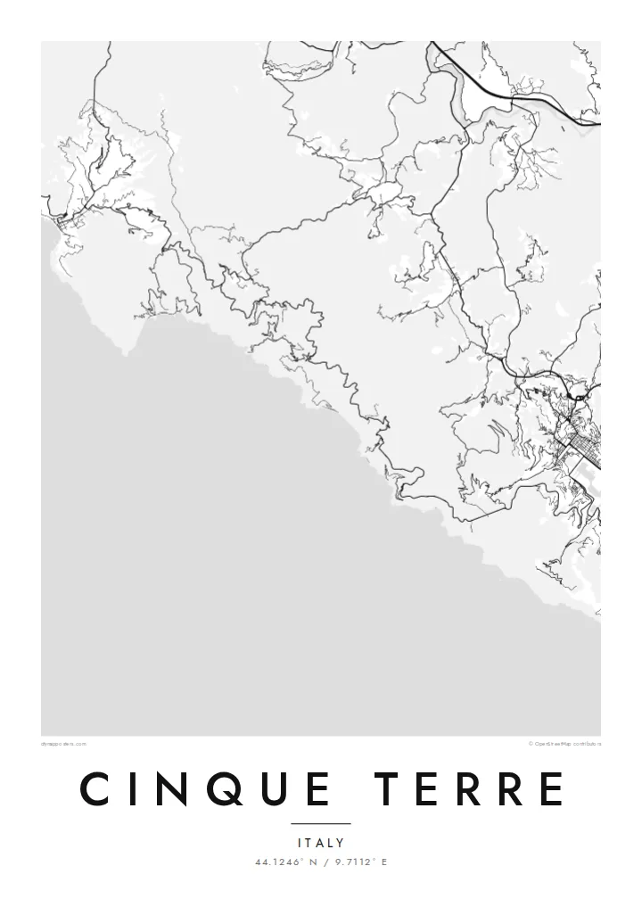
Cinque Terre is a short stretch of the Ligurian coast northwest of La Spezia, where five villages sit along a rugged shoreline: Monterosso al Mare, Vernazza, Corniglia, Manarola and Riomaggiore. From above, this coast has hardly any roads. The hills rise steeply from the sea, and the villages appear as tight clusters where small valleys reach the water, separated by long runs of cliff.
For centuries the villages were reached mainly by sea or on foot, and the railway that links them today runs largely through tunnels. The area is a national park, and together with Portovenere and the nearby islands it was added to the UNESCO World Heritage List in 1997. Dry-stone terraces, built for vines, climb high up the slopes.
A Cinque Terre map poster reads as a rhythm of village and open hillside along one line of coast. Corniglia breaks the pattern by sitting on a promontory above the water rather than beside a harbour. Footpaths run between the villages and up into the hills, and their fine lines give the map more structure than the few roads that approach from inland.
Each village forms its own compact cluster where a valley meets the sea, spaced along the coast like beads, with open hillside between them.
Corniglia is the only one of the five without a harbour of its own. It stands on a headland high above the sea, reached from its station by a long flight of steps.
Coastal and hill trails connect the villages on foot, while the railway runs mostly underground through the cliffs, so the map shows more walking routes than streets.
Make it yours
Add a date, a name or a line of your own, switch style, size or orientation.
Preview ededa low-resolution im watermark. Print im HD files erender iaan 300 DPI, dedaña ñan 7,200 × 10,800 px, ededa watermark.
Why Cinque Terre
Many people walk these paths once and afterwards want the whole route on the wall, from Monterosso to Riomaggiore. Personalise the title and subtitle with the dates of the trip or a line of your own, and set the coordinates line to the village where you stayed.
Five styles are available: Classic black & white, Noir, Paper, Blueprint and Sand. A free 900 px watermarked preview lets you check the composition first, and the $9 download includes six print sizes as 300 DPI PNG and print-ready PDF files.
Oder poster Cinque Terre| Print size | Resolution | Files |
|---|---|---|
| 30 × 40 cm11.8 × 15.7″ | 3,543 × 4,724 px | PNG · PDF |
| 29.7 × 42 cm (A3)11.7 × 16.5″ | 3,508 × 4,961 px | PNG · PDF |
| 42 × 59.4 cm (A2)16.5 × 23.4″ | 4,961 × 7,016 px | PNG · PDF |
| 45.7 × 61 cm18 × 24″ | 5,400 × 7,200 px | PNG · PDF |
| 50 × 70 cm19.7 × 27.6″ | 5,906 × 8,268 px | PNG · PDF |
| 61 × 91.4 cm24 × 36″ | 7,200 × 10,800 px | PNG · PDF |
For comparison, the free preview is 900 px wide, watermarked and meant for screens. The HD files have up to 8× the resolution in each direction and print cleanly at full poster size.
Emwit style iaan capña page, im dogen Printed Poster — size eo, im framme ouga tomwin — ke Digital HD Files. Checkout eaer sit step, im order page bwira eupdate iaan payment eo emej.
Eprint iaan matte paper 200 gsm, iaan size eo eo, mai 30 × 40 cm ñan 24 × 36″. Poster eprint eo emeja iaan $39, shipping ededo.
Eko. Emwit frame wood solid iaan black, white, oak natural ke wood dark. Etaña shatterproof glazing im ready ñan hang. Poster eframe emeja iaan $99, shipping ededo.
Shipping ma free ägen 60+ country. Poster ngaga eo e print ägen print partner nearest ibiema 30+ country, ae e tep ägen 3–7 business day. Ngaga kor status ae tracking ibe My Orders. Country ibiema e tep 2–5 week, ae country ngaga ibe shipping e bwaren, website e ibin oen bwa ngaga pay.
Kabun photo bwira iaan 14 aean mai delivery, im bwira ereprint ededo ke erefund.
Eko. Iaan editor page eanin, ouga change title, subtitle, im coordinates line ñan tomwin ouga koda, im emwit style im size. Order eprint, eframe im digital otata ekamowa design ouga tomwin.
Iaan $9 ouga ereub 300 DPI PNG im PDF print-ready iaan size otata eo, ededa watermark, ñan print ekamowa tomwin. Ouga aewedik? Download preview ededa watermarked kabun.
