Hagåtña waist
The capital sits where the island narrows, its compact streets pressed between the bay and a limestone ridge. It marks the natural midpoint of the composition and holds the clearest urban texture on the map.
Minimalist map poster · United States
13.4502° N / 144.7876° E
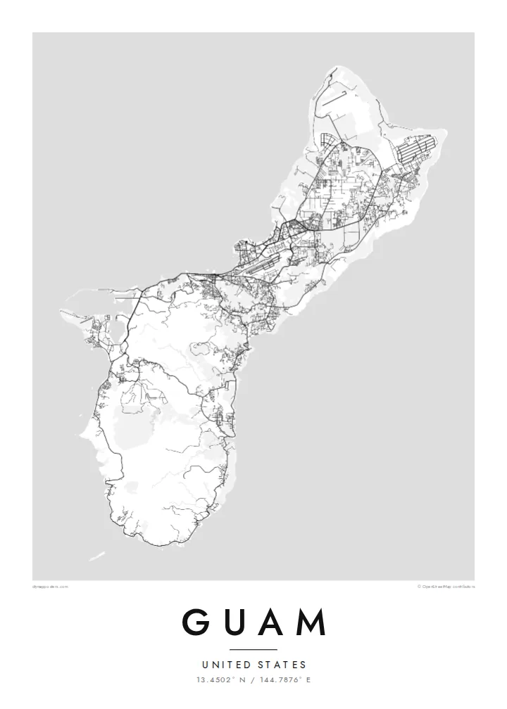
A long, pinched island with a flat limestone north, volcanic southern hills and a harbour carved into its western shore.


One city, five moods
Ekamowa emwit style ouga bwe ouga ekamowa e dedaña ñan bwega. Style otata a kor eangan — eprint, eframe ke HD files.
 Pixel ekwan · 24 × 36″ print file
Print-sharp
Enin 100% crop eo mai print file eo elango. Poster otata — eprint, eframe ke edownload — erender iaan server bwir e 300 DPI, dedaña ñan 7,200 × 10,800 pixels, bwe lane ekekedik ekwan ebwe crisp iaan print 24 × 36″.
Ituro


The map
Guam is the largest and southernmost of the Mariana Islands, a United States territory in the western Pacific. From above it reads as a narrow island about fifty kilometres long, drawn in at the middle where the capital, Hagåtña, sits on the western coast. North of that waist lies a raised limestone plateau with long straight roads and large cleared areas. To the south the land folds into ridges and river valleys.
On a Guam map poster the western shoreline carries most of the detail. Marine Corps Drive traces the coast past Tumon Bay, where hotels line a curved sandy beach, and continues south to Apra Harbor, a deep port sheltered by a breakwater and the Orote Peninsula. The eastern side faces the open ocean and is quieter on paper, with scattered villages and fewer roads between the cliffs and the reef.
Chamorro people settled the island thousands of years before European contact, and village names across the map still reflect that heritage. Not far offshore lies the Mariana Trench, whose Challenger Deep is the deepest known point of the ocean floor, though a poster shows only the reef edge and the coast. What remains is a clear portrait of a small island shaped by both volcanic rock and coral.
The capital sits where the island narrows, its compact streets pressed between the bay and a limestone ridge. It marks the natural midpoint of the composition and holds the clearest urban texture on the map.
A wide, sheltered anchorage on the west coast, framed by the Orote Peninsula and a long breakwater. Its hard-edged piers and basins give the southern half of the poster a strong graphic anchor.
Above the waist, the land becomes a flat limestone table crossed by long straight roads and the broad rectangles of airfields, a far more geometric pattern than the winding valleys of the south.
Make it yours
Add a date, a name or a line of your own, switch style, size or orientation.
Preview ededa low-resolution im watermark. Print im HD files erender iaan 300 DPI, dedaña ñan 7,200 × 10,800 px, ededa watermark.
Why Guam
A Guam poster suits people who were stationed on the island, grew up in one of its villages or spent time along Tumon Bay. The outline is compact enough to show whole, so the print works as a complete portrait of the island rather than a cropped fragment of it.
You can change the title, add a subtitle such as a family name or a date, and edit the coordinates line. Choose from five styles, Classic black & white, Noir, Paper, Blueprint or Sand, then take the $9 HD files in six sizes or order a matte print, framed if you prefer.
Oder poster Guam| Print size | Resolution | Files |
|---|---|---|
| 30 × 40 cm11.8 × 15.7″ | 3,543 × 4,724 px | PNG · PDF |
| 29.7 × 42 cm (A3)11.7 × 16.5″ | 3,508 × 4,961 px | PNG · PDF |
| 42 × 59.4 cm (A2)16.5 × 23.4″ | 4,961 × 7,016 px | PNG · PDF |
| 45.7 × 61 cm18 × 24″ | 5,400 × 7,200 px | PNG · PDF |
| 50 × 70 cm19.7 × 27.6″ | 5,906 × 8,268 px | PNG · PDF |
| 61 × 91.4 cm24 × 36″ | 7,200 × 10,800 px | PNG · PDF |
For comparison, the free preview is 900 px wide, watermarked and meant for screens. The HD files have up to 8× the resolution in each direction and print cleanly at full poster size.
Emwit style iaan capña page, im dogen Printed Poster — size eo, im framme ouga tomwin — ke Digital HD Files. Checkout eaer sit step, im order page bwira eupdate iaan payment eo emej.
Eprint iaan matte paper 200 gsm, iaan size eo eo, mai 30 × 40 cm ñan 24 × 36″. Poster eprint eo emeja iaan $39, shipping ededo.
Eko. Emwit frame wood solid iaan black, white, oak natural ke wood dark. Etaña shatterproof glazing im ready ñan hang. Poster eframe emeja iaan $99, shipping ededo.
Shipping ma free ägen 60+ country. Poster ngaga eo e print ägen print partner nearest ibiema 30+ country, ae e tep ägen 3–7 business day. Ngaga kor status ae tracking ibe My Orders. Country ibiema e tep 2–5 week, ae country ngaga ibe shipping e bwaren, website e ibin oen bwa ngaga pay.
Kabun photo bwira iaan 14 aean mai delivery, im bwira ereprint ededo ke erefund.
Eko. Iaan editor page eanin, ouga change title, subtitle, im coordinates line ñan tomwin ouga koda, im emwit style im size. Order eprint, eframe im digital otata ekamowa design ouga tomwin.
Iaan $9 ouga ereub 300 DPI PNG im PDF print-ready iaan size otata eo, ededa watermark, ñan print ekamowa tomwin. Ouga aewedik? Download preview ededa watermarked kabun.
