Pearl River channels
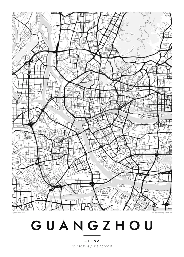
The river splits and rejoins as it crosses the city, leaving islands and peninsulas between its branches. These ribbons of water give the poster its main structure and divide north from south.
Minimalist map poster · China
23.1167° N / 113.2500° E
A dense river city where the Pearl River splits around islands, with the slopes of Baiyun Mountain holding back the streets to the north


One city, five moods
Ekamowa emwit style ouga bwe ouga ekamowa e dedaña ñan bwega. Style otata a kor eangan — eprint, eframe ke HD files.
 Pixel ekwan · 24 × 36″ print file
Print-sharp
Enin 100% crop eo mai print file eo elango. Poster otata — eprint, eframe ke edownload — erender iaan server bwir e 300 DPI, dedaña ñan 7,200 × 10,800 pixels, bwe lane ekekedik ekwan ebwe crisp iaan print 24 × 36″.
Ituro


The map
Guangzhou is organised around water. The Pearl River runs through the city from west to east, and its channels divide the urban area into distinct banks and islands. Haizhu, on the south side, is a district entirely wrapped by river branches, and further downstream the delta begins to widen toward the sea. On a map, bridges cross these channels at close intervals, stitching the halves of the city together.
The older districts of Liwan and Yuexiu hold the historic core, with an irregular, closely packed street pattern. Small Shamian Island, once a foreign concession, appears as a neat elongated shape on the river’s edge. To the east, Zhujiang New Town lays down a wide, formal axis that faces the Canton Tower across the water, and the long ridge of Baiyun Mountain closes off the north.
The city, historically known in the West as Canton, has been a trading port for more than two thousand years and was an early hub of maritime trade with Southeast Asia and beyond. The Canton Fair, held here since 1957, remains one of the largest trade fairs in China. A Guangzhou map poster captures that river-bound, commercial character in a single frame.
The river splits and rejoins as it crosses the city, leaving islands and peninsulas between its branches. These ribbons of water give the poster its main structure and divide north from south.
A small island on the river bank in Liwan, laid out with a tidy grid of tree-lined streets. Its regular plan stands out clearly against the tighter lanes of the surrounding old town.
A broad central axis of parks and plazas runs north to south through the business district and continues across the river toward the Canton Tower, giving the modern city a clear ceremonial line.
Make it yours
Add a date, a name or a line of your own, switch style, size or orientation.
Preview ededa low-resolution im watermark. Print im HD files erender iaan 300 DPI, dedaña ñan 7,200 × 10,800 px, ededa watermark.
Why Guangzhou
Guangzhou tends to belong to people with a real connection to it, whether through family in Guangdong, years spent studying there or regular trips to the Canton Fair. The river divides the frame into strong shapes, so the poster reads well from across a room.
The title, subtitle and coordinates line are all editable, so the print can carry a name, a district or the date you moved there. Pick one of five styles, Classic black & white, Noir, Paper, Blueprint or Sand, to match the room it will hang in.
Oder poster Guangzhou| Print size | Resolution | Files |
|---|---|---|
| 30 × 40 cm11.8 × 15.7″ | 3,543 × 4,724 px | PNG · PDF |
| 29.7 × 42 cm (A3)11.7 × 16.5″ | 3,508 × 4,961 px | PNG · PDF |
| 42 × 59.4 cm (A2)16.5 × 23.4″ | 4,961 × 7,016 px | PNG · PDF |
| 45.7 × 61 cm18 × 24″ | 5,400 × 7,200 px | PNG · PDF |
| 50 × 70 cm19.7 × 27.6″ | 5,906 × 8,268 px | PNG · PDF |
| 61 × 91.4 cm24 × 36″ | 7,200 × 10,800 px | PNG · PDF |
For comparison, the free preview is 900 px wide, watermarked and meant for screens. The HD files have up to 8× the resolution in each direction and print cleanly at full poster size.
Emwit style iaan capña page, im dogen Printed Poster — size eo, im framme ouga tomwin — ke Digital HD Files. Checkout eaer sit step, im order page bwira eupdate iaan payment eo emej.
Eprint iaan matte paper 200 gsm, iaan size eo eo, mai 30 × 40 cm ñan 24 × 36″. Poster eprint eo emeja iaan $39, shipping ededo.
Eko. Emwit frame wood solid iaan black, white, oak natural ke wood dark. Etaña shatterproof glazing im ready ñan hang. Poster eframe emeja iaan $99, shipping ededo.
Shipping ma free ägen 60+ country. Poster ngaga eo e print ägen print partner nearest ibiema 30+ country, ae e tep ägen 3–7 business day. Ngaga kor status ae tracking ibe My Orders. Country ibiema e tep 2–5 week, ae country ngaga ibe shipping e bwaren, website e ibin oen bwa ngaga pay.
Kabun photo bwira iaan 14 aean mai delivery, im bwira ereprint ededo ke erefund.
Eko. Iaan editor page eanin, ouga change title, subtitle, im coordinates line ñan tomwin ouga koda, im emwit style im size. Order eprint, eframe im digital otata ekamowa design ouga tomwin.
Iaan $9 ouga ereub 300 DPI PNG im PDF print-ready iaan size otata eo, ededa watermark, ñan print ekamowa tomwin. Ouga aewedik? Download preview ededa watermarked kabun.
