Canal and river
The Caen canal and the Orne run in parallel along the town's eastern side, two straight lines of water that give the poster a firm edge.
Minimalist map poster · France
49.2109° N / 0.3065° W
A planned new town beside Caen, its modernist districts bounded by the Orne and the Caen canal
One city, five moods
Ekamowa emwit style ouga bwe ouga ekamowa e dedaña ñan bwega. Style otata a kor eangan — eprint, eframe ke HD files.
 Pixel ekwan · 24 × 36″ print file
Print-sharp
Enin 100% crop eo mai print file eo elango. Poster otata — eprint, eframe ke edownload — erender iaan server bwir e 300 DPI, dedaña ñan 7,200 × 10,800 pixels, bwe lane ekekedik ekwan ebwe crisp iaan print 24 × 36″.
Ituro


The map
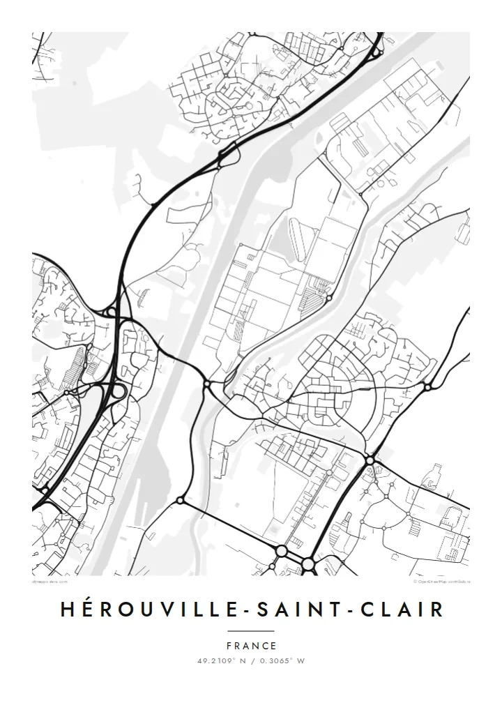
Hérouville-Saint-Clair adjoins Caen to the north-east, and most of what appears on the map was built from the 1960s onward, when a small village was transformed into a planned new town. From above, the result is unmistakably modern: large residential districts with curving access roads, pedestrian routes, green spaces and clusters of apartment blocks set apart from through traffic.
The town's eastern edge is defined by water. The Orne river and the Caen canal, which runs to the sea at Ouistreham, lie side by side here, forming two long parallel lines that separate Hérouville from the land beyond. Ring roads and main arteries around Caen cut across the map with sweeping curves.
A Hérouville-Saint-Clair map poster is especially interesting for anyone who appreciates post-war urban planning. Instead of a medieval core, the map shows distinct neighbourhoods, each designed as a unit, stitched together by boulevards and green corridors. The canal and river provide a strong, straight counterpoint to those rounded, self-contained forms.
The Caen canal and the Orne run in parallel along the town's eastern side, two straight lines of water that give the poster a firm edge.
Neighbourhoods laid out during the new-town era appear as distinct units with looping internal roads, a pattern very different from a traditional French centre.
Main roads and the ring road around Caen sweep across the map, connecting Hérouville to the city and giving the composition its broad curves.
Make it yours
Add a date, a name or a line of your own, switch style, size or orientation.
Preview ededa low-resolution im watermark. Print im HD files erender iaan 300 DPI, dedaña ñan 7,200 × 10,800 px, ededa watermark.
Why Hérouville-Saint-Clair
Hérouville suits people who grew up in its districts, studied in Caen or simply enjoy the look of mid-century planning. The map has a graphic, almost architectural quality that works well in modern interiors.
Personalise the title and subtitle, perhaps with a district name or the year you moved, and set the coordinates line. Blueprint highlights the planned layout, while Classic black & white, Noir, Paper and Sand offer other moods.
Oder poster Hérouville-Saint-Clair| Print size | Resolution | Files |
|---|---|---|
| 30 × 40 cm11.8 × 15.7″ | 3,543 × 4,724 px | PNG · PDF |
| 29.7 × 42 cm (A3)11.7 × 16.5″ | 3,508 × 4,961 px | PNG · PDF |
| 42 × 59.4 cm (A2)16.5 × 23.4″ | 4,961 × 7,016 px | PNG · PDF |
| 45.7 × 61 cm18 × 24″ | 5,400 × 7,200 px | PNG · PDF |
| 50 × 70 cm19.7 × 27.6″ | 5,906 × 8,268 px | PNG · PDF |
| 61 × 91.4 cm24 × 36″ | 7,200 × 10,800 px | PNG · PDF |
For comparison, the free preview is 900 px wide, watermarked and meant for screens. The HD files have up to 8× the resolution in each direction and print cleanly at full poster size.
Emwit style iaan capña page, im dogen Printed Poster — size eo, im framme ouga tomwin — ke Digital HD Files. Checkout eaer sit step, im order page bwira eupdate iaan payment eo emej.
Eprint iaan matte paper 200 gsm, iaan size eo eo, mai 30 × 40 cm ñan 24 × 36″. Poster eprint eo emeja iaan $39, shipping ededo.
Eko. Emwit frame wood solid iaan black, white, oak natural ke wood dark. Etaña shatterproof glazing im ready ñan hang. Poster eframe emeja iaan $99, shipping ededo.
Shipping ma free ägen 60+ country. Poster ngaga eo e print ägen print partner nearest ibiema 30+ country, ae e tep ägen 3–7 business day. Ngaga kor status ae tracking ibe My Orders. Country ibiema e tep 2–5 week, ae country ngaga ibe shipping e bwaren, website e ibin oen bwa ngaga pay.
Kabun photo bwira iaan 14 aean mai delivery, im bwira ereprint ededo ke erefund.
Eko. Iaan editor page eanin, ouga change title, subtitle, im coordinates line ñan tomwin ouga koda, im emwit style im size. Order eprint, eframe im digital otata ekamowa design ouga tomwin.
Iaan $9 ouga ereub 300 DPI PNG im PDF print-ready iaan size otata eo, ededa watermark, ñan print ekamowa tomwin. Ouga aewedik? Download preview ededa watermarked kabun.
Nearby
