Oval old town
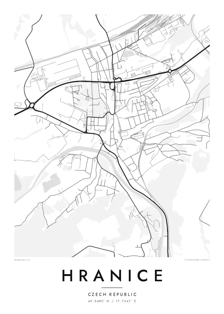
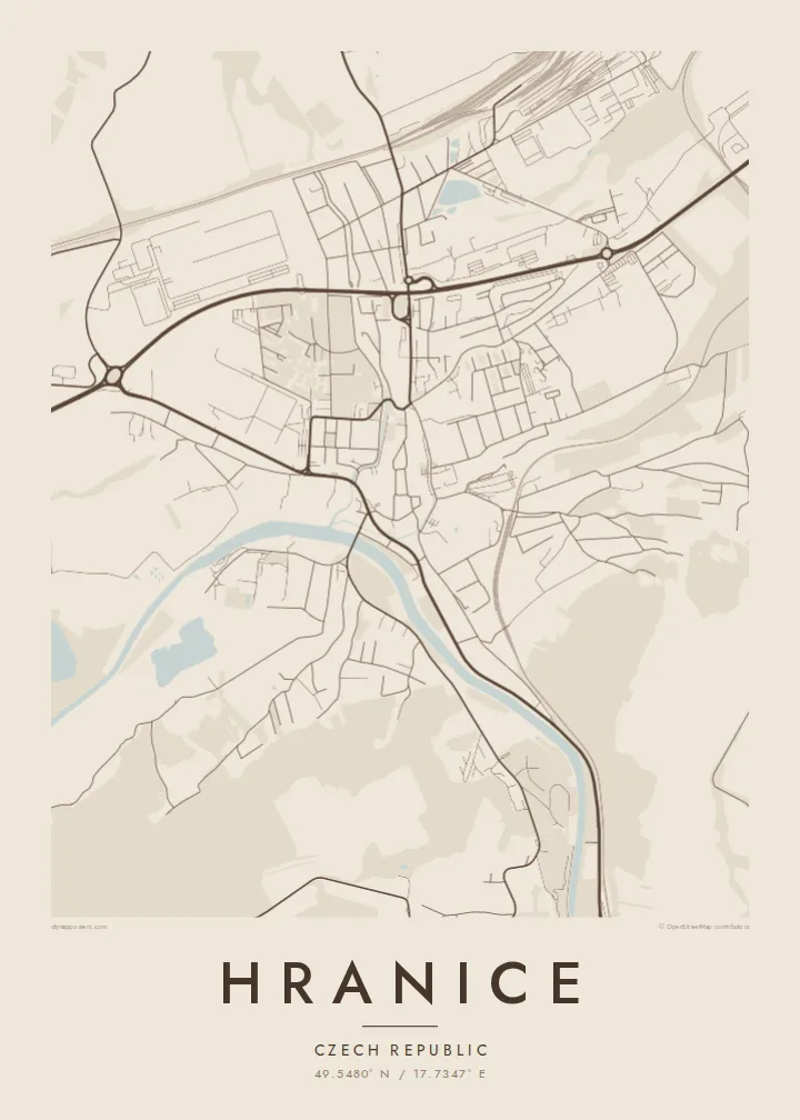
The historic centre forms a compact oval around a main square. Its outline follows the course of the former town walls.
Minimalist map poster · Czechia
49.5480° N / 17.7347° E
A Moravian town on the Bečva river, with a walled old core and the Moravian Gate valley around it


One city, five moods
Ekamowa emwit style ouga bwe ouga ekamowa e dedaña ñan bwega. Style otata a kor eangan — eprint, eframe ke HD files.
 Pixel ekwan · 24 × 36″ print file
Print-sharp
Enin 100% crop eo mai print file eo elango. Poster otata — eprint, eframe ke edownload — erender iaan server bwir e 300 DPI, dedaña ñan 7,200 × 10,800 pixels, bwe lane ekekedik ekwan ebwe crisp iaan print 24 × 36″.
Ituro


The map
Hranice lies in eastern Moravia, in the Moravian Gate, a lowland corridor between the Carpathians and the Sudetes that has served as a route for trade and travel for centuries. The Bečva river runs past the town. The old centre sits on higher ground above it, compact and roughly oval, with a main square and streets that still follow the line of its old walls.
Just outside town is the Hranice Abyss, a limestone chasm with a flooded cave measured as the deepest of its kind in the world. On the map, it appears only as a patch of woodland near the river, a small area that hides remarkable depths below. Railway lines and main roads follow the valley past the town.
A Hranice map poster shows a town shaped by its position. There is the tight historic core, the river curving below, and the transport lines running through the gap between the mountains. The black-and-white rendering makes the oval of the old town especially clear, set against the more scattered pattern of the newer districts.
The historic centre forms a compact oval around a main square. Its outline follows the course of the former town walls.
The river curves below the old town, with bridges crossing to the other bank. It gives the map a clear flowing line.
Railways and roads run through the valley past Hranice, marking the historic route between the mountain ranges.
Make it yours
Add a date, a name or a line of your own, switch style, size or orientation.
Preview ededa low-resolution im watermark. Print im HD files erender iaan 300 DPI, dedaña ñan 7,200 × 10,800 px, ededa watermark.
Why Hranice
Hranice appeals to people who grew up in Moravia, studied here, or came to see the Abyss and stayed with the town in their memory. The clear oval of the old centre gives the print a strong focal point, and it looks good even in the smallest size.
Change the title, subtitle and coordinates line to your own text. Choose Classic black & white, Noir, Paper, Blueprint or Sand. There is a free 900 px watermarked preview to check the result, and the full HD files cost $9.
Oder poster Hranice| Print size | Resolution | Files |
|---|---|---|
| 30 × 40 cm11.8 × 15.7″ | 3,543 × 4,724 px | PNG · PDF |
| 29.7 × 42 cm (A3)11.7 × 16.5″ | 3,508 × 4,961 px | PNG · PDF |
| 42 × 59.4 cm (A2)16.5 × 23.4″ | 4,961 × 7,016 px | PNG · PDF |
| 45.7 × 61 cm18 × 24″ | 5,400 × 7,200 px | PNG · PDF |
| 50 × 70 cm19.7 × 27.6″ | 5,906 × 8,268 px | PNG · PDF |
| 61 × 91.4 cm24 × 36″ | 7,200 × 10,800 px | PNG · PDF |
For comparison, the free preview is 900 px wide, watermarked and meant for screens. The HD files have up to 8× the resolution in each direction and print cleanly at full poster size.
Emwit style iaan capña page, im dogen Printed Poster — size eo, im framme ouga tomwin — ke Digital HD Files. Checkout eaer sit step, im order page bwira eupdate iaan payment eo emej.
Eprint iaan matte paper 200 gsm, iaan size eo eo, mai 30 × 40 cm ñan 24 × 36″. Poster eprint eo emeja iaan $39, shipping ededo.
Eko. Emwit frame wood solid iaan black, white, oak natural ke wood dark. Etaña shatterproof glazing im ready ñan hang. Poster eframe emeja iaan $99, shipping ededo.
Shipping ma free ägen 60+ country. Poster ngaga eo e print ägen print partner nearest ibiema 30+ country, ae e tep ägen 3–7 business day. Ngaga kor status ae tracking ibe My Orders. Country ibiema e tep 2–5 week, ae country ngaga ibe shipping e bwaren, website e ibin oen bwa ngaga pay.
Kabun photo bwira iaan 14 aean mai delivery, im bwira ereprint ededo ke erefund.
Eko. Iaan editor page eanin, ouga change title, subtitle, im coordinates line ñan tomwin ouga koda, im emwit style im size. Order eprint, eframe im digital otata ekamowa design ouga tomwin.
Iaan $9 ouga ereub 300 DPI PNG im PDF print-ready iaan size otata eo, ededa watermark, ñan print ekamowa tomwin. Ouga aewedik? Download preview ededa watermarked kabun.
