Karakoram Highway
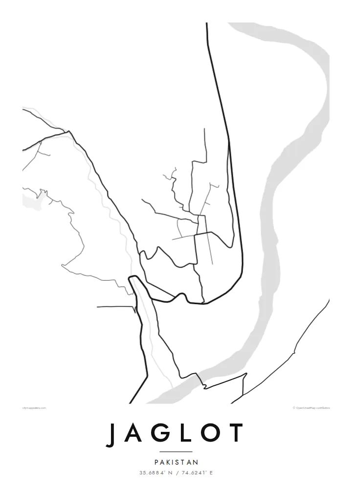
The main road runs the length of the valley and passes directly through Jaglot. On the map, it appears as a long, confident line connecting the region north and south.
Minimalist map poster · Pakistan
35.6884° N / 74.6241° E
A mountain town on the Karakoram Highway, beside the Indus near the point where three great ranges meet


One city, five moods
Ekamowa emwit style ouga bwe ouga ekamowa e dedaña ñan bwega. Style otata a kor eangan — eprint, eframe ke HD files.
 Pixel ekwan · 24 × 36″ print file
Print-sharp
Enin 100% crop eo mai print file eo elango. Poster otata — eprint, eframe ke edownload — erender iaan server bwir e 300 DPI, dedaña ñan 7,200 × 10,800 pixels, bwe lane ekekedik ekwan ebwe crisp iaan print 24 × 36″.
Ituro


The map
Jaglot lies in Gilgit-Baltistan, in a deep valley on the Karakoram Highway south of Gilgit. The Indus runs nearby, and the Gilgit River joins it close to the town. On a map, the settlement is a thin strip of streets and fields squeezed between river and mountainside, with the highway threading straight through.
Close to Jaglot, a viewpoint marks the meeting point of three mountain ranges: the Himalaya, the Karakoram and the Hindu Kush. The map shows the effect of this rugged terrain. Flat land exists only along the rivers. Terraced fields and villages sit on alluvial fans below steep slopes, and every road has to follow the valleys.
A Jaglot map poster makes this geography easy to read. The highway, the rivers and the narrow band of settlement form a few strong lines through otherwise empty mountain ground. In black and white, it gives a clear view of one of the most striking valley junctions in northern Pakistan.
The main road runs the length of the valley and passes directly through Jaglot. On the map, it appears as a long, confident line connecting the region north and south.
The Gilgit River meets the Indus close to the town. Their joining channels are the defining water feature of the whole composition.
A nearby viewpoint marks where the Himalaya, Karakoram and Hindu Kush meet. Around it, the map is mostly steep, uninhabited mountain ground.
Make it yours
Add a date, a name or a line of your own, switch style, size or orientation.
Preview ededa low-resolution im watermark. Print im HD files erender iaan 300 DPI, dedaña ñan 7,200 × 10,800 px, ededa watermark.
Why Jaglot
The poster suits travellers who have driven the Karakoram Highway, climbers heading to the northern peaks and families from Gilgit-Baltistan. Use the personalised title, subtitle and coordinates line to record a journey, a trek date or a home village.
Pick one of five styles: Classic black & white, Noir, Paper, Blueprint or Sand. The digital files are $9 for six sizes, each as a 300 DPI PNG and a print-ready PDF. Printed posters on matte paper ship from partners in more than 30 countries.
Oder poster Jaglot| Print size | Resolution | Files |
|---|---|---|
| 30 × 40 cm11.8 × 15.7″ | 3,543 × 4,724 px | PNG · PDF |
| 29.7 × 42 cm (A3)11.7 × 16.5″ | 3,508 × 4,961 px | PNG · PDF |
| 42 × 59.4 cm (A2)16.5 × 23.4″ | 4,961 × 7,016 px | PNG · PDF |
| 45.7 × 61 cm18 × 24″ | 5,400 × 7,200 px | PNG · PDF |
| 50 × 70 cm19.7 × 27.6″ | 5,906 × 8,268 px | PNG · PDF |
| 61 × 91.4 cm24 × 36″ | 7,200 × 10,800 px | PNG · PDF |
For comparison, the free preview is 900 px wide, watermarked and meant for screens. The HD files have up to 8× the resolution in each direction and print cleanly at full poster size.
Emwit style iaan capña page, im dogen Printed Poster — size eo, im framme ouga tomwin — ke Digital HD Files. Checkout eaer sit step, im order page bwira eupdate iaan payment eo emej.
Eprint iaan matte paper 200 gsm, iaan size eo eo, mai 30 × 40 cm ñan 24 × 36″. Poster eprint eo emeja iaan $39, shipping ededo.
Eko. Emwit frame wood solid iaan black, white, oak natural ke wood dark. Etaña shatterproof glazing im ready ñan hang. Poster eframe emeja iaan $99, shipping ededo.
Shipping ma free ägen 60+ country. Poster ngaga eo e print ägen print partner nearest ibiema 30+ country, ae e tep ägen 3–7 business day. Ngaga kor status ae tracking ibe My Orders. Country ibiema e tep 2–5 week, ae country ngaga ibe shipping e bwaren, website e ibin oen bwa ngaga pay.
Kabun photo bwira iaan 14 aean mai delivery, im bwira ereprint ededo ke erefund.
Eko. Iaan editor page eanin, ouga change title, subtitle, im coordinates line ñan tomwin ouga koda, im emwit style im size. Order eprint, eframe im digital otata ekamowa design ouga tomwin.
Iaan $9 ouga ereub 300 DPI PNG im PDF print-ready iaan size otata eo, ededa watermark, ñan print ekamowa tomwin. Ouga aewedik? Download preview ededa watermarked kabun.
