Prytanée grounds
The former Jesuit college founded under Henri IV forms a large rectangular complex of buildings, courtyards and gardens, one of the most distinctive shapes on the map.
Minimalist map poster · France
47.6981° N / 0.0755° W
A Loir valley town of broad avenues and river channels, with the long rectangle of the Prytanée at its heart.


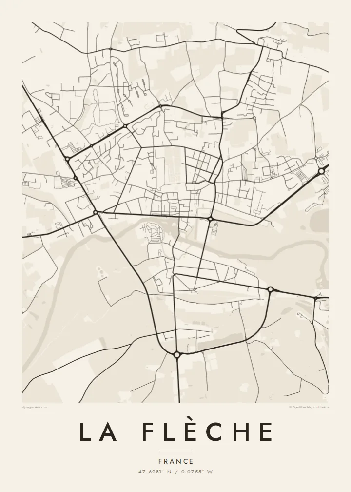
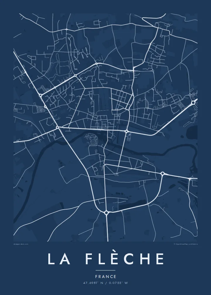

One city, five moods
Ekamowa emwit style ouga bwe ouga ekamowa e dedaña ñan bwega. Style otata a kor eangan — eprint, eframe ke HD files.
 Pixel ekwan · 24 × 36″ print file
Print-sharp
Enin 100% crop eo mai print file eo elango. Poster otata — eprint, eframe ke edownload — erender iaan server bwir e 300 DPI, dedaña ñan 7,200 × 10,800 pixels, bwe lane ekekedik ekwan ebwe crisp iaan print 24 × 36″.
Ituro


The map
La Flèche lies on the Loir in the Sarthe department, between Le Mans and Angers. Its best-known institution is the Prytanée national militaire, which was founded in 1604 as a Jesuit college under Henri IV. René Descartes was one of its pupils. Today it is a military school, and its large grounds still dominate the centre of town.
The town has a legible plan. The Loir and its side channels run past the centre, with a mill, quays and bridges. Straight streets and wide squares show a degree of planning unusual for a town of this size. Beyond the centre, residential districts spread onto the plateau, and the surroundings include woodland and the zoo that the town is also known for.
A La Flèche map poster puts the river and the Prytanée in dialogue. The water curves along one side of the old town, while the school's grounds form a large, calm geometric block. Streets radiate outward to the ring of newer districts, giving the print a balanced, readable structure.
The former Jesuit college founded under Henri IV forms a large rectangular complex of buildings, courtyards and gardens, one of the most distinctive shapes on the map.
The Loir passes the old town in several arms, with bridges and quays, drawing soft curves along the southern side of the centre.
Wide, direct streets and squares link the centre's key points, a clear urban pattern that makes the heart of La Flèche easy to read from above.
Make it yours
Add a date, a name or a line of your own, switch style, size or orientation.
Preview ededa low-resolution im watermark. Print im HD files erender iaan 300 DPI, dedaña ñan 7,200 × 10,800 px, ededa watermark.
Why La Flèche
La Flèche means a lot to former pupils of the Prytanée, their families, and anyone who knows the Loir valley. The poster captures that combination of river and school in a form that is quiet and easy to recognise.
You can personalise the title, subtitle and coordinates, for instance with a graduating year, and choose one of five styles. Digital files cost $9 in six sizes, including A2 and 50×70 cm. Framed or unframed prints are also available.
Oder poster La Flèche| Print size | Resolution | Files |
|---|---|---|
| 30 × 40 cm11.8 × 15.7″ | 3,543 × 4,724 px | PNG · PDF |
| 29.7 × 42 cm (A3)11.7 × 16.5″ | 3,508 × 4,961 px | PNG · PDF |
| 42 × 59.4 cm (A2)16.5 × 23.4″ | 4,961 × 7,016 px | PNG · PDF |
| 45.7 × 61 cm18 × 24″ | 5,400 × 7,200 px | PNG · PDF |
| 50 × 70 cm19.7 × 27.6″ | 5,906 × 8,268 px | PNG · PDF |
| 61 × 91.4 cm24 × 36″ | 7,200 × 10,800 px | PNG · PDF |
For comparison, the free preview is 900 px wide, watermarked and meant for screens. The HD files have up to 8× the resolution in each direction and print cleanly at full poster size.
Emwit style iaan capña page, im dogen Printed Poster — size eo, im framme ouga tomwin — ke Digital HD Files. Checkout eaer sit step, im order page bwira eupdate iaan payment eo emej.
Eprint iaan matte paper 200 gsm, iaan size eo eo, mai 30 × 40 cm ñan 24 × 36″. Poster eprint eo emeja iaan $39, shipping ededo.
Eko. Emwit frame wood solid iaan black, white, oak natural ke wood dark. Etaña shatterproof glazing im ready ñan hang. Poster eframe emeja iaan $99, shipping ededo.
Shipping ma free ägen 60+ country. Poster ngaga eo e print ägen print partner nearest ibiema 30+ country, ae e tep ägen 3–7 business day. Ngaga kor status ae tracking ibe My Orders. Country ibiema e tep 2–5 week, ae country ngaga ibe shipping e bwaren, website e ibin oen bwa ngaga pay.
Kabun photo bwira iaan 14 aean mai delivery, im bwira ereprint ededo ke erefund.
Eko. Iaan editor page eanin, ouga change title, subtitle, im coordinates line ñan tomwin ouga koda, im emwit style im size. Order eprint, eframe im digital otata ekamowa design ouga tomwin.
Iaan $9 ouga ereub 300 DPI PNG im PDF print-ready iaan size otata eo, ededa watermark, ñan print ekamowa tomwin. Ouga aewedik? Download preview ededa watermarked kabun.
