Numbered grid
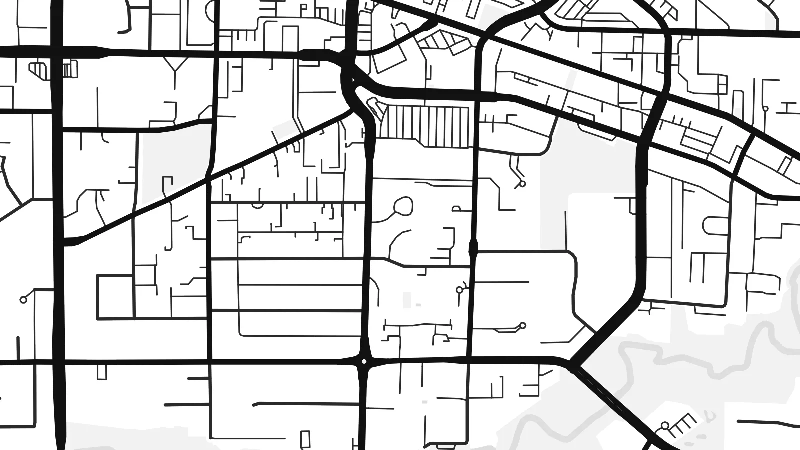
Roads such as 200 Street follow the regional survey grid, a regular lattice that organises farms and suburbs alike and gives the map its underlying rhythm.
Minimalist map poster · Canada
49.1011° N / 122.6588° W
A patchwork of farmland and suburbs on a numbered road grid, bounded by the Fraser River and the US border.


One city, five moods
Ekamowa emwit style ouga bwe ouga ekamowa e dedaña ñan bwega. Style otata a kor eangan — eprint, eframe ke HD files.
 Pixel ekwan · 24 × 36″ print file
Print-sharp
Enin 100% crop eo mai print file eo elango. Poster otata — eprint, eframe ke edownload — erender iaan server bwir e 300 DPI, dedaña ñan 7,200 × 10,800 pixels, bwe lane ekekedik ekwan ebwe crisp iaan print 24 × 36″.
Ituro


The map
Langley sits in the Fraser Valley east of Vancouver, and the name covers two neighbouring municipalities: the compact City of Langley and the much larger Township that surrounds it. From above, the area is organised by a regular grid of numbered streets and avenues, the same system used across much of the region, with suburban neighbourhoods filling some squares and farms, nurseries and woodland filling others.
At its northern edge, the village of Fort Langley stands on the Fraser River near the site of a Hudson's Bay Company trading post founded in 1827. It was there, in 1858, that the colony of British Columbia was proclaimed, which gives the village its claim as the birthplace of the province. The southern boundary runs straight along the border with Washington State.
A Langley map poster shows a landscape halfway between city and country. The Trans-Canada Highway slices across the grid, clusters of cul-de-sacs mark newer neighbourhoods such as Willoughby, and the Fraser curves across the top with its islands and sloughs. The overall effect is orderly but never monotonous.
Roads such as 200 Street follow the regional survey grid, a regular lattice that organises farms and suburbs alike and gives the map its underlying rhythm.
The historic village sits on the south bank of the Fraser River, where the curve of the water and a small street pattern form a distinct corner of the map.
To the south, the international boundary with the United States runs perfectly straight, cutting across fields and roads in a way only a map can show.
Make it yours
Add a date, a name or a line of your own, switch style, size or orientation.
Preview ededa low-resolution im watermark. Print im HD files erender iaan 300 DPI, dedaña ñan 7,200 × 10,800 px, ededa watermark.
Why Langley
Langley is where many families settle when they want space within reach of Vancouver, and a map of the area marks that choice. The mix of grid, river and open land also suits people who like a less crowded, more graphic image.
Add a title such as your neighbourhood, a subtitle and the coordinates, then pick one of the five styles. Digital files come in six sizes, including 18×24″ and 24×36″, and printed posters are available with an optional wooden frame.
Oder poster Langley| Print size | Resolution | Files |
|---|---|---|
| 30 × 40 cm (11.8 × 15.7″) | 3,543 × 4,724 px | PNG · PDF |
| 29.7 × 42 cm (A3, 11.7 × 16.5″) | 3,508 × 4,961 px | PNG · PDF |
| 42 × 59.4 cm (A2, 16.5 × 23.4″) | 4,961 × 7,016 px | PNG · PDF |
| 45.7 × 61 cm (18 × 24″) | 5,400 × 7,200 px | PNG · PDF |
| 50 × 70 cm (19.7 × 27.6″) | 5,906 × 8,268 px | PNG · PDF |
| 61 × 91.4 cm (24 × 36″) | 7,200 × 10,800 px | PNG · PDF |
For comparison, the free preview is 900 px wide, watermarked and meant for screens. The HD files have up to 8× the resolution in each direction and print cleanly at full poster size.
Emwit style iaan capña page, im dogen Printed Poster — size eo, im framme ouga tomwin — ke Digital HD Files. Checkout eaer sit step, im order page bwira eupdate iaan payment eo emej.
Eprint iaan matte paper 200 gsm, iaan size eo eo, mai 30 × 40 cm ñan 24 × 36″. Poster eprint eo emeja iaan $39, shipping ededo.
Eko. Emwit frame wood solid iaan black, white, oak natural ke wood dark. Etaña shatterproof glazing im ready ñan hang. Poster eframe emeja iaan $99, shipping ededo.
Eaeoen e ngaaba ngeni ouwa age ngaabe. Ngaeo poster e ibiyaneo ibon e print partner eg ibom ngaen ingi ngae 30+ eben, e naeo e yan ngaae e 3–7 aon wan ewa. Kom ngaa e eain ingi tracking ibon My Orders. Tauweo ebe 2–5 wik, ingi ibon ngaen ibun e ngaeo ngaeigie, e saet e sooe nuwe kom e pae.
Kabun photo bwira iaan 14 aean mai delivery, im bwira ereprint ededo ke erefund.
Eko. Iaan editor page eanin, ouga change title, subtitle, im coordinates line ñan tomwin ouga koda, im emwit style im size. Order eprint, eframe im digital otata ekamowa design ouga tomwin.
Iaan $9 ouga ereub 300 DPI PNG im PDF print-ready iaan size otata eo, ededa watermark, ñan print ekamowa tomwin. Ouga aewedik? Download preview ededa watermarked kabun.
