Two framing rivers
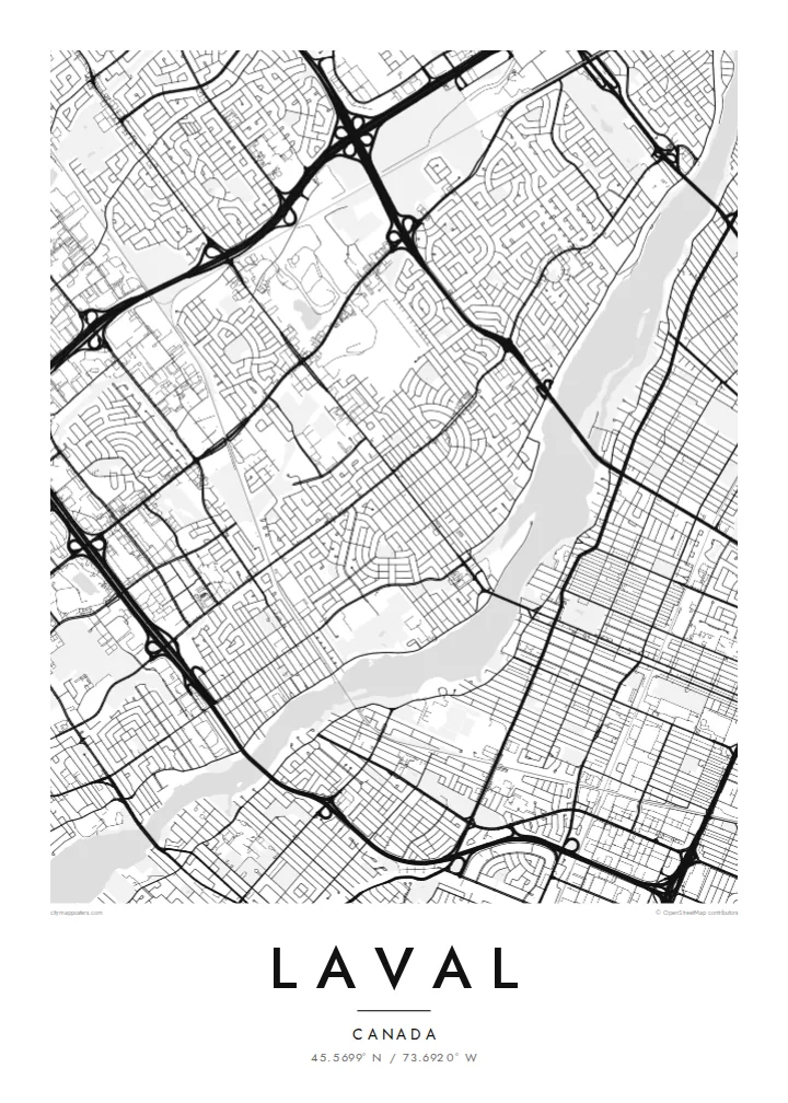
The Rivière des Prairies and the Rivière des Mille Îles wrap around the island. Their many small islands and inlets create a detailed, lacy edge on both sides.
Minimalist map poster · Canada
45.5699° N / 73.6920° W
An island city ringed by two rivers, with highways, suburban crescents and the metro's reach across the water.


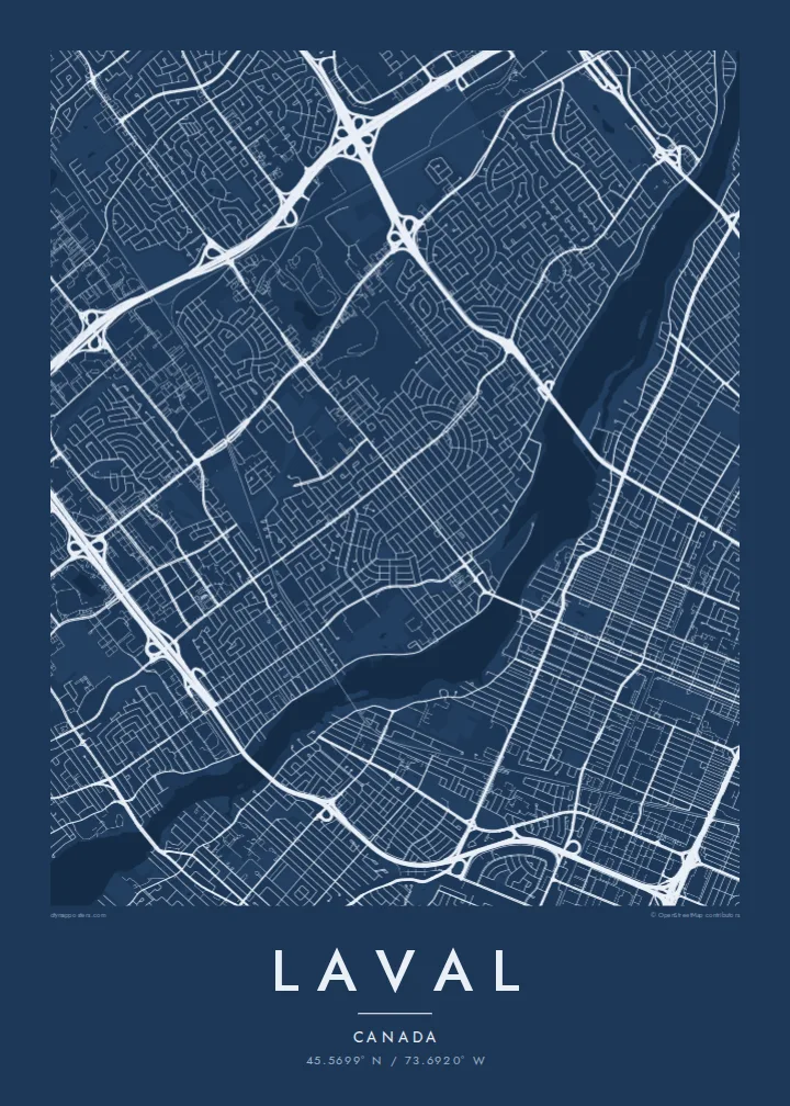

One city, five moods
Ekamowa emwit style ouga bwe ouga ekamowa e dedaña ñan bwega. Style otata a kor eangan — eprint, eframe ke HD files.
 Pixel ekwan · 24 × 36″ print file
Print-sharp
Enin 100% crop eo mai print file eo elango. Poster otata — eprint, eframe ke edownload — erender iaan server bwir e 300 DPI, dedaña ñan 7,200 × 10,800 pixels, bwe lane ekekedik ekwan ebwe crisp iaan print 24 × 36″.
Ituro


The map
Laval covers all of Île Jésus, a large island north of Montreal. It is bounded by the Rivière des Prairies to the south and the Rivière des Mille Îles to the north. On a map it is one of the most clearly defined city shapes in Canada: an elongated island outline, fully built up in places, with both riverbanks traced by roads and small islands.
Inside that outline, Laval is a patchwork of suburban neighbourhoods. You see curving crescents and cul-de-sacs, older village cores along the rivers, and big commercial areas next to highway interchanges. Autoroutes 13, 15, 19 and 440 cut straight lines across the island, and bridges fan out to Montreal and to the North Shore.
The modern city was formed in 1965, when fourteen municipalities on the island merged. In 2007 Montreal's Orange Line crossed the river and three metro stations opened in Laval, including Montmorency. A Laval map poster shows the whole island at once, so the rivers frame the city like a border drawn by nature.
The Rivière des Prairies and the Rivière des Mille Îles wrap around the island. Their many small islands and inlets create a detailed, lacy edge on both sides.
Straight highways cross the island north to south and east to west. They meet in large cloverleaf interchanges that stand out clearly against the finer residential streets.
Along the riverbanks, older settlements such as Sainte-Rose and Saint-Vincent-de-Paul keep their small, irregular street patterns, unlike the planned suburbs inland.
Make it yours
Add a date, a name or a line of your own, switch style, size or orientation.
Preview ededa low-resolution im watermark. Print im HD files erender iaan 300 DPI, dedaña ñan 7,200 × 10,800 px, ededa watermark.
Why Laval
People who grew up in Laval often feel it gets overlooked next to Montreal. This poster puts the island's own shape at the centre, and it makes a fitting gift for a first home, a family move or a return after years away.
The title, subtitle and coordinates line can all be changed. You could use a neighbourhood name, a street or a year. Choose from Classic black & white, Noir, Paper, Blueprint and Sand. The island shape reads well in each, and Paper suits a softer interior.
Oder poster Laval| Print size | Resolution | Files |
|---|---|---|
| 30 × 40 cm (11.8 × 15.7″) | 3,543 × 4,724 px | PNG · PDF |
| 29.7 × 42 cm (A3, 11.7 × 16.5″) | 3,508 × 4,961 px | PNG · PDF |
| 42 × 59.4 cm (A2, 16.5 × 23.4″) | 4,961 × 7,016 px | PNG · PDF |
| 45.7 × 61 cm (18 × 24″) | 5,400 × 7,200 px | PNG · PDF |
| 50 × 70 cm (19.7 × 27.6″) | 5,906 × 8,268 px | PNG · PDF |
| 61 × 91.4 cm (24 × 36″) | 7,200 × 10,800 px | PNG · PDF |
For comparison, the free preview is 900 px wide, watermarked and meant for screens. The HD files have up to 8× the resolution in each direction and print cleanly at full poster size.
Emwit style iaan capña page, im dogen Printed Poster — size eo, im framme ouga tomwin — ke Digital HD Files. Checkout eaer sit step, im order page bwira eupdate iaan payment eo emej.
Eprint iaan matte paper 200 gsm, iaan size eo eo, mai 30 × 40 cm ñan 24 × 36″. Poster eprint eo emeja iaan $39, shipping ededo.
Eko. Emwit frame wood solid iaan black, white, oak natural ke wood dark. Etaña shatterproof glazing im ready ñan hang. Poster eframe emeja iaan $99, shipping ededo.
Eaeoen e ngaaba ngeni ouwa age ngaabe. Ngaeo poster e ibiyaneo ibon e print partner eg ibom ngaen ingi ngae 30+ eben, e naeo e yan ngaae e 3–7 aon wan ewa. Kom ngaa e eain ingi tracking ibon My Orders. Tauweo ebe 2–5 wik, ingi ibon ngaen ibun e ngaeo ngaeigie, e saet e sooe nuwe kom e pae.
Kabun photo bwira iaan 14 aean mai delivery, im bwira ereprint ededo ke erefund.
Eko. Iaan editor page eanin, ouga change title, subtitle, im coordinates line ñan tomwin ouga koda, im emwit style im size. Order eprint, eframe im digital otata ekamowa design ouga tomwin.
Iaan $9 ouga ereub 300 DPI PNG im PDF print-ready iaan size otata eo, ededa watermark, ñan print ekamowa tomwin. Ouga aewedik? Download preview ededa watermarked kabun.
Nearby
